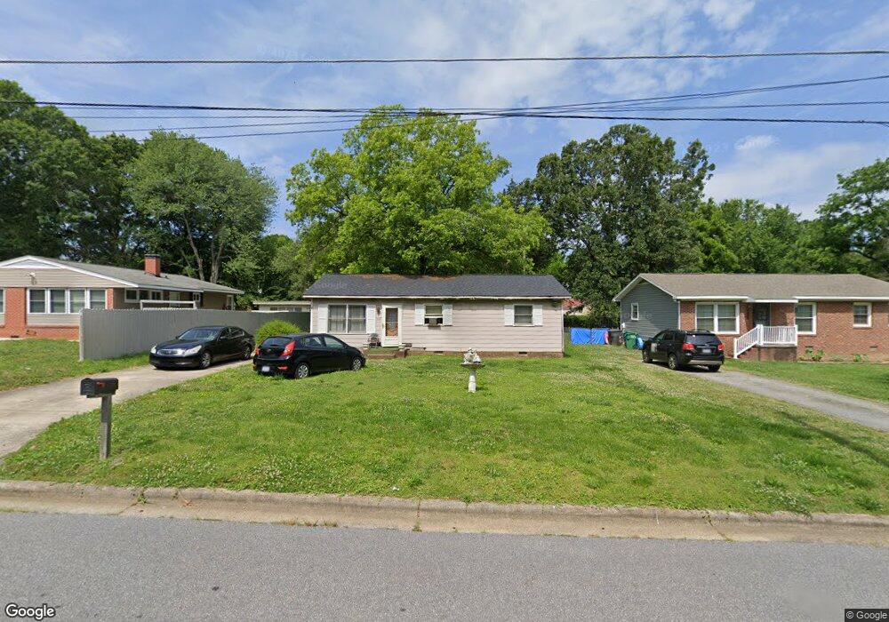
1501 Forrest St High Point, NC 27262
Greater High Point NeighborhoodEstimated Value: $160,000 - $176,000
3
Beds
2
Baths
960
Sq Ft
$173/Sq Ft
Est. Value
About This Home
This home is located at 1501 Forrest St, High Point, NC 27262 and is currently estimated at $166,000, approximately $172 per square foot. 1501 Forrest St is a home located in Guilford County with nearby schools including Oak View Elementary School, Welborn Academy of Science & Technology, and High Point Central High School.
Ownership History
Date
Name
Owned For
Owner Type
Purchase Details
Closed on
Oct 26, 2023
Sold by
Llg Trustee Llc
Bought by
Bms Investment Properties Llc
Current Estimated Value
Purchase Details
Closed on
Jul 24, 2006
Sold by
Dawkins Mildred
Bought by
Mccollum Mary P
Home Financials for this Owner
Home Financials are based on the most recent Mortgage that was taken out on this home.
Original Mortgage
$69,000
Interest Rate
10.65%
Mortgage Type
Purchase Money Mortgage
Purchase Details
Closed on
Nov 14, 2002
Sold by
Houck Wayne F and Houck Pamela J
Bought by
Dawkins Johnny and Dawkins Mildred
Home Financials for this Owner
Home Financials are based on the most recent Mortgage that was taken out on this home.
Original Mortgage
$63,600
Interest Rate
8.5%
Create a Home Valuation Report for This Property
The Home Valuation Report is an in-depth analysis detailing your home's value as well as a comparison with similar homes in the area
Home Values in the Area
Average Home Value in this Area
Purchase History
| Date | Buyer | Sale Price | Title Company |
|---|---|---|---|
| Bms Investment Properties Llc | $91,500 | None Listed On Document | |
| Mccollum Mary P | $69,000 | None Available | |
| Dawkins Johnny | $79,500 | -- |
Source: Public Records
Mortgage History
| Date | Status | Borrower | Loan Amount |
|---|---|---|---|
| Previous Owner | Mccollum Mary P | $69,000 | |
| Previous Owner | Dawkins Johnny | $63,600 | |
| Closed | Dawkins Johnny | $15,900 |
Source: Public Records
Tax History Compared to Growth
Tax History
| Year | Tax Paid | Tax Assessment Tax Assessment Total Assessment is a certain percentage of the fair market value that is determined by local assessors to be the total taxable value of land and additions on the property. | Land | Improvement |
|---|---|---|---|---|
| 2025 | $1,735 | $95,100 | $10,000 | $85,100 |
| 2024 | $1,735 | $95,100 | $10,000 | $85,100 |
| 2023 | $1,735 | $95,100 | $10,000 | $85,100 |
| 2022 | $1,282 | $95,100 | $10,000 | $85,100 |
| 2021 | $1,034 | $75,000 | $10,000 | $65,000 |
| 2020 | $1,034 | $75,000 | $10,000 | $65,000 |
| 2019 | $1,034 | $75,000 | $0 | $0 |
| 2018 | $1,028 | $75,000 | $0 | $0 |
| 2017 | $1,028 | $75,000 | $0 | $0 |
| 2016 | $1,022 | $72,900 | $0 | $0 |
| 2015 | $1,028 | $72,900 | $0 | $0 |
| 2014 | $1,045 | $72,900 | $0 | $0 |
Source: Public Records
Map
Nearby Homes
- 1406 Bridges Dr
- 1110 Forrest St
- 1108 Forrest St
- 910 Charlotte Ave
- 907 E Dayton Ave
- 910 E Dayton Ave
- 1607 Bridges Dr
- 1428 Futrelle Dr
- 435 Chester Woods Ct
- 1714 N Hamilton St Unit A
- 1714 N Hamilton St Unit B
- 1704 N Hamilton St Unit D
- 1740 N Hamilton St Unit G
- 1825 Johnson St Unit B
- 1814 Guyer St Unit A
- 1507 Larkin St
- 1433 Larkin St
- 1611 Beaucrest Ave
- 2021 Arden Place
- 1519 Mcguinn Dr
- 1415 Forrest St
- 1503 Forrest St
- 1413 Forrest St
- 1505 Forrest St
- 1136 Tabor St
- 1134 Tabor St
- 1411 Forrest St
- 1138 Tabor St
- 1132 Tabor St
- 901 Norwood Ave
- 1130 Tabor St
- 1140 Tabor St
- 1506 Forrest St
- 1508 Forrest St
- 1409 Forrest St
- 903 Norwood Ave
- 1609 Forrest St
- 1128 Tabor St
- 1142 Tabor St
- 1608 Forrest St