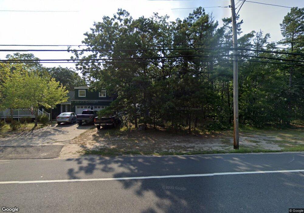
1501 Route 50 Mays Landing, NJ 08330
Estimated Value: $187,000
--
Bed
--
Bath
1,456
Sq Ft
$128/Sq Ft
Est. Value
About This Home
This home is located at 1501 Route 50, Mays Landing, NJ 08330 and is currently priced at $187,000, approximately $128 per square foot. 1501 Route 50 is a home located in Atlantic County with nearby schools including Joseph Shaner School, George L. Hess Educational Complex, and William Davies Middle School.
Ownership History
Date
Name
Owned For
Owner Type
Purchase Details
Closed on
Sep 20, 2004
Sold by
Quality Modular Homes Llc
Bought by
Kelusak Richard and Watson Donna
Current Estimated Value
Home Financials for this Owner
Home Financials are based on the most recent Mortgage that was taken out on this home.
Original Mortgage
$200,544
Interest Rate
5.89%
Mortgage Type
Construction
Purchase Details
Closed on
Oct 15, 2003
Sold by
Cape Barbara A and Gursky William
Bought by
Quality Modular Homes Llc
Create a Home Valuation Report for This Property
The Home Valuation Report is an in-depth analysis detailing your home's value as well as a comparison with similar homes in the area
Home Values in the Area
Average Home Value in this Area
Purchase History
| Date | Buyer | Sale Price | Title Company |
|---|---|---|---|
| Kelusak Richard | $90,000 | Fidelity National Title | |
| Quality Modular Homes Llc | $55,000 | -- |
Source: Public Records
Mortgage History
| Date | Status | Borrower | Loan Amount |
|---|---|---|---|
| Closed | Kelusak Richard | $200,544 |
Source: Public Records
Tax History Compared to Growth
Tax History
| Year | Tax Paid | Tax Assessment Tax Assessment Total Assessment is a certain percentage of the fair market value that is determined by local assessors to be the total taxable value of land and additions on the property. | Land | Improvement |
|---|---|---|---|---|
| 2025 | -- | $239,200 | $53,500 | $185,700 |
| 2024 | -- | $239,200 | $53,500 | $185,700 |
| 2023 | -- | $239,200 | $53,500 | $185,700 |
| 2022 | $0 | $239,200 | $53,500 | $185,700 |
| 2021 | $0 | $239,200 | $53,500 | $185,700 |
| 2020 | $0 | $239,200 | $53,500 | $185,700 |
| 2019 | $0 | $239,200 | $53,500 | $185,700 |
| 2018 | $0 | $239,200 | $53,500 | $185,700 |
| 2017 | $0 | $239,200 | $53,500 | $185,700 |
| 2016 | $0 | $239,200 | $53,500 | $185,700 |
| 2015 | $6,634 | $239,200 | $53,500 | $185,700 |
| 2014 | $6,541 | $258,500 | $62,400 | $196,100 |
Source: Public Records
Map
Nearby Homes
- Bl 531 Lot 8&9 Adams Ave
- 0 Cape May Ave
- 18 Lewis Dr
- Lot:11.02-12.02 Estelle Ave
- B:534 L:11.01 Estelle Ave
- B:534 L:12.02 Estelle Ave
- B:534 L:11.02 Estelle Ave
- 94 Merlino Ln
- 1st First Ave
- 42 Ernst Ct
- 40 Vender Ln
- 55 Lewis Dr
- 22 Ernst Ct
- 5910 Somerset Dr
- Rt 50 and Old Mays Landing Rd
- 5906 Vine Dr
- 5910 Redwood Ct
- 5926 Berry Dr
- 526 Bainbridge Ave
- 850 Morningside Dr
- 1509 Route 50
- 1409 New Jersey 50
- 1409 Route 50
- 52 Ernst Ct
- 66 Ernst Ct
- 72 Ernst Ct
- 32 Ernst Ct
- 64 Ernst Ct
- 56 Ernst Ct
- 14 Ernst Ct
- 1401 Route 50
- 1317 Route 50
- 1313 Route 50
- 106 Blvd Route 50
- 212 Boulevard Route 50
- 1310 Route 50
- Ct"><font <Font Dir="auto" Style="vertical-Align: Inherit;"> Ct
- 5907 Sweet Gum Dr
- 5908 Buttercup Ln
- 13 Lewis Dr