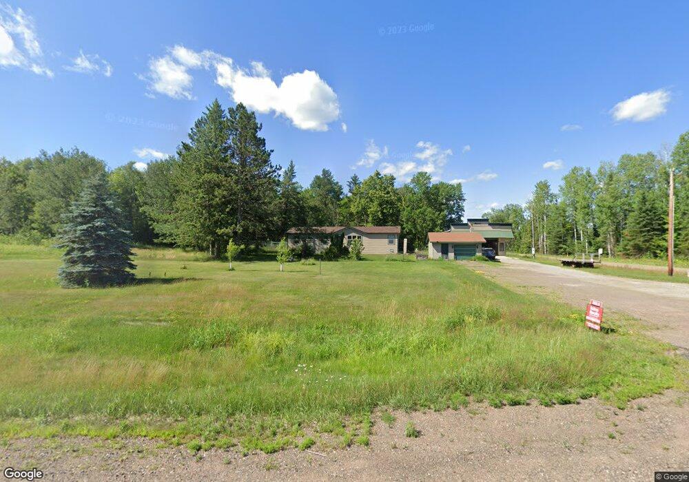
15012 Highway 27 McGregor, MN 55760
Estimated Value: $220,000 - $257,328
3
Beds
2
Baths
1,680
Sq Ft
$144/Sq Ft
Est. Value
About This Home
This home is located at 15012 Highway 27, McGregor, MN 55760 and is currently estimated at $241,443, approximately $143 per square foot. 15012 Highway 27 is a home located in Aitkin County with nearby schools including McGregor Elementary School and McGregor Secondary School.
Ownership History
Date
Name
Owned For
Owner Type
Purchase Details
Closed on
Aug 3, 2023
Sold by
Fleming Christopher
Bought by
Coleman Shanna and Coleman Casey
Current Estimated Value
Home Financials for this Owner
Home Financials are based on the most recent Mortgage that was taken out on this home.
Original Mortgage
$235,000
Outstanding Balance
$229,504
Interest Rate
6.67%
Mortgage Type
New Conventional
Estimated Equity
$11,939
Purchase Details
Closed on
Nov 2, 2015
Sold by
Anderson David David
Bought by
Altrichter Robert and Altrichter Geraldine
Purchase Details
Closed on
Oct 1, 1999
Bought by
Anderson David and Anderson Yvonne
Create a Home Valuation Report for This Property
The Home Valuation Report is an in-depth analysis detailing your home's value as well as a comparison with similar homes in the area
Home Values in the Area
Average Home Value in this Area
Purchase History
| Date | Buyer | Sale Price | Title Company |
|---|---|---|---|
| Coleman Shanna | $235,000 | -- | |
| Altrichter Robert | $152,000 | -- | |
| Anderson David | $40,500 | -- |
Source: Public Records
Mortgage History
| Date | Status | Borrower | Loan Amount |
|---|---|---|---|
| Open | Coleman Shanna | $235,000 |
Source: Public Records
Tax History Compared to Growth
Tax History
| Year | Tax Paid | Tax Assessment Tax Assessment Total Assessment is a certain percentage of the fair market value that is determined by local assessors to be the total taxable value of land and additions on the property. | Land | Improvement |
|---|---|---|---|---|
| 2025 | $1,212 | $215,600 | $71,000 | $144,600 |
| 2024 | $1,080 | $199,500 | $72,800 | $126,700 |
| 2023 | $1,050 | $187,800 | $61,100 | $126,700 |
| 2022 | $1,118 | $170,400 | $52,700 | $117,700 |
| 2021 | $1,060 | $141,100 | $38,900 | $102,200 |
| 2020 | $920 | $133,000 | $41,400 | $91,600 |
| 2019 | $820 | $116,100 | $41,400 | $74,700 |
| 2018 | $714 | $105,300 | $42,000 | $63,300 |
| 2017 | $654 | $94,700 | $39,300 | $55,400 |
| 2016 | $550 | $92,000 | $40,600 | $51,400 |
| 2014 | $582 | $87,100 | $31,600 | $55,500 |
| 2012 | $6 | $97,900 | $32,300 | $65,600 |
Source: Public Records
Map
Nearby Homes
- 16794 Driftwood St
- 24007 Kestrel Ave
- 72xx Brown Rd
- 16466 220th St
- 22148 126th Place
- Split Rock Road Split Rock Rd
- TBD Kestrel Ave
- TBD County Road 19
- TBD Fairview Rd
- 16466 x 220th St
- Fairview Rd
- 32837 240th Place
- 14331 395th Ln
- County Road 19
- 39769 Kestrel Ave
- XXXX Silver Creek Rd
- 2757 Erickson Rd
- 601X Brown Rd
- 6014 Brown Rd
- TBD 120th Place
- 15012 15012 State Hwy 27--
- 30025 Kestrel Ave
- 15012 State Highway 27
- 15012 State Highway 27
- 15077 State Highway 27
- 29870 Kestrel Ave
- XXX 330th St
- 30248 Kestrel Ave
- 30635 Kestrel Ave
- 30635 Kestrel Ave
- 30653 Kestrel Ave
- 30546 Kestrel Ave
- 29325 Kestrel Ave
- xxx Driftwood
- TBD Driftwood St
- 14440 State Hwy 27
- 14425 State Highway 27
- 15983 State Highway 27
- 15983 State Highway 27
- 15983 State Highway 27