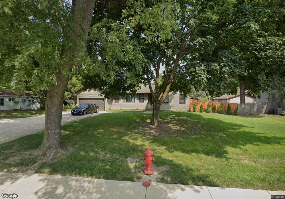
15015 S Route 59 Plainfield, IL 60544
East Plainfield NeighborhoodEstimated Value: $407,000 - $458,000
--
Bed
--
Bath
1,920
Sq Ft
$222/Sq Ft
Est. Value
About This Home
This home is located at 15015 S Route 59, Plainfield, IL 60544 and is currently estimated at $426,046, approximately $221 per square foot. 15015 S Route 59 is a home located in Will County with nearby schools including Central Elementary School, Indian Trail Middle School, and Plainfield Central High School.
Ownership History
Date
Name
Owned For
Owner Type
Purchase Details
Closed on
Nov 4, 2025
Sold by
Bessette Marc A
Bought by
Marc A Bessette Trust and Bessette
Current Estimated Value
Purchase Details
Closed on
Jan 9, 2021
Sold by
Bessette Living Trust and Bessette Donna M
Bought by
Bessette Marc A
Purchase Details
Closed on
Oct 23, 2008
Sold by
Bessette Lowell H and Bessette Donna M
Bought by
Bessette Lowell H and Bessette Donna M
Purchase Details
Closed on
Feb 18, 2003
Sold by
First Midwest Bank
Bought by
Bessette Lowell H and Bessette Donna M
Create a Home Valuation Report for This Property
The Home Valuation Report is an in-depth analysis detailing your home's value as well as a comparison with similar homes in the area
Home Values in the Area
Average Home Value in this Area
Purchase History
| Date | Buyer | Sale Price | Title Company |
|---|---|---|---|
| Marc A Bessette Trust | -- | None Listed On Document | |
| Bessette Marc A | -- | Wheeler Paul | |
| Bessette Lowell H | -- | None Available | |
| Bessette Lowell H | -- | -- |
Source: Public Records
Tax History Compared to Growth
Tax History
| Year | Tax Paid | Tax Assessment Tax Assessment Total Assessment is a certain percentage of the fair market value that is determined by local assessors to be the total taxable value of land and additions on the property. | Land | Improvement |
|---|---|---|---|---|
| 2024 | $9,394 | $127,417 | $25,885 | $101,532 |
| 2023 | $9,394 | $115,081 | $23,379 | $91,702 |
| 2022 | $8,625 | $106,256 | $21,586 | $84,670 |
| 2021 | $8,176 | $99,305 | $20,174 | $79,131 |
| 2020 | $8,072 | $96,488 | $19,602 | $76,886 |
| 2019 | $7,809 | $91,937 | $18,677 | $73,260 |
| 2018 | $7,488 | $86,380 | $17,548 | $68,832 |
| 2017 | $7,279 | $82,087 | $16,676 | $65,411 |
| 2016 | $7,122 | $78,290 | $15,905 | $62,385 |
| 2015 | $7,507 | $73,339 | $14,899 | $58,440 |
| 2014 | $7,507 | $78,333 | $21,956 | $56,377 |
| 2013 | $7,507 | $78,333 | $21,956 | $56,377 |
Source: Public Records
Map
Nearby Homes
- 25446 W Emory Ln
- 25448 W Emory Ln
- 23909 W Main St
- 24003 W Commercial St
- 14814 S Penn Rd
- 23627 W Chicago St
- 000 Wood Farm Rd
- 14946 S Darr Dr
- 14954 S Darr Dr
- 14942 S Darr Dr
- 3.37AC Lockport St
- 14932 S Henebry Ln
- 25500 W Alabaster Cir
- 14853 S Henebry Ln
- 14864 S Henebry Ln
- 14848 S Henebry Ln
- 14809 S Henebry Ln
- 14913 S Mccarthy Cir
- 14852 S Henebry Ln
- 14856 S Henebry Ln
- 15021 S Route 59
- 15003 S Route 59
- 15010 S Bartlett Ave
- 15018 S Bartlett Ave
- 15018 S Route 59
- 15018 S Route 59 Unit SOUTH
- 15018 S Route 59
- 14941 S Route 59
- 15022 S Route 59
- 15022 S Bartlett Ave
- 15018 S Route 59
- 15008 S Route 59
- 15014 S Route 59
- 15004 S Bartlett Ave
- 15002 S Route 59
- 15004 S Bartlett Ave
- 14935 S Route 59
- 14930 S Bartlett Ave
- 712 N Bartlett Ave
- 14934 S Arnold St