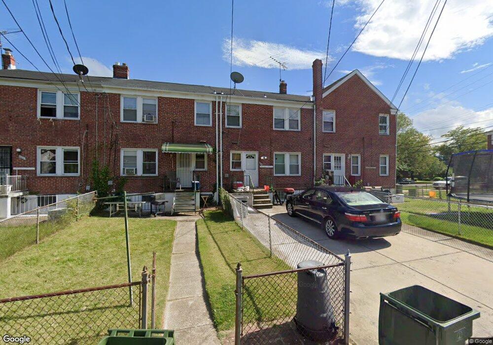
1502 Burnwood Rd Baltimore, MD 21239
Perring Loch NeighborhoodEstimated Value: $230,406 - $279,000
3
Beds
2
Baths
1,280
Sq Ft
$199/Sq Ft
Est. Value
About This Home
This home is located at 1502 Burnwood Rd, Baltimore, MD 21239 and is currently estimated at $254,703, approximately $198 per square foot. 1502 Burnwood Rd is a home located in Baltimore City with nearby schools including Northwood Elementary School, Booker T. Washington Middle School, and Paul Laurence Dunbar High School.
Ownership History
Date
Name
Owned For
Owner Type
Purchase Details
Closed on
Dec 14, 2010
Sold by
Jasper William
Bought by
Thomas Anthony D
Current Estimated Value
Home Financials for this Owner
Home Financials are based on the most recent Mortgage that was taken out on this home.
Original Mortgage
$148,978
Outstanding Balance
$96,659
Interest Rate
3.87%
Mortgage Type
FHA
Estimated Equity
$158,044
Purchase Details
Closed on
Aug 10, 1994
Sold by
Lapaglia Pauline
Bought by
Jasper William
Home Financials for this Owner
Home Financials are based on the most recent Mortgage that was taken out on this home.
Original Mortgage
$45,550
Interest Rate
8.52%
Create a Home Valuation Report for This Property
The Home Valuation Report is an in-depth analysis detailing your home's value as well as a comparison with similar homes in the area
Home Values in the Area
Average Home Value in this Area
Purchase History
| Date | Buyer | Sale Price | Title Company |
|---|---|---|---|
| Thomas Anthony D | $151,000 | -- | |
| Jasper William | $77,200 | -- |
Source: Public Records
Mortgage History
| Date | Status | Borrower | Loan Amount |
|---|---|---|---|
| Open | Thomas Anthony D | $148,978 | |
| Closed | Thomas Anthony D | $5,000 | |
| Previous Owner | Jasper William | $45,550 |
Source: Public Records
Tax History Compared to Growth
Tax History
| Year | Tax Paid | Tax Assessment Tax Assessment Total Assessment is a certain percentage of the fair market value that is determined by local assessors to be the total taxable value of land and additions on the property. | Land | Improvement |
|---|---|---|---|---|
| 2025 | $2,929 | $145,533 | -- | -- |
| 2024 | $2,929 | $135,700 | $36,000 | $99,700 |
| 2023 | $2,889 | $134,300 | $0 | $0 |
| 2022 | $2,860 | $132,900 | $0 | $0 |
| 2021 | $3,103 | $131,500 | $36,000 | $95,500 |
| 2020 | $2,785 | $129,467 | $0 | $0 |
| 2019 | $2,723 | $127,433 | $0 | $0 |
| 2018 | $2,736 | $125,400 | $36,000 | $89,400 |
| 2017 | $2,741 | $124,400 | $0 | $0 |
| 2016 | $3,216 | $123,400 | $0 | $0 |
| 2015 | $3,216 | $122,400 | $0 | $0 |
| 2014 | $3,216 | $122,400 | $0 | $0 |
Source: Public Records
Map
Nearby Homes
- 1402 Woodbourne Ave
- 1613 Winford Rd
- 1631 Woodbourne Ave
- 1800 Burnwood Rd
- 1814 Winford Rd
- 1809 Northbourne Rd
- 1809 Hillenwood Rd
- 5515 Hillen Rd
- 1231 Sheridan Ave
- 1324 Winston Ave
- 1808 Swansea Rd
- 1346 Pentwood Rd
- 1656 Ramblewood Rd
- 1645 Gleneagle Rd
- 1205 Sheridan Ave
- 1317 Pentwood Rd
- 1062 Cameron Rd
- 1645 Sherwood Ave
- 5716 Leith Walk
- 2045 Woodbourne Ave
- 1504 Burnwood Rd
- 1506 Burnwood Rd
- 1508 Burnwood Rd
- 1500 Burnwood Rd
- 1510 Burnwood Rd
- 1512 Burnwood Rd
- 1501 Northbourne Rd
- 1503 Northbourne Rd
- 1514 Burnwood Rd
- 1505 Northbourne Rd
- 1507 Northbourne Rd
- 1509 Northbourne Rd
- 5303 Loch Raven Blvd
- 5305 Loch Raven Blvd
- 1511 Northbourne Rd
- 1516 Burnwood Rd
- 5301 Loch Raven Blvd
- 5307 Loch Raven Blvd
- 1509 Burnwood Rd
- 1511 Burnwood Rd