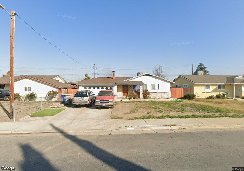
1502 Dorian Dr Bakersfield, CA 93304
Wible Orchard NeighborhoodEstimated Value: $256,000 - $317,000
3
Beds
1
Bath
1,049
Sq Ft
$267/Sq Ft
Est. Value
About This Home
This home is located at 1502 Dorian Dr, Bakersfield, CA 93304 and is currently estimated at $280,006, approximately $266 per square foot. 1502 Dorian Dr is a home located in Kern County with nearby schools including Frank West Elementary School, Curran Middle School, and South High School.
Ownership History
Date
Name
Owned For
Owner Type
Purchase Details
Closed on
Dec 29, 2003
Sold by
Najar Maria T
Bought by
Najar Juan A
Current Estimated Value
Purchase Details
Closed on
Oct 20, 2003
Sold by
Loma Vista Real Estate Holdings
Bought by
Najar Juan A
Home Financials for this Owner
Home Financials are based on the most recent Mortgage that was taken out on this home.
Original Mortgage
$96,750
Interest Rate
5.81%
Mortgage Type
Purchase Money Mortgage
Purchase Details
Closed on
Sep 10, 2003
Sold by
Lopez Jesus E and Lopez Sylvia R
Bought by
Loma Vista Real Estate Holdings
Home Financials for this Owner
Home Financials are based on the most recent Mortgage that was taken out on this home.
Original Mortgage
$96,750
Interest Rate
5.81%
Mortgage Type
Purchase Money Mortgage
Purchase Details
Closed on
Nov 12, 1999
Sold by
T A N D S
Bought by
Lopez Jesus E
Home Financials for this Owner
Home Financials are based on the most recent Mortgage that was taken out on this home.
Original Mortgage
$67,896
Interest Rate
7.69%
Mortgage Type
FHA
Purchase Details
Closed on
Sep 15, 1999
Sold by
Hud
Bought by
T A N D S and Stocktonians Taking Action To Neutralize
Home Financials for this Owner
Home Financials are based on the most recent Mortgage that was taken out on this home.
Original Mortgage
$67,896
Interest Rate
7.69%
Mortgage Type
FHA
Purchase Details
Closed on
May 21, 1999
Sold by
Homeside Lending Inc
Bought by
Hud
Purchase Details
Closed on
Feb 11, 1999
Sold by
Perales Andrew and Perales Annette C
Bought by
Homeside Lending Inc
Purchase Details
Closed on
Apr 27, 1994
Sold by
Collins Jimmy and Collins Sheron J
Bought by
Perales Andrew
Home Financials for this Owner
Home Financials are based on the most recent Mortgage that was taken out on this home.
Original Mortgage
$70,450
Interest Rate
8.56%
Mortgage Type
FHA
Create a Home Valuation Report for This Property
The Home Valuation Report is an in-depth analysis detailing your home's value as well as a comparison with similar homes in the area
Home Values in the Area
Average Home Value in this Area
Purchase History
| Date | Buyer | Sale Price | Title Company |
|---|---|---|---|
| Najar Juan A | -- | Fidelity Title | |
| Najar Juan A | $115,500 | Fidelity Title | |
| Loma Vista Real Estate Holdings | $76,869 | Fidelity Title | |
| Lopez Jesus E | $68,000 | Stewart Title | |
| T A N D S | $53,000 | American Title Co | |
| Hud | $74,924 | Fidelity Title Co | |
| Homeside Lending Inc | $74,924 | Fidelity National Title Ins | |
| Perales Andrew | $72,000 | First American Title Ins Co |
Source: Public Records
Mortgage History
| Date | Status | Borrower | Loan Amount |
|---|---|---|---|
| Previous Owner | Najar Juan A | $96,750 | |
| Previous Owner | Lopez Jesus E | $67,896 | |
| Previous Owner | T A N D S | $52,750 | |
| Previous Owner | Perales Andrew | $70,450 | |
| Closed | Perales Andrew | $3,100 | |
| Closed | Lopez Jesus E | $4,080 |
Source: Public Records
Tax History
| Year | Tax Paid | Tax Assessment Tax Assessment Total Assessment is a certain percentage of the fair market value that is determined by local assessors to be the total taxable value of land and additions on the property. | Land | Improvement |
|---|---|---|---|---|
| 2025 | $2,388 | $152,821 | $35,534 | $117,287 |
| 2024 | $2,333 | $149,826 | $34,838 | $114,988 |
| 2023 | $2,333 | $146,889 | $34,155 | $112,734 |
| 2022 | $2,273 | $144,010 | $33,486 | $110,524 |
| 2021 | $2,164 | $141,187 | $32,830 | $108,357 |
| 2020 | $2,127 | $139,740 | $32,494 | $107,246 |
| 2019 | $2,084 | $137,000 | $34,000 | $103,000 |
| 2018 | $1,972 | $129,000 | $32,000 | $97,000 |
| 2017 | $1,818 | $115,000 | $29,000 | $86,000 |
| 2016 | $1,726 | $117,000 | $29,000 | $88,000 |
| 2015 | $1,313 | $80,000 | $20,000 | $60,000 |
| 2014 | $1,287 | $80,000 | $20,000 | $60,000 |
Source: Public Records
Map
Nearby Homes
- 1312 Dorian Dr
- 2330 S J St
- 2323 S J St
- 2709 Laurel Dr
- 2701 Houchin Rd
- 443 Myrtle St
- 3204 S I St
- 2222 S Chester Ave
- 1804 Le May Ave
- 1410 Southgate Dr
- 827 Wilson Rd
- 4609 S H St
- 1813 Stillman Ave
- 2909 S Chester Ave
- 2612 Lee Dr
- 1017 Curtis Dr
- 1325 Carson Ave
- 1804 Hodges Ave
- 904 Curtis Dr
- 3000 S Chester Ave Unit 53
- 1418 Dorian Dr
- 1506 Dorian Dr
- 1501 Antonia Way
- 1414 Dorian Dr
- 1510 Dorian Dr
- 1417 Antonia Way
- 1505 Antonia Way
- 1413 Antonia Way
- 1509 Antonia Way
- 1501 Dorian Dr
- 1417 Dorian Dr
- 1505 Dorian Dr
- 1410 Dorian Dr
- 1514 Dorian Dr
- 1413 Dorian Dr
- 1509 Dorian Dr
- 1409 Antonia Way
- 1513 Antonia Way Unit 501 F
- 1513 Antonia Way
- 1406 Dorian Dr
Your Personal Tour Guide
Ask me questions while you tour the home.