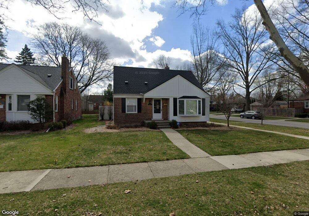
1502 E Melton Rd Birmingham, MI 48009
Estimated Value: $416,288 - $509,000
2
Beds
1
Bath
1,242
Sq Ft
$366/Sq Ft
Est. Value
About This Home
This home is located at 1502 E Melton Rd, Birmingham, MI 48009 and is currently estimated at $454,072, approximately $365 per square foot. 1502 E Melton Rd is a home located in Oakland County with nearby schools including Pembroke Elementary School, Derby Middle School, and Ernest W. Seaholm High School.
Ownership History
Date
Name
Owned For
Owner Type
Purchase Details
Closed on
Oct 4, 2004
Sold by
Leon Carlos and Leon Radhika C Acharya
Bought by
Beckeman Laura M
Current Estimated Value
Purchase Details
Closed on
Nov 5, 2001
Sold by
Defrancesco John R
Bought by
Leon Carlos
Purchase Details
Closed on
May 29, 1997
Sold by
Carter Mark N
Bought by
Defrancesco John R
Home Financials for this Owner
Home Financials are based on the most recent Mortgage that was taken out on this home.
Original Mortgage
$150,400
Interest Rate
8%
Create a Home Valuation Report for This Property
The Home Valuation Report is an in-depth analysis detailing your home's value as well as a comparison with similar homes in the area
Home Values in the Area
Average Home Value in this Area
Purchase History
| Date | Buyer | Sale Price | Title Company |
|---|---|---|---|
| Beckeman Laura M | $288,750 | -- | |
| Leon Carlos | $250,500 | -- | |
| Defrancesco John R | $188,000 | -- |
Source: Public Records
Mortgage History
| Date | Status | Borrower | Loan Amount |
|---|---|---|---|
| Previous Owner | Defrancesco John R | $150,400 |
Source: Public Records
Tax History
| Year | Tax Paid | Tax Assessment Tax Assessment Total Assessment is a certain percentage of the fair market value that is determined by local assessors to be the total taxable value of land and additions on the property. | Land | Improvement |
|---|---|---|---|---|
| 2025 | $4,153 | $196,000 | $0 | $0 |
| 2024 | $3,666 | $183,950 | $0 | $0 |
| 2023 | $3,513 | $165,430 | $0 | $0 |
| 2022 | $3,767 | $158,870 | $0 | $0 |
| 2021 | $3,801 | $158,580 | $0 | $0 |
| 2020 | $3,386 | $150,800 | $0 | $0 |
| 2019 | $3,833 | $140,340 | $0 | $0 |
| 2018 | $3,803 | $131,170 | $0 | $0 |
| 2017 | $3,797 | $128,070 | $0 | $0 |
| 2016 | $3,804 | $124,540 | $0 | $0 |
| 2015 | -- | $118,800 | $0 | $0 |
| 2014 | -- | $99,140 | $0 | $0 |
| 2011 | -- | $83,670 | $0 | $0 |
Source: Public Records
Map
Nearby Homes
- 1257 S Eton St
- 1845 Humphrey Ave
- 1909 W Melton Rd
- 1982 E Lincoln St
- 1815 E Lincoln St
- 1963 Cole St
- 1588 Bennaville Ave
- 4725 Elmwood Ave
- 1723 E 14 Mile Rd Unit B
- 1717 E 14 Mile Rd Unit C
- 1798 Webster St
- 1571 Ruffner Ave
- 1544 Sheffield Rd
- 1476 Humphrey Ave
- 1840 Holland St
- 4707 Olivia Ave
- 1982 Haynes St
- 1368 Bennaville Ave
- 1732 Holland St
- 1323 Bennaville Ave
- 1516 E Melton Rd
- 1526 E Melton Rd
- 1532 E Melton Rd
- 1501 Mansfield Rd
- 1515 Mansfield Rd
- 1494 E Melton Rd
- 1527 Mansfield Rd
- 1456 E Melton Rd Unit Bldg-Unit
- 1456 E Melton Rd
- 2095 Sheffield Rd
- 1503 E Melton Rd
- 1527 E Melton Rd
- 1533 Mansfield Rd
- 1576 E Melton Rd
- 1519 E Melton Rd
- 1533 E Melton Rd
- 1418 E Melton Rd
- 1575 Mansfield Rd
- 1577 E Melton Rd
- 1493 E Melton Rd
Your Personal Tour Guide
Ask me questions while you tour the home.