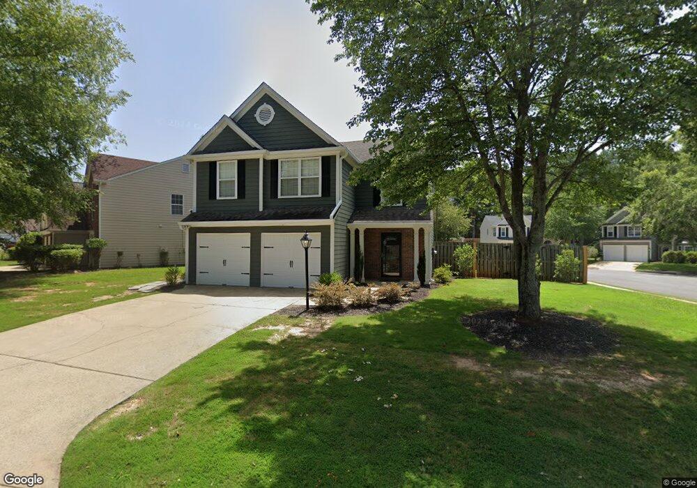
1502 Evanston Ct Marietta, GA 30062
Northwestern Marietta NeighborhoodEstimated Value: $404,037 - $462,000
3
Beds
3
Baths
1,710
Sq Ft
$250/Sq Ft
Est. Value
About This Home
This home is located at 1502 Evanston Ct, Marietta, GA 30062 and is currently estimated at $427,259, approximately $249 per square foot. 1502 Evanston Ct is a home located in Cobb County with nearby schools including Sawyer Road Elementary School, Marietta Sixth Grade Academy, and Marietta Middle School.
Ownership History
Date
Name
Owned For
Owner Type
Purchase Details
Closed on
Nov 4, 2002
Sold by
Evanston Court Land Trust
Bought by
Marman Properties Llc
Current Estimated Value
Purchase Details
Closed on
May 1, 2000
Sold by
Rogers Sharon M
Bought by
Hamman H A
Purchase Details
Closed on
Jul 31, 1996
Sold by
S G Torrey Atlanta Ltd
Bought by
Rogers Sharon M
Create a Home Valuation Report for This Property
The Home Valuation Report is an in-depth analysis detailing your home's value as well as a comparison with similar homes in the area
Home Values in the Area
Average Home Value in this Area
Purchase History
| Date | Buyer | Sale Price | Title Company |
|---|---|---|---|
| Marman Properties Llc | $19,000 | -- | |
| Hamman H A | $17,700 | -- | |
| Rogers Sharon M | $121,900 | -- |
Source: Public Records
Mortgage History
| Date | Status | Borrower | Loan Amount |
|---|---|---|---|
| Closed | Rogers Sharon M | $0 |
Source: Public Records
Tax History Compared to Growth
Tax History
| Year | Tax Paid | Tax Assessment Tax Assessment Total Assessment is a certain percentage of the fair market value that is determined by local assessors to be the total taxable value of land and additions on the property. | Land | Improvement |
|---|---|---|---|---|
| 2025 | $1,451 | $171,556 | $34,000 | $137,556 |
| 2024 | $1,237 | $146,212 | $28,000 | $118,212 |
| 2023 | $1,237 | $146,212 | $28,000 | $118,212 |
| 2022 | $1,148 | $135,656 | $28,000 | $107,656 |
| 2021 | $882 | $102,724 | $28,000 | $74,724 |
| 2020 | $840 | $97,760 | $28,000 | $69,760 |
| 2019 | $767 | $89,248 | $28,000 | $61,248 |
| 2018 | $734 | $85,484 | $28,000 | $57,484 |
| 2017 | $589 | $85,484 | $28,000 | $57,484 |
| 2016 | $489 | $70,992 | $25,600 | $45,392 |
| 2015 | $532 | $70,992 | $25,600 | $45,392 |
| 2014 | $550 | $70,992 | $0 | $0 |
Source: Public Records
Map
Nearby Homes
- 1519 Evanston Ln
- 1582 Cambridge
- 1442 Glenover Cir
- 1599 Cambridge Place
- 1800 Chardin Way
- 1387 Woodcutt Place
- 1368 Woodcutt Place
- 1871 Chardin Way
- 1580 Reids Ferry Way
- 1593 Pinebreeze Dr
- 1391 Brentwood Ln
- 1716 Chanson Place
- 1425 Rosewood Creek Dr
- 1511 Emerald Glen Dr
- 1490 Longwing Ln
- 1834 Butterfly NE
- 1834 Butterfly Way
- 1838 Butterfly NE
- 1854 Butterfly Way
- 1850 Butterfly Way NE
- 1508R Evanston Ct
- 1508 Evanston Ct
- 1514 Evanston Ct
- 1525 Evanston Ln
- 1512 Evanston Ln
- 1516 Evanston Ln
- 1529 Evanston Ln
- 1508 Evanston Ln
- 1520 Evanston Ct
- 1515 Evanston Ct
- 1509 Evanston Ct
- 1521 Evanston Ct
- 1513 Evanston Ln
- 1528 Evanston Ln
- 1527 Evanston Ct
- 1504 Evanston Ln
- 1520 Evanston Ln
- 1526 Evanston Ct
- 1672 Evanston Cir
- 1509 Evanston Ln