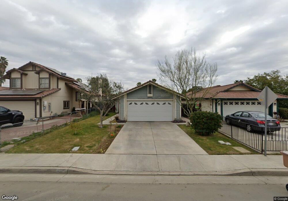
1504 Langston Ct Bakersfield, CA 93307
South Wible Orchard NeighborhoodEstimated Value: $253,065 - $298,000
2
Beds
1
Bath
877
Sq Ft
$310/Sq Ft
Est. Value
About This Home
This home is located at 1504 Langston Ct, Bakersfield, CA 93307 and is currently estimated at $272,266, approximately $310 per square foot. 1504 Langston Ct is a home located in Kern County with nearby schools including Raffaello Palla Elementary School, Greenfield Middle School, and South High School.
Ownership History
Date
Name
Owned For
Owner Type
Purchase Details
Closed on
Feb 2, 1996
Sold by
Va
Bought by
Martinez Rodolfo M
Current Estimated Value
Home Financials for this Owner
Home Financials are based on the most recent Mortgage that was taken out on this home.
Original Mortgage
$52,750
Outstanding Balance
$1,748
Interest Rate
7.14%
Mortgage Type
Seller Take Back
Estimated Equity
$270,518
Purchase Details
Closed on
Aug 31, 1995
Sold by
Gmac Mtg Corp Of Pa
Bought by
Va
Purchase Details
Closed on
Aug 30, 1995
Sold by
Murphy Jack and Murphy Joy
Bought by
Gmac Mtg Corp Of Pa
Create a Home Valuation Report for This Property
The Home Valuation Report is an in-depth analysis detailing your home's value as well as a comparison with similar homes in the area
Home Values in the Area
Average Home Value in this Area
Purchase History
| Date | Buyer | Sale Price | Title Company |
|---|---|---|---|
| Martinez Rodolfo M | $53,000 | First American Title Co | |
| Va | -- | Nations Title | |
| Gmac Mtg Corp Of Pa | $53,292 | Nations Title |
Source: Public Records
Mortgage History
| Date | Status | Borrower | Loan Amount |
|---|---|---|---|
| Open | Martinez Rodolfo M | $52,750 |
Source: Public Records
Tax History
| Year | Tax Paid | Tax Assessment Tax Assessment Total Assessment is a certain percentage of the fair market value that is determined by local assessors to be the total taxable value of land and additions on the property. | Land | Improvement |
|---|---|---|---|---|
| 2025 | $1,634 | $87,598 | $19,918 | $67,680 |
| 2024 | $1,589 | $85,881 | $19,528 | $66,353 |
| 2023 | $1,589 | $84,198 | $19,146 | $65,052 |
| 2022 | $1,553 | $82,548 | $18,771 | $63,777 |
| 2021 | $1,448 | $80,930 | $18,403 | $62,527 |
| 2020 | $1,402 | $80,101 | $18,215 | $61,886 |
| 2019 | $1,378 | $80,101 | $18,215 | $61,886 |
| 2018 | $1,329 | $76,992 | $17,508 | $59,484 |
| 2017 | $1,311 | $75,483 | $17,165 | $58,318 |
| 2016 | $1,251 | $74,004 | $16,829 | $57,175 |
| 2015 | $1,232 | $72,894 | $16,577 | $56,317 |
| 2014 | $1,208 | $71,467 | $16,253 | $55,214 |
Source: Public Records
Map
Nearby Homes
- 5217 Stancliff St
- 5320 Jonah St
- 1328 Malerbi Ct
- 4908 Jonah St
- 1304 Santiago Ct
- 1900 Faxon Ave
- 1304 Canyon Ct
- 4804 Olivia St
- 1501 Calcutta Dr Unit 5
- 1501 Calcutta Dr Unit 48
- 1501 Calcutta Dr Unit 9
- 4604 Mount Everest Way
- 5712 Midas St
- 5804 Chandler Way
- 0 Pacheco Rd
- 2005 Kelso Peak Ave
- 2213 Faith Ave
- 5900 Camp St
- 4600 Alexander St
- 5712 Osborne St
- 1508 Langston Ct
- 1500 Langston Ct
- 1512 Langston Ct
- 1505 Brandy Ct
- 1516 Langston Ct
- 1501 Brandy Ct
- 1509 Brandy Ct
- 1513 Brandy Ct
- 1600 Langston Ct
- 1517 Brandy Ct
- 1505 Langston Ct
- 1509 Langston Ct
- 1501 Langston Ct
- 5216 Jonah St Unit A
- 5220 Jonah St
- 1513 Langston Ct
- 5212 Jonah St
- 1601 Brandy Ct
- 1604 Langston Ct
- 1517 Langston Ct Unit A
Your Personal Tour Guide
Ask me questions while you tour the home.