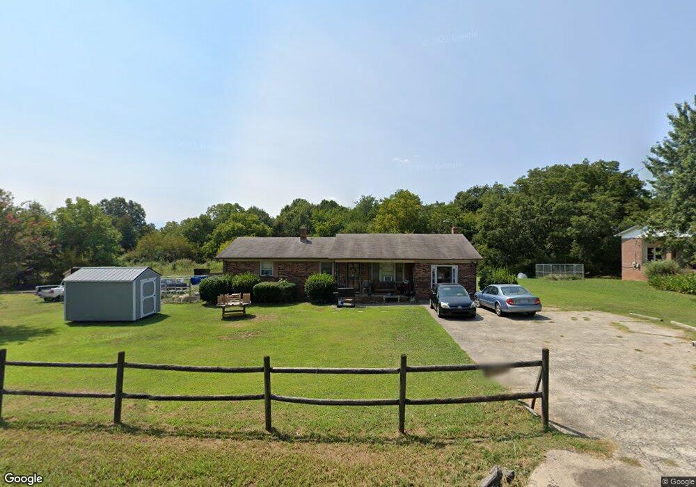
1504 Longbranch Rd Grover, NC 28073
Estimated Value: $194,851 - $233,000
Studio
--
Bath
1,377
Sq Ft
$155/Sq Ft
Est. Value
About This Home
This home is located at 1504 Longbranch Rd, Grover, NC 28073 and is currently estimated at $213,213, approximately $154 per square foot. 1504 Longbranch Rd is a home located in Cleveland County with nearby schools including Grover Elementary School, Kings Mountain Middle, and Kings Mountain Intermediate School.
Ownership History
Date
Name
Owned For
Owner Type
Purchase Details
Closed on
Feb 13, 2006
Sold by
Bell Joe and Bell Virginia
Bought by
Moore Patrice and Moore Thomas Lee
Current Estimated Value
Home Financials for this Owner
Home Financials are based on the most recent Mortgage that was taken out on this home.
Original Mortgage
$59,920
Outstanding Balance
$39,004
Interest Rate
8.99%
Mortgage Type
Assumption
Estimated Equity
$174,209
Create a Home Valuation Report for This Property
The Home Valuation Report is an in-depth analysis detailing your home's value as well as a comparison with similar homes in the area
Home Values in the Area
Average Home Value in this Area
Purchase History
| Date | Buyer | Sale Price | Title Company |
|---|---|---|---|
| Moore Patrice | $75,000 | None Available |
Source: Public Records
Mortgage History
| Date | Status | Borrower | Loan Amount |
|---|---|---|---|
| Open | Moore Patrice | $59,920 |
Source: Public Records
Tax History
| Year | Tax Paid | Tax Assessment Tax Assessment Total Assessment is a certain percentage of the fair market value that is determined by local assessors to be the total taxable value of land and additions on the property. | Land | Improvement |
|---|---|---|---|---|
| 2025 | $881 | $138,662 | $12,254 | $126,408 |
| 2024 | $913 | $104,766 | $10,598 | $94,168 |
| 2023 | $909 | $104,766 | $10,598 | $94,168 |
| 2022 | $909 | $104,766 | $10,598 | $94,168 |
| 2021 | $911 | $104,766 | $10,598 | $94,168 |
| 2020 | $775 | $84,819 | $9,692 | $75,127 |
| 2019 | $775 | $84,819 | $9,692 | $75,127 |
| 2018 | $771 | $84,819 | $9,692 | $75,127 |
| 2017 | $767 | $84,819 | $9,692 | $75,127 |
| 2016 | $732 | $84,819 | $9,692 | $75,127 |
| 2015 | $708 | $81,809 | $8,213 | $73,596 |
| 2014 | $708 | $81,809 | $8,213 | $73,596 |
Source: Public Records
Map
Nearby Homes
- 213 Mullinax Dr
- 210 Roy Bell Rd
- 127 Mullinax Dr
- 105 Elm Rd
- 101 Park Ln
- 304 A S Main St
- 0 Mill Creek Rd
- Holly Springs Plan at Grover Walk
- 304 B S Main St
- 304 D S Main St
- 304 C S Main St
- 219 Watterson Rd
- 129 Lakeview Dr
- 238 Lakeview Dr
- 105 Trotter Ln
- 707 Sandalwood Ln
- 114 Lakeview Dr
- 00 Mill Creek Rd
- 164 Blackburn Dr
- 907 Bethlehem Rd
- 1502 Longbranch Rd
- 00 Long Branch Rd Unit Lot 118
- 1428 Longbranch Rd
- 1511 Longbranch Rd
- 1501 Longbranch Rd Unit 7
- 000 Long Branch Rd Unit Lot - 119
- 1503 Longbranch Rd
- 1510 Longbranch Rd
- 1514 Longbranch Rd
- 1513 Longbranch Rd
- 1424 Longbranch Rd
- 103 Springwood Rd
- 1515 Longbranch Rd
- 1515 Longbranch Rd Unit 3
- 1423 Longbranch Rd
- 1520 Longbranch Rd
- 1420 Longbranch Rd
- 104 Springwood Rd Unit 1
- 1517 Longbranch Rd Unit 1
- 1517 Longbranch Rd Unit 2
Your Personal Tour Guide
Ask me questions while you tour the home.