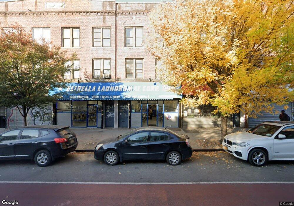
1504 Nostrand Ave Brooklyn, NY 11226
Flatbush Neighborhood
--
Bed
--
Bath
2,436
Sq Ft
871
Sq Ft Lot
About This Home
This home is located at 1504 Nostrand Ave, Brooklyn, NY 11226. 1504 Nostrand Ave is a home located in Kings County with nearby schools including P.S. 399 Stanley Eugene Clarke, Middle School 246 Walt Whitman, and Flatbush Ascend Charter School.
Ownership History
Date
Name
Owned For
Owner Type
Purchase Details
Closed on
Jan 17, 2007
Sold by
Albano Alphonse
Bought by
1504 Nostrand Realty Llc
Home Financials for this Owner
Home Financials are based on the most recent Mortgage that was taken out on this home.
Original Mortgage
$475,000
Outstanding Balance
$283,068
Interest Rate
6.16%
Mortgage Type
Commercial
Purchase Details
Closed on
May 17, 2002
Sold by
Albano Frances
Bought by
Albano Alphonse
Create a Home Valuation Report for This Property
The Home Valuation Report is an in-depth analysis detailing your home's value as well as a comparison with similar homes in the area
Home Values in the Area
Average Home Value in this Area
Purchase History
| Date | Buyer | Sale Price | Title Company |
|---|---|---|---|
| 1504 Nostrand Realty Llc | $50,000 | -- | |
| 1504 Nostrand Realty Llc | $50,000 | -- | |
| Albano Alphonse | -- | -- | |
| Albano Alphonse | -- | -- |
Source: Public Records
Mortgage History
| Date | Status | Borrower | Loan Amount |
|---|---|---|---|
| Open | 1504 Nostrand Realty Llc | $475,000 | |
| Closed | 1504 Nostrand Realty Llc | $475,000 |
Source: Public Records
Tax History Compared to Growth
Tax History
| Year | Tax Paid | Tax Assessment Tax Assessment Total Assessment is a certain percentage of the fair market value that is determined by local assessors to be the total taxable value of land and additions on the property. | Land | Improvement |
|---|---|---|---|---|
| 2025 | $6,320 | $93,600 | $11,760 | $81,840 |
| 2024 | $6,320 | $80,340 | $11,760 | $68,580 |
| 2023 | $6,282 | $70,980 | $11,760 | $59,220 |
| 2022 | $6,106 | $55,740 | $11,760 | $43,980 |
| 2021 | $6,200 | $47,700 | $11,760 | $35,940 |
| 2020 | $5,849 | $30,180 | $11,760 | $18,420 |
| 2019 | $5,485 | $26,220 | $11,760 | $14,460 |
| 2018 | $5,254 | $25,776 | $10,084 | $15,692 |
| 2017 | $5,196 | $25,488 | $10,697 | $14,791 |
| 2016 | $4,943 | $24,727 | $10,076 | $14,651 |
| 2015 | $2,900 | $23,328 | $10,991 | $12,337 |
| 2014 | $2,900 | $22,768 | $10,805 | $11,963 |
Source: Public Records
Map
Nearby Homes
- 1505 Nostrand Ave Unit 1509
- 1515 Nostrand Ave
- 2819 Snyder Ave
- 3104 Snyder Ave
- 14 E 32nd St
- 3120 Church Ave
- 29 Veronica Place
- 890 Rogers Ave Unit 4
- 291 Martense St Unit 4M
- 25 Veronica Place
- 892 Rogers Ave
- 1406 Nostrand Ave
- 1020 New York Ave Unit MULTI
- 2605 Albemarle Rd
- 260 Linden Blvd Unit 2H
- 1022 New York Ave Unit MULTI
- 54 Veronica Place Unit 1B
- 54 Veronica Place Unit 2D
- 941 New York Ave
- 62 Veronica Place Unit PH
- 1502 Nostrand Ave
- 1502 Nostrand Ave Unit 2
- 1500 Nostrand Ave
- 1506 Nostrand Ave
- 1508 Nostrand Ave
- 1510 Nostrand Ave
- 1512 Nostrand Ave Unit 2
- 1512 Nostrand Ave
- 174 Erasmus St
- 172 Erasmus St
- 1503 Nostrand Ave
- 1503 Nostrand Ave Unit 2A
- 1503 Nostrand Ave Unit 4A
- 1499A Nostrand Ave Unit 1 A
- 1499 Nostrand Ave Unit 4 B
- 1499 Nostrand Ave Unit 3-B
- 1499 Nostrand Ave Unit 1-B
- 1499 Nostrand Ave Unit 1-F
- 1499 Nostrand Ave
- 1501-1505 Nostrand Ave