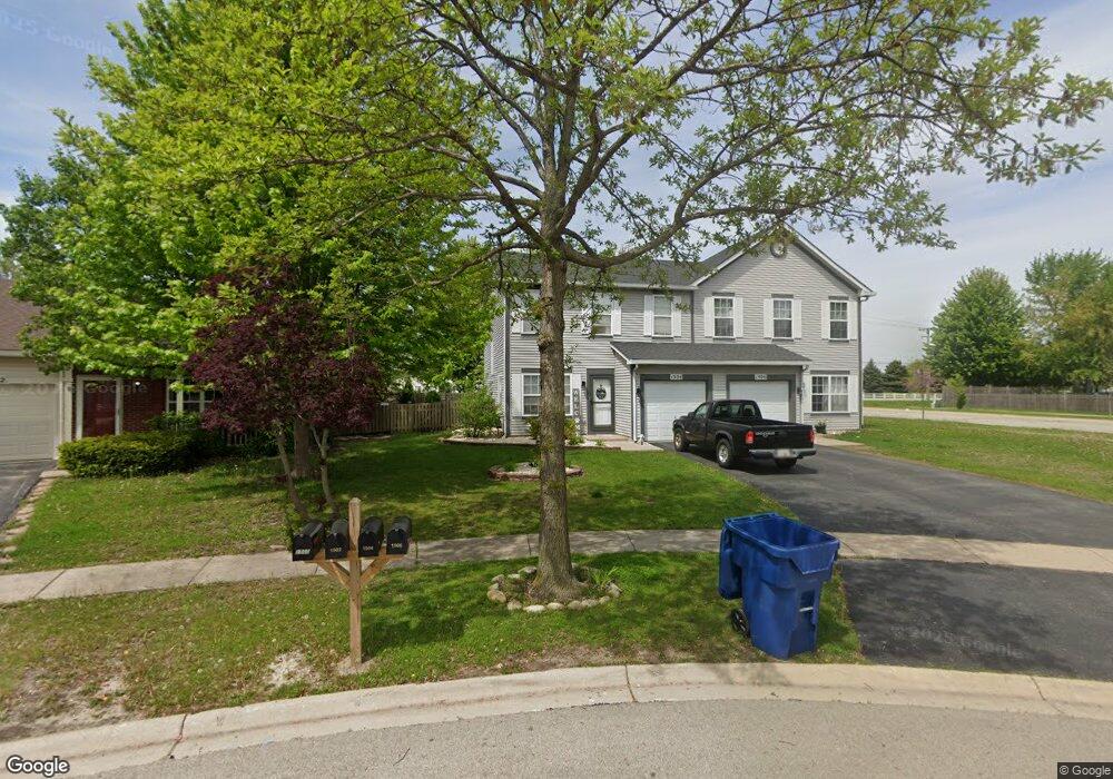
1504 Red Top Ln Minooka, IL 60447
Estimated Value: $238,000 - $261,000
2
Beds
2
Baths
1,324
Sq Ft
$187/Sq Ft
Est. Value
About This Home
This home is located at 1504 Red Top Ln, Minooka, IL 60447 and is currently estimated at $247,022, approximately $186 per square foot. 1504 Red Top Ln is a home located in Grundy County with nearby schools including Minooka Primary Center, Minooka Elementary School, and Minooka Junior High School.
Ownership History
Date
Name
Owned For
Owner Type
Purchase Details
Closed on
Aug 1, 2019
Sold by
Hessling Harry H and Hessling Harry H
Bought by
Solomon Eric
Current Estimated Value
Home Financials for this Owner
Home Financials are based on the most recent Mortgage that was taken out on this home.
Original Mortgage
$142,590
Outstanding Balance
$125,938
Interest Rate
3.8%
Mortgage Type
Construction
Estimated Equity
$121,084
Purchase Details
Closed on
Mar 31, 2014
Sold by
Harry H Harry H
Bought by
Hessling Harry H and The Harry H Hessling Living Trust
Home Financials for this Owner
Home Financials are based on the most recent Mortgage that was taken out on this home.
Original Mortgage
$50,000
Interest Rate
4.41%
Mortgage Type
Credit Line Revolving
Create a Home Valuation Report for This Property
The Home Valuation Report is an in-depth analysis detailing your home's value as well as a comparison with similar homes in the area
Home Values in the Area
Average Home Value in this Area
Purchase History
| Date | Buyer | Sale Price | Title Company |
|---|---|---|---|
| Solomon Eric | $147,000 | None Available | |
| Hessling Harry H | -- | -- |
Source: Public Records
Mortgage History
| Date | Status | Borrower | Loan Amount |
|---|---|---|---|
| Open | Burcenski Tanya | $35,000 | |
| Open | Solomon Eric | $142,590 | |
| Previous Owner | Hessling Harry H | $50,000 |
Source: Public Records
Tax History Compared to Growth
Tax History
| Year | Tax Paid | Tax Assessment Tax Assessment Total Assessment is a certain percentage of the fair market value that is determined by local assessors to be the total taxable value of land and additions on the property. | Land | Improvement |
|---|---|---|---|---|
| 2024 | $4,851 | $60,472 | $8,184 | $52,288 |
| 2023 | $4,421 | $55,120 | $7,460 | $47,660 |
| 2022 | $3,630 | $51,250 | $6,936 | $44,314 |
| 2021 | $3,463 | $48,514 | $6,566 | $41,948 |
| 2020 | $3,367 | $46,408 | $6,281 | $40,127 |
| 2019 | $1,697 | $42,971 | $5,816 | $37,155 |
| 2018 | $1,739 | $37,848 | $5,751 | $32,097 |
| 2017 | $1,775 | $36,142 | $5,492 | $30,650 |
| 2016 | $1,776 | $33,926 | $5,155 | $28,771 |
| 2015 | $1,716 | $30,839 | $4,686 | $26,153 |
| 2014 | $1,647 | $31,594 | $5,575 | $26,019 |
| 2013 | $2,121 | $31,340 | $5,650 | $25,690 |
Source: Public Records
Map
Nearby Homes
- 1468 Sedge Pass
- 1404 Plantain Dr
- 1448 Sedge Pass
- 1935 Waters Edge Dr
- 1941 Waters Edge Dr
- 1413 Sedge Pass
- 25226 S Mallard Dr
- 825 Grant Dr
- 1420 Marigold Ln
- 2080 Waters Edge Dr
- 324 Wabena Ct
- 25441 S Mallard Dr
- The Rosewood Plan at The Preserve At Heritage Woods - The Preserve at Heritage Woods
- The Lakewood Plan at The Preserve At Heritage Woods - The Preserve at Heritage Woods
- The Cedarwood Plan at The Preserve At Heritage Woods - The Preserve at Heritage Woods
- The Beechwood Plan at The Preserve At Heritage Woods - The Preserve at Heritage Woods
- 25204 Westwind Dr
- 27357 W Porto Ln
- 27410 W Porto Ln
- 1074-1080 Clover Dr
- 1504 Red Top Ln Unit 1504
- 1506 Red Top Ln
- 1500 Red Top Ln
- 1498 Red Top Ln
- 1471 Plantain Dr
- 1496 Red Top Ln
- 1477 Plantain Dr
- 1494 Red Top Ln
- 1494 Red Top Ln Unit 2
- 1469 Plantain Dr
- 1479 Plantain Dr Unit 1479
- 1479 Plantain Dr
- 1492 Red Top Ln
- 1481 Plantain Dr
- 1467 Plantain Dr
- 1475 Red Top Ln Unit 1475
- 1475 Red Top Ln
- 1490 Red Top Ln
- 1483 Plantain Dr
- 1465 Plantain Dr