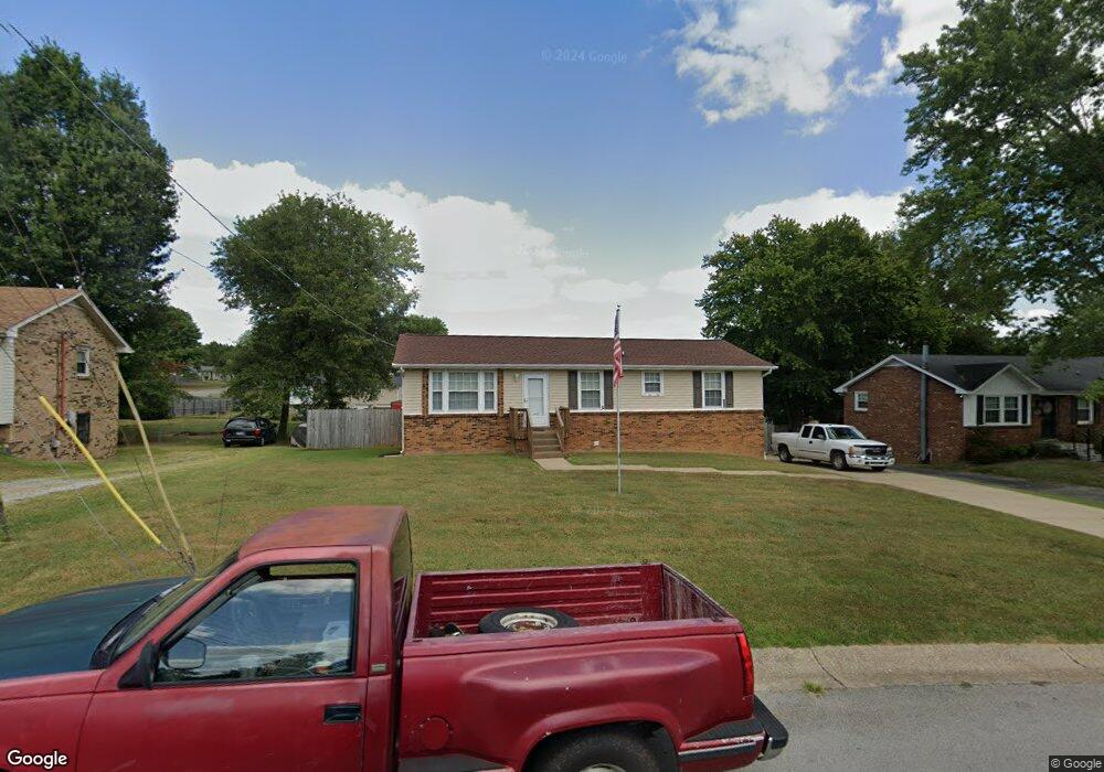
1504 S Freestone Dr Clarksville, TN 37042
Estimated Value: $222,711 - $280,000
--
Bed
2
Baths
1,802
Sq Ft
$140/Sq Ft
Est. Value
About This Home
This home is located at 1504 S Freestone Dr, Clarksville, TN 37042 and is currently estimated at $253,178, approximately $140 per square foot. 1504 S Freestone Dr is a home located in Montgomery County with nearby schools including Minglewood Elementary School, New Providence Middle School, and Northwest High School.
Ownership History
Date
Name
Owned For
Owner Type
Purchase Details
Closed on
Sep 30, 2010
Sold by
Martin Marty
Bought by
Beall David C
Current Estimated Value
Home Financials for this Owner
Home Financials are based on the most recent Mortgage that was taken out on this home.
Original Mortgage
$127,687
Outstanding Balance
$84,303
Interest Rate
4.36%
Estimated Equity
$168,875
Purchase Details
Closed on
Apr 7, 2010
Sold by
Us Bank National Associati
Bought by
Martin Marty
Purchase Details
Closed on
Jan 4, 2010
Sold by
Borders Donald B
Bought by
Us Bank National Association T
Purchase Details
Closed on
Dec 23, 2006
Sold by
Harvey Daniel L
Bought by
Borders Donald B
Purchase Details
Closed on
May 10, 2002
Sold by
Earp Randy C
Bought by
Earp Family Trust
Create a Home Valuation Report for This Property
The Home Valuation Report is an in-depth analysis detailing your home's value as well as a comparison with similar homes in the area
Home Values in the Area
Average Home Value in this Area
Purchase History
| Date | Buyer | Sale Price | Title Company |
|---|---|---|---|
| Beall David C | $125,000 | -- | |
| Martin Marty | $40,900 | -- | |
| Us Bank National Association T | $96,750 | -- | |
| Borders Donald B | $89,900 | -- | |
| Earp Family Trust | -- | -- |
Source: Public Records
Mortgage History
| Date | Status | Borrower | Loan Amount |
|---|---|---|---|
| Open | Earp Family Trust | $127,687 |
Source: Public Records
Tax History Compared to Growth
Tax History
| Year | Tax Paid | Tax Assessment Tax Assessment Total Assessment is a certain percentage of the fair market value that is determined by local assessors to be the total taxable value of land and additions on the property. | Land | Improvement |
|---|---|---|---|---|
| 2024 | $1,727 | $57,950 | $0 | $0 |
| 2023 | $1,727 | $35,625 | $0 | $0 |
| 2022 | $1,503 | $35,625 | $0 | $0 |
| 2021 | $1,503 | $35,425 | $0 | $0 |
| 2020 | $1,424 | $35,425 | $0 | $0 |
| 2019 | $1,424 | $35,425 | $0 | $0 |
| 2018 | $1,221 | $21,300 | $0 | $0 |
| 2017 | $351 | $28,325 | $0 | $0 |
| 2016 | $870 | $28,325 | $0 | $0 |
| 2015 | $1,194 | $28,325 | $0 | $0 |
| 2014 | $1,178 | $28,325 | $0 | $0 |
| 2013 | $1,148 | $26,225 | $0 | $0 |
Source: Public Records
Map
Nearby Homes
- 535 Lafayette Rd
- 102 Winston Ct
- 384 Lillie Belle Ln
- 202 Orchard Rd
- 382 Louise Ln
- 213 Orchard Rd
- 214 Cunningham Ln
- 222 Cunningham Ln
- 402 Lillie Belle Ln
- 245 Raintree Dr
- 148 Cunningham Place
- 510 Yvonne Dr
- 1554 Cherry Tree Dr
- 517 Jewel Dr
- 623 Lafayette Rd
- 13 Charlemagne Blvd
- 25 Charlemagne Blvd
- 224 Drayton Dr Unit G
- 224 Drayton Dr Unit F
- 224 Drayton Dr Unit E
- 1502 S Freestone Dr
- 1506 S Freestone Dr
- 1506 S Freestone Dr
- 1559 Armistead Dr
- 205 Kirby Dr
- 101 Waterwheel Cir
- 200 Allie Kat Way
- 898 Wild Elm Ct
- 1561 Armistead Dr
- 1508 S Freestone Dr
- 1505 S Freestone Dr
- 1557 Armistead Dr
- 1503 S Freestone Dr
- 1565 Armistead Dr
- 1510 Freestone Ct
- 1501 S Freestone Dr
- 0 Armistead Dr
- 204 Aster Dr
- 203 Aster Dr
- 62 Easthaven