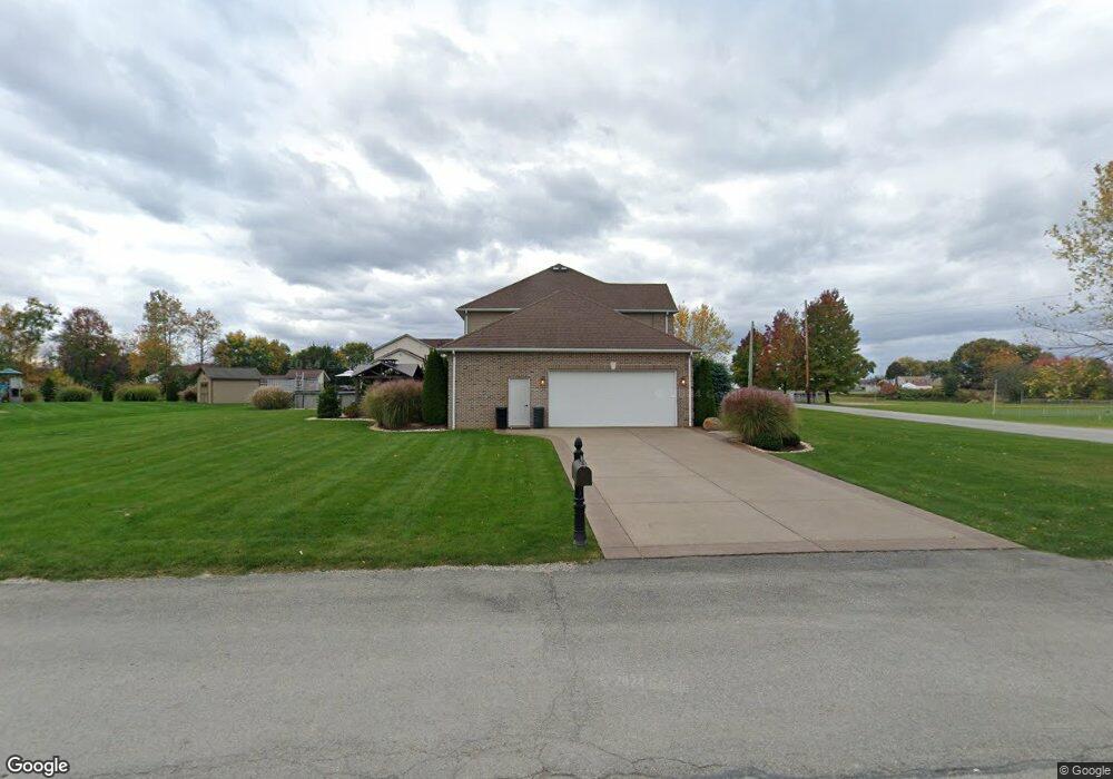
1504 Sampson St Conway, PA 15027
Estimated Value: $320,000 - $519,068
4
Beds
3
Baths
2,545
Sq Ft
$172/Sq Ft
Est. Value
About This Home
This home is located at 1504 Sampson St, Conway, PA 15027 and is currently estimated at $437,767, approximately $172 per square foot. 1504 Sampson St is a home with nearby schools including Freedom Area Elementary School, Freedom Area Middle School, and Freedom Area Senior High School.
Ownership History
Date
Name
Owned For
Owner Type
Purchase Details
Closed on
Jun 23, 2020
Sold by
Stauber Mark W
Bought by
Stauber Mark W and Stauber Johanna L
Current Estimated Value
Purchase Details
Closed on
Feb 21, 2013
Sold by
Rose Gary K and Rose Debra A
Bought by
Stauber Mark W
Purchase Details
Closed on
Oct 12, 2007
Sold by
Carpenter Donald L
Bought by
Rose Gary K
Create a Home Valuation Report for This Property
The Home Valuation Report is an in-depth analysis detailing your home's value as well as a comparison with similar homes in the area
Home Values in the Area
Average Home Value in this Area
Purchase History
| Date | Buyer | Sale Price | Title Company |
|---|---|---|---|
| Stauber Mark W | -- | None Available | |
| Stauber Mark W | $48,000 | None Available | |
| Rose Gary K | $40,000 | -- |
Source: Public Records
Mortgage History
| Date | Status | Borrower | Loan Amount |
|---|---|---|---|
| Open | Stauber Mark W | $201,000 | |
| Closed | Stauber Mark W | $31,080 | |
| Closed | Stauber Mark W | $23,000 | |
| Closed | Stauber Mark W | $236,000 |
Source: Public Records
Tax History Compared to Growth
Tax History
| Year | Tax Paid | Tax Assessment Tax Assessment Total Assessment is a certain percentage of the fair market value that is determined by local assessors to be the total taxable value of land and additions on the property. | Land | Improvement |
|---|---|---|---|---|
| 2025 | $1,480 | $201,700 | $24,750 | $176,950 |
| 2024 | $6,910 | $201,700 | $24,750 | $176,950 |
| 2023 | $7,675 | $62,450 | $6,000 | $56,450 |
| 2022 | $7,457 | $62,450 | $6,000 | $56,450 |
| 2021 | $7,457 | $62,450 | $6,000 | $56,450 |
| 2020 | $6,951 | $62,450 | $6,000 | $56,450 |
| 2019 | $6,951 | $62,450 | $6,000 | $56,450 |
| 2018 | $6,682 | $62,450 | $6,000 | $56,450 |
| 2017 | $6,682 | $62,450 | $6,000 | $56,450 |
| 2016 | $6,066 | $62,450 | $6,000 | $56,450 |
| 2015 | $39 | $62,150 | $6,000 | $56,150 |
| 2014 | $39 | $1,750 | $1,750 | $0 |
Source: Public Records
Map
Nearby Homes
- 1416 Sampson St
- 1517 Foote St
- 1421 Miller St
- 744 N Gross St
- 1113 Foote St
- 1079 Catherine Dr
- 1040 Catherine Dr
- 500 Conway Wallrose Rd
- 1025 Catherine Dr
- 1408 4th Ave
- 1001 7th Ave
- 1401 3rd Ave
- 1341 2nd Ave
- 354 11th St
- 155 Sproat Ave
- 110 13th St
- 1001 2nd Ave
- 145 Oliver Ave
- 899 19th St
- 149 Shady River Blvd Unit 40 B