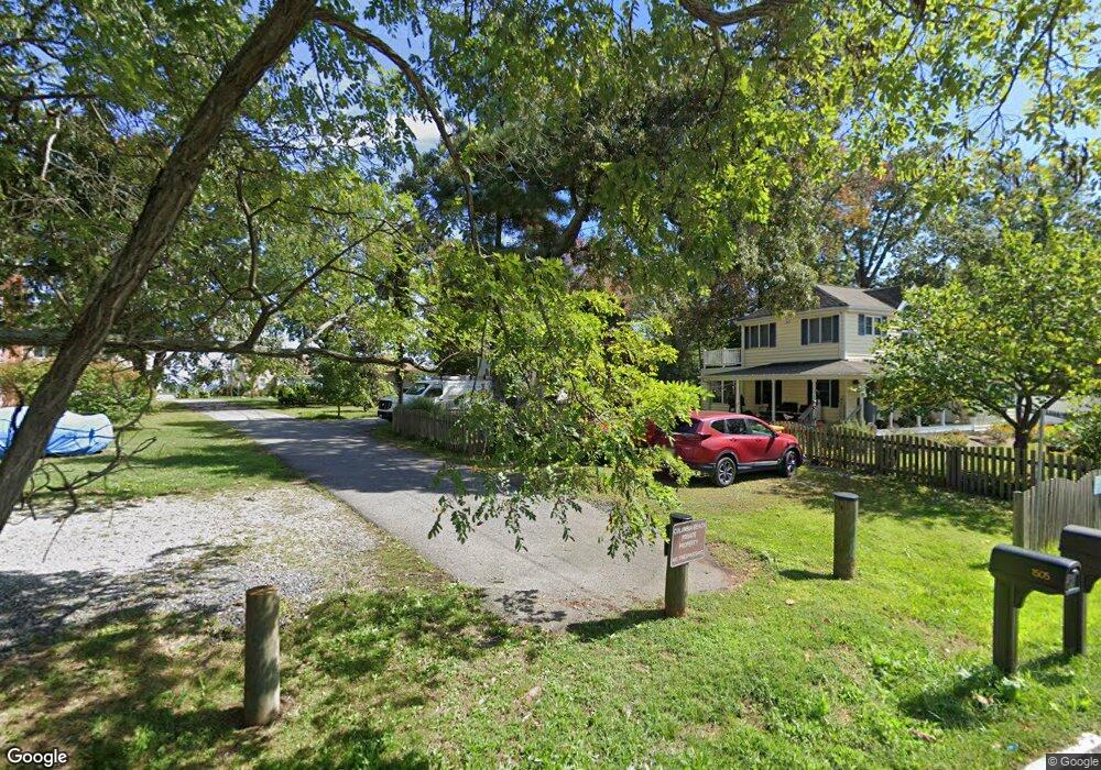
1505 Booker Rd Shady Side, MD 20764
Estimated Value: $341,000 - $372,000
--
Bed
2
Baths
960
Sq Ft
$370/Sq Ft
Est. Value
About This Home
This home is located at 1505 Booker Rd, Shady Side, MD 20764 and is currently estimated at $355,009, approximately $369 per square foot. 1505 Booker Rd is a home located in Anne Arundel County with nearby schools including Shady Side Elementary School, Southern Middle School, and Southern High School.
Ownership History
Date
Name
Owned For
Owner Type
Purchase Details
Closed on
Mar 6, 2001
Sold by
Steinlein Alice E
Bought by
Steinlein Alice E
Current Estimated Value
Purchase Details
Closed on
Nov 30, 2000
Sold by
Blanks Keith M
Bought by
Steinlein Alice E and Madison David L
Purchase Details
Closed on
May 5, 1998
Sold by
Annapolis Specialty Houses Inc
Bought by
Blanks Keith M and Blanks Tane M
Purchase Details
Closed on
Dec 4, 1997
Sold by
E L Gilbert Revocable Trust
Bought by
Annapolis Specialty Houses Inc and Real Estate General , Ltd ,
Create a Home Valuation Report for This Property
The Home Valuation Report is an in-depth analysis detailing your home's value as well as a comparison with similar homes in the area
Home Values in the Area
Average Home Value in this Area
Purchase History
| Date | Buyer | Sale Price | Title Company |
|---|---|---|---|
| Steinlein Alice E | $4,000 | -- | |
| Steinlein Alice E | $129,900 | -- | |
| Blanks Keith M | $120,000 | -- | |
| Annapolis Specialty Houses Inc | $19,500 | -- |
Source: Public Records
Mortgage History
| Date | Status | Borrower | Loan Amount |
|---|---|---|---|
| Closed | Annapolis Specialty Houses Inc | -- |
Source: Public Records
Tax History Compared to Growth
Tax History
| Year | Tax Paid | Tax Assessment Tax Assessment Total Assessment is a certain percentage of the fair market value that is determined by local assessors to be the total taxable value of land and additions on the property. | Land | Improvement |
|---|---|---|---|---|
| 2025 | $3,481 | $270,900 | -- | -- |
| 2024 | $3,481 | $249,700 | $0 | $0 |
| 2023 | $1,891 | $228,500 | $115,000 | $113,500 |
| 2022 | $3,209 | $221,433 | $0 | $0 |
| 2021 | $6,052 | $214,367 | $0 | $0 |
| 2020 | $2,935 | $207,300 | $110,000 | $97,300 |
| 2019 | $2,871 | $204,533 | $0 | $0 |
| 2018 | $2,046 | $201,767 | $0 | $0 |
| 2017 | $2,764 | $199,000 | $0 | $0 |
| 2016 | -- | $197,333 | $0 | $0 |
| 2015 | -- | $195,667 | $0 | $0 |
| 2014 | -- | $194,000 | $0 | $0 |
Source: Public Records
Map
Nearby Homes
- 5250 Al Jones Dr
- 1711 Columbia Beach Rd
- 5235 Al Jones Dr
- 1731 Columbia Beach Rd
- 5211 Al Jones Dr
- 1520 Lincoln Rd
- 1166 Cedar Ave
- 1195 Cedar Ave
- 1445 & 1447 Haile Pkwy
- 0 Haile Pkwy Unit MDAA2127474
- 0 Haile Pkwy Unit MDAA2109444
- 1461 Cedarhurst Rd
- 1436 Haile Pkwy
- 1199 Oak Ave
- 1192 Oak Ave
- 1408 & 1410 Haile Pkwy
- 1428 Haile Pkwy
- 1220 Grove Ave
- 1185 Holly Ave
- 5196 Chesapeake Ave
- 1501 Booker Rd
- 5300 Al Jones Dr
- 5304 Al Jones Dr
- 1502 Garst Rd
- 1500 Garst Rd
- 1500 Booker Rd
- 1502 Booker Rd
- 5308 Al Jones Dr
- 1707 Columbia Beach Rd
- 5301 Al Jones Dr
- 5271 Al Jones Dr
- 1501 Washington Rd
- 5307 Al Jones Dr
- 5262 Al Jones Dr
- 5269 Al Jones Dr
- 5312 Al Jones Dr
- 5267 Al Jones Dr
- 1715 Columbia Beach Rd
- 5020 Al Jones Dr
- 0 Al Jones Dr