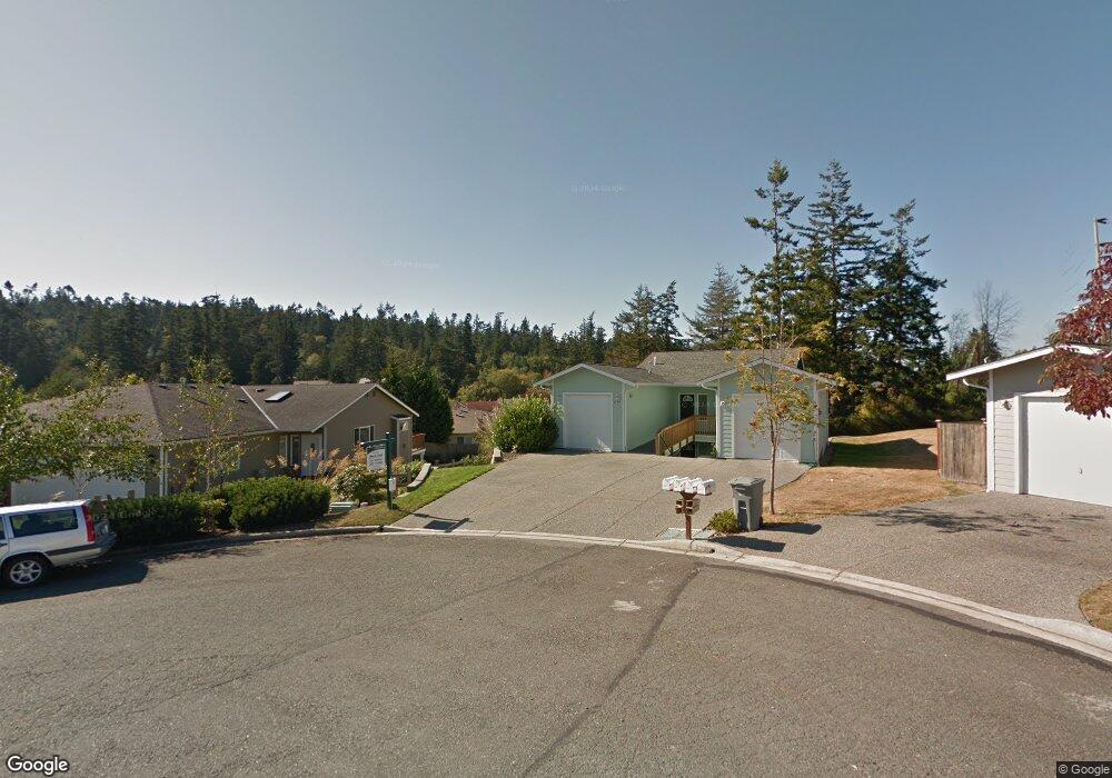
1505 Burrows Ct Unit 1505 Anacortes, WA 98221
Skyline NeighborhoodEstimated Value: $488,630 - $629,000
2
Beds
2
Baths
1,185
Sq Ft
$463/Sq Ft
Est. Value
About This Home
This home is located at 1505 Burrows Ct Unit 1505, Anacortes, WA 98221 and is currently estimated at $548,408, approximately $462 per square foot. 1505 Burrows Ct Unit 1505 is a home located in Skagit County with nearby schools including Anacortes High School.
Ownership History
Date
Name
Owned For
Owner Type
Purchase Details
Closed on
Mar 21, 2025
Sold by
Wayne And Erin Evans Trust and Evans Wayne E
Bought by
Evans Daniel Milo and Evans Kacie Ann
Current Estimated Value
Purchase Details
Closed on
Apr 11, 2023
Sold by
Lois Marie Hart Revocable Trust
Bought by
Wayne And Erin Evans Trust
Purchase Details
Closed on
Mar 16, 2015
Sold by
Kisner Roger L and Kisner Nancy W
Bought by
Hart Lois Marie
Purchase Details
Closed on
Mar 21, 2006
Sold by
Remmenga Joshua D and Remmenga Lyle D
Bought by
Kisner Roger L and Kisner Nancy W
Purchase Details
Closed on
Jul 12, 2004
Sold by
Jenssen Craig and Jenssen Kim
Bought by
Remmenga Lyle D and Remmenga Sharon J
Home Financials for this Owner
Home Financials are based on the most recent Mortgage that was taken out on this home.
Original Mortgage
$159,000
Interest Rate
6.27%
Create a Home Valuation Report for This Property
The Home Valuation Report is an in-depth analysis detailing your home's value as well as a comparison with similar homes in the area
Home Values in the Area
Average Home Value in this Area
Purchase History
| Date | Buyer | Sale Price | Title Company |
|---|---|---|---|
| Evans Daniel Milo | -- | None Listed On Document | |
| Wayne And Erin Evans Trust | -- | None Listed On Document | |
| Hart Lois Marie | $175,000 | Guardian Northwest Title Co | |
| Kisner Roger L | $245,280 | Chicago Title Company Island | |
| Remmenga Lyle D | $212,000 | Chicago Title Co |
Source: Public Records
Mortgage History
| Date | Status | Borrower | Loan Amount |
|---|---|---|---|
| Previous Owner | Remmenga Lyle D | $159,000 |
Source: Public Records
Tax History Compared to Growth
Tax History
| Year | Tax Paid | Tax Assessment Tax Assessment Total Assessment is a certain percentage of the fair market value that is determined by local assessors to be the total taxable value of land and additions on the property. | Land | Improvement |
|---|---|---|---|---|
| 2025 | $3,643 | $498,800 | $225,800 | $273,000 |
| 2024 | $3,427 | $482,100 | $225,000 | $257,100 |
| 2023 | $3,427 | $454,100 | $232,700 | $221,400 |
| 2022 | $2,991 | $395,200 | $200,400 | $194,800 |
| 2021 | $2,726 | $349,500 | $163,200 | $186,300 |
| 2020 | $2,684 | $295,300 | $0 | $0 |
| 2019 | $2,341 | $284,900 | $0 | $0 |
| 2018 | $2,392 | $248,100 | $0 | $0 |
| 2017 | $2,003 | $228,200 | $0 | $0 |
| 2016 | $1,884 | $210,300 | $74,500 | $135,800 |
| 2015 | $1,827 | $190,200 | $67,800 | $122,400 |
| 2013 | $1,745 | $179,100 | $0 | $0 |
Source: Public Records
Map
Nearby Homes
- 6000 Sands Way
- 2806 Coho Ln
- 1710 Skyline Way Unit 103
- 2712 Coho Ln
- 6127 Parkside Dr
- 1800 Skyline Way Unit 206
- 1800 Skyline Way Unit 205
- 5610 Rosario Way
- 2301 Sundown Ct
- 5320 Ferry Terminal Rd
- 4902 Portalis Way Unit 1
- 1907 Tweed Place
- 2016 Piper Cir
- 4909 Edwards Way
- 4700 Camano Place
- 4607 Camano Place
- 4604 Yorkshire Dr
- 2317 Twin Place
- 4429 Bryce Dr
- 4205 Tyler Way
- 1507 Burrows Ct Unit 1507
- 1509 Burrows Ct Unit 1509
- 1511 Burrows Ct Unit 1511
- 6006 Parkside Dr
- 1503 Burrows Ct
- 1503 Burrows Ct Unit B
- 1503 Burrows Ct Unit A
- 6008 Parkside Dr
- 1508 Burrows Ct
- 6002 Parkside Dr Unit E
- 6002 Parkside Dr Unit C
- 6002 Parkside Dr Unit D
- 6002 Parkside Dr Unit B
- 6002 Parkside Dr Unit A
- 6002 Parkside Dr
- 1501 Burrows Ct
- 1506 Burrows Ct
- 1504 Burrows Ct
- 6010 Sunset Ave
- 6020 Sunset Ave