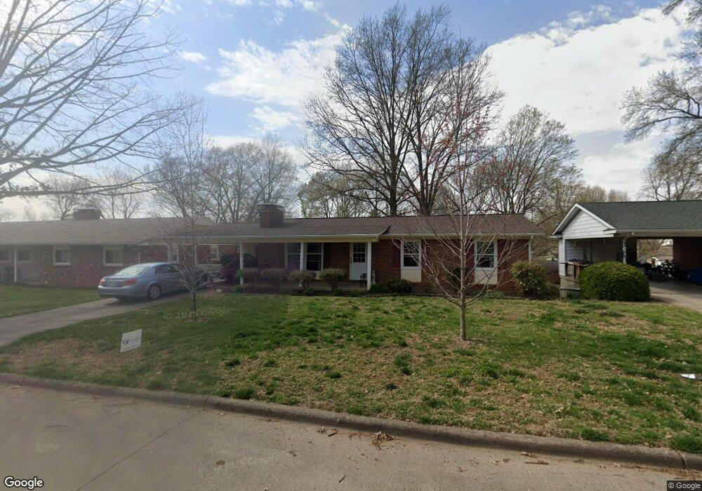
1505 E Riverside Dr Cape Girardeau, MO 63701
Estimated Value: $194,000 - $209,899
3
Beds
2
Baths
1,316
Sq Ft
$154/Sq Ft
Est. Value
About This Home
This home is located at 1505 E Riverside Dr, Cape Girardeau, MO 63701 and is currently estimated at $202,475, approximately $153 per square foot. 1505 E Riverside Dr is a home with nearby schools including Alma Schrader Elementary School, Central Middle School, and Central Junior High School.
Ownership History
Date
Name
Owned For
Owner Type
Purchase Details
Closed on
Nov 12, 2025
Sold by
Martin Charles R and Martin Jean L
Bought by
Charles R Martin And Jean L Martin Joint Revo and Martin
Current Estimated Value
Purchase Details
Closed on
Nov 24, 2014
Sold by
Flori Trust
Bought by
Martin Charles R and Martin Jean L
Home Financials for this Owner
Home Financials are based on the most recent Mortgage that was taken out on this home.
Original Mortgage
$67,500
Interest Rate
3.99%
Mortgage Type
New Conventional
Create a Home Valuation Report for This Property
The Home Valuation Report is an in-depth analysis detailing your home's value as well as a comparison with similar homes in the area
Purchase History
| Date | Buyer | Sale Price | Title Company |
|---|---|---|---|
| Charles R Martin And Jean L Martin Joint Revo | -- | None Listed On Document | |
| Martin Charles R | -- | -- |
Source: Public Records
Mortgage History
| Date | Status | Borrower | Loan Amount |
|---|---|---|---|
| Previous Owner | Martin Charles R | $67,500 |
Source: Public Records
Tax History
| Year | Tax Paid | Tax Assessment Tax Assessment Total Assessment is a certain percentage of the fair market value that is determined by local assessors to be the total taxable value of land and additions on the property. | Land | Improvement |
|---|---|---|---|---|
| 2025 | $1,171 | $22,420 | $2,810 | $19,610 |
| 2024 | $11 | $21,360 | $2,680 | $18,680 |
| 2023 | $1,110 | $21,360 | $2,680 | $18,680 |
| 2022 | $1,023 | $19,680 | $2,470 | $17,210 |
| 2021 | $1,023 | $19,680 | $2,470 | $17,210 |
| 2020 | $1,026 | $19,680 | $2,470 | $17,210 |
| 2019 | $1,025 | $19,680 | $0 | $0 |
| 2018 | $1,023 | $19,680 | $0 | $0 |
| 2017 | $1,025 | $19,680 | $0 | $0 |
| 2016 | $960 | $18,510 | $0 | $0 |
| 2015 | $984 | $18,950 | $0 | $0 |
| 2014 | $989 | $18,950 | $0 | $0 |
Source: Public Records
Map
Nearby Homes
- 3055/3057 Patriot Dr
- 1813 Belleridge Pike
- 983 Rifle Dr
- 835 Lochinvar Ln
- 1705 Paul Revere Dr
- 1843 Dixie Blvd
- 2449 Janet Dr
- 3042 Northchurch
- 1925 Randol Dr
- 2533 Tulip Ln
- 1646 Westwood Dr
- 2325 Sherwood Dr
- 1829 Weissinger Ln W
- 3013 Hopper Rd
- 3022 Beavercreek Dr
- 2753 Adeline St
- 3014 Keystone Dr
- 2231 Sherwood Dr
- 2214 Kent Dr
- 1960 Briarwood Dr
- 1509 E Riverside Dr
- 1501 E Riverside Dr
- 1508 E Riverside Dr
- 1513 E Riverside Dr
- 1504 E Riverside Dr
- 1512 E Riverside Dr
- 1502 E Riverside Dr
- 1508 Kingsbury St
- 1517 E Riverside Dr
- 1471 Kingsway Dr
- 1516 E Riverside Dr
- 1456 Kingsway Dr
- 1467 Kingsway Dr
- 1512 Kingsbury Rd
- 1521 E Riverside Dr
- 1520 E Riverside Dr
- 1516 Kingsbury St
- 1459 Kingsway Dr
- 1543 Grandview Dr