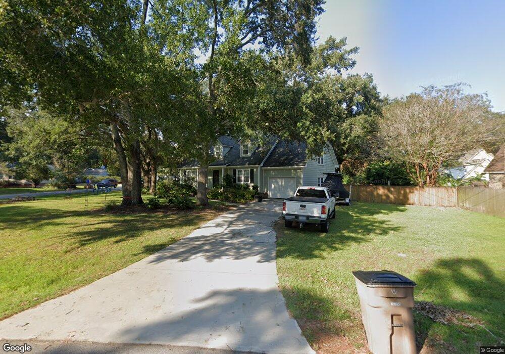
1505 Kentwood Cir Charleston, SC 29412
James Island NeighborhoodEstimated Value: $577,000 - $661,000
3
Beds
2
Baths
1,914
Sq Ft
$322/Sq Ft
Est. Value
About This Home
This home is located at 1505 Kentwood Cir, Charleston, SC 29412 and is currently estimated at $616,202, approximately $321 per square foot. 1505 Kentwood Cir is a home located in Charleston County with nearby schools including James Island Elementary School, Camp Road Middle, and Septima P Clark Corporate Academy.
Ownership History
Date
Name
Owned For
Owner Type
Purchase Details
Closed on
Feb 25, 2021
Sold by
Elam Andrew D
Bought by
Elam Andrew D and Elam Jessica R
Current Estimated Value
Home Financials for this Owner
Home Financials are based on the most recent Mortgage that was taken out on this home.
Original Mortgage
$243,500
Outstanding Balance
$180,486
Interest Rate
2.7%
Mortgage Type
New Conventional
Estimated Equity
$435,716
Purchase Details
Closed on
Feb 25, 2010
Sold by
Washington Anthony L
Bought by
Elam Andrew D
Home Financials for this Owner
Home Financials are based on the most recent Mortgage that was taken out on this home.
Original Mortgage
$173,992
Interest Rate
4.87%
Mortgage Type
FHA
Create a Home Valuation Report for This Property
The Home Valuation Report is an in-depth analysis detailing your home's value as well as a comparison with similar homes in the area
Home Values in the Area
Average Home Value in this Area
Purchase History
| Date | Buyer | Sale Price | Title Company |
|---|---|---|---|
| Elam Andrew D | -- | None Available | |
| Elam Andrew D | $190,000 | -- |
Source: Public Records
Mortgage History
| Date | Status | Borrower | Loan Amount |
|---|---|---|---|
| Open | Elam Andrew D | $243,500 | |
| Closed | Elam Andrew D | $173,992 |
Source: Public Records
Tax History Compared to Growth
Tax History
| Year | Tax Paid | Tax Assessment Tax Assessment Total Assessment is a certain percentage of the fair market value that is determined by local assessors to be the total taxable value of land and additions on the property. | Land | Improvement |
|---|---|---|---|---|
| 2024 | $1,208 | $9,520 | $0 | $0 |
| 2023 | $1,208 | $9,520 | $0 | $0 |
| 2022 | $1,088 | $9,520 | $0 | $0 |
| 2021 | $1,162 | $9,520 | $0 | $0 |
| 2020 | $1,174 | $9,520 | $0 | $0 |
| 2019 | $1,076 | $8,280 | $0 | $0 |
| 2017 | $1,140 | $8,280 | $0 | $0 |
| 2016 | $1,095 | $8,280 | $0 | $0 |
| 2015 | $1,132 | $8,280 | $0 | $0 |
| 2014 | $954 | $0 | $0 | $0 |
| 2011 | -- | $0 | $0 | $0 |
Source: Public Records
Map
Nearby Homes
- 1030 Pauline Ave
- 1014 Arborwood Dr
- 1135 Bellwood Rd
- 1153 Pauline Ave
- 1152 Bradford Ave
- 1047 Bradford Ave
- 1107 Secessionville Rd
- 1418 Kentwood Cir
- 1453 Camp Rd
- 1182 Folly Rd Unit A,B,C,D
- 1 S Anderson Ave
- 1206 Folly Rd
- 17 S Anderson Ave Unit A,B,C, D
- 1530 Fort Johnson Rd Unit 1E
- 1530 Fort Johnson Rd Unit 1L
- 1402 Camp Rd Unit 5E
- 1402 Camp Rd Unit 6E
- 1402 Camp Rd Unit 1H
- 1402 Camp Rd Unit 8B
- 1402 Camp Rd Unit 9C
- 1501 Kentwood Cir
- 1047 Arborwood Dr
- 1043 Arborwood Dr
- 1507 Kentwood Cir
- 1502 Kentwood Cir
- 1504 Kentwood Cir
- 1497 Kentwood Cir
- 1039 Arborwood Dr
- 1498 Kentwood Cir
- 1506 Kentwood Cir
- 1509 Kentwood Cir
- 1496 Kentwood Cir
- 1508 Kentwood Cir
- 1493 Kentwood Cir
- 1035 Arborwood Dr
- 1050 Arborwood Dr
- 1441 Downwood Place
- 1046 Arborwood Dr
- 1042 Arborwood Dr
- 1514 Kentwood Cir