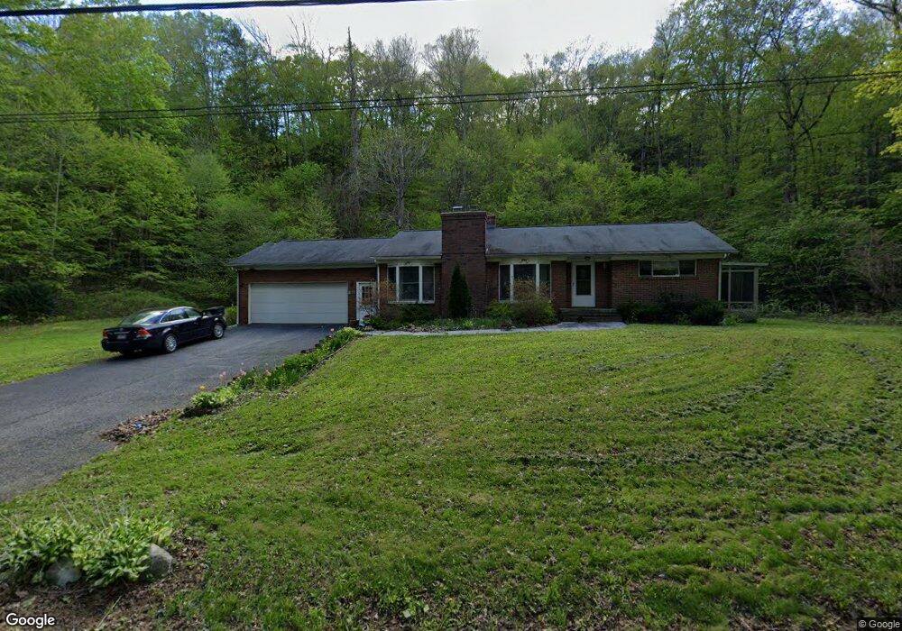
1505 Norfolk Rd Torrington, CT 06790
Estimated Value: $241,000 - $330,000
3
Beds
2
Baths
1,332
Sq Ft
$220/Sq Ft
Est. Value
About This Home
This home is located at 1505 Norfolk Rd, Torrington, CT 06790 and is currently estimated at $292,785, approximately $219 per square foot. 1505 Norfolk Rd is a home located in Litchfield County with nearby schools including Torrington Middle School, Torrington High School, and St. John Paul the Great Academy.
Ownership History
Date
Name
Owned For
Owner Type
Purchase Details
Closed on
May 1, 2017
Sold by
Leahy Michele R
Bought by
Sheehy Joan D
Current Estimated Value
Purchase Details
Closed on
May 22, 2001
Sold by
Wilcox Russell A and Wilcox Tammy L
Bought by
Leahy Michele R
Purchase Details
Closed on
Jan 20, 1994
Sold by
Marino Gary and Marino Chris M
Bought by
Groskritz Tammy L and Wilcox Russell A
Create a Home Valuation Report for This Property
The Home Valuation Report is an in-depth analysis detailing your home's value as well as a comparison with similar homes in the area
Home Values in the Area
Average Home Value in this Area
Purchase History
| Date | Buyer | Sale Price | Title Company |
|---|---|---|---|
| Sheehy Joan D | $159,000 | -- | |
| Leahy Michele R | $138,900 | -- | |
| Groskritz Tammy L | $104,000 | -- |
Source: Public Records
Mortgage History
| Date | Status | Borrower | Loan Amount |
|---|---|---|---|
| Previous Owner | Groskritz Tammy L | $117,100 | |
| Previous Owner | Groskritz Tammy L | $109,300 | |
| Previous Owner | Groskritz Tammy L | $109,050 |
Source: Public Records
Tax History Compared to Growth
Tax History
| Year | Tax Paid | Tax Assessment Tax Assessment Total Assessment is a certain percentage of the fair market value that is determined by local assessors to be the total taxable value of land and additions on the property. | Land | Improvement |
|---|---|---|---|---|
| 2025 | $6,626 | $172,340 | $23,800 | $148,540 |
| 2024 | $5,060 | $105,480 | $23,770 | $81,710 |
| 2023 | $5,059 | $105,480 | $23,770 | $81,710 |
| 2022 | $4,972 | $105,480 | $23,770 | $81,710 |
| 2021 | $4,870 | $105,480 | $23,770 | $81,710 |
| 2020 | $4,870 | $105,480 | $23,770 | $81,710 |
| 2019 | $4,699 | $101,780 | $29,200 | $72,580 |
| 2018 | $4,699 | $101,780 | $29,200 | $72,580 |
| 2017 | $4,326 | $94,550 | $29,200 | $65,350 |
| 2016 | $4,326 | $94,550 | $29,200 | $65,350 |
| 2015 | $4,326 | $94,550 | $29,200 | $65,350 |
| 2014 | $4,348 | $119,710 | $42,840 | $76,870 |
Source: Public Records
Map
Nearby Homes
- 721 Marshall Lake Rd
- 111 Mill Ln
- 79 Brass Mill Dam Rd
- 000 Newfield Rd
- 0 Meyer Rd
- 197 Meyer Rd
- 617 Guerdat Rd
- 187 Lovers Ln Unit 61
- 75 Hunter Ct Unit 75
- 0 Stoneridge Dr
- 109 East St N
- 107 Queens Rd Unit K107
- 3 Surrey Ln Unit L3
- 168 Newfield Rd
- 27 Surrey Ln Unit d27
- 38 Surrey Ln Unit 38
- 0 Queens Rd
- 839 Main St Unit 65
- 839 Main St Unit 12
- 839 Main St Unit 91
- 1210 University Dr
- 1375 Norfolk Rd
- 1365 Norfolk Rd
- 1355 Norfolk Rd
- 1345 Norfolk Rd
- 1650 Norfolk Rd
- 1335 Norfolk Rd
- 1211 University Dr
- 1325 Norfolk Rd
- 1269 University Dr
- 362 Brandy Hill Rd
- 1705 Norfolk Rd
- 1715 Norfolk Rd
- 300 Brandy Hill Rd
- 260 Brandy Hill Rd
- 1725 Norfolk Rd
- 400 Brandy Hill Rd
- n/a Norfolk Rd
- 178 Norfolk Rd
- 757 Norfolk Rd