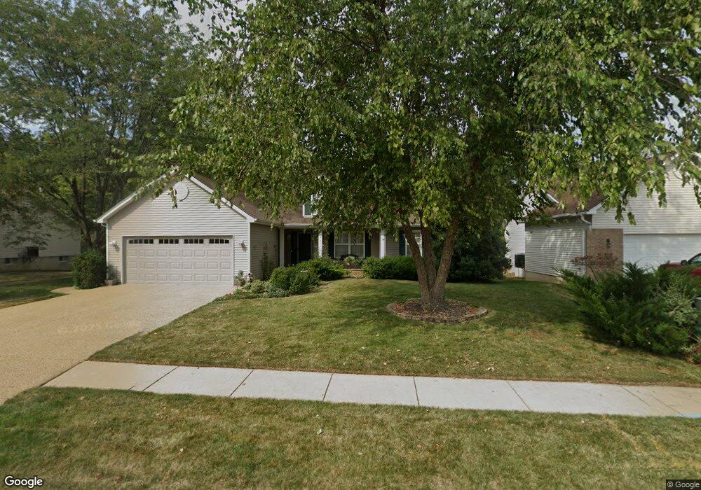
1505 Parsons Bend Ct O Fallon, MO 63366
Estimated Value: $394,916 - $453,000
4
Beds
3
Baths
1,708
Sq Ft
$247/Sq Ft
Est. Value
About This Home
This home is located at 1505 Parsons Bend Ct, O Fallon, MO 63366 and is currently estimated at $421,229, approximately $246 per square foot. 1505 Parsons Bend Ct is a home located in St. Charles County with nearby schools including Dardenne Elementary School, Fort Zumwalt West Middle School, and Fort Zumwalt West High School.
Ownership History
Date
Name
Owned For
Owner Type
Purchase Details
Closed on
Dec 30, 2009
Sold by
Willhite Doyle O and Willhite Elizabeth
Bought by
Campbell Carole S
Current Estimated Value
Purchase Details
Closed on
Apr 28, 2000
Sold by
Mls Homes Inc
Bought by
Willhite Doyle O and Willhite Elizabeth
Home Financials for this Owner
Home Financials are based on the most recent Mortgage that was taken out on this home.
Original Mortgage
$110,000
Interest Rate
8.21%
Create a Home Valuation Report for This Property
The Home Valuation Report is an in-depth analysis detailing your home's value as well as a comparison with similar homes in the area
Home Values in the Area
Average Home Value in this Area
Purchase History
| Date | Buyer | Sale Price | Title Company |
|---|---|---|---|
| Campbell Carole S | $230,000 | Ust | |
| Willhite Doyle O | -- | Emmons Title |
Source: Public Records
Mortgage History
| Date | Status | Borrower | Loan Amount |
|---|---|---|---|
| Previous Owner | Willhite Doyle O | $110,000 | |
| Closed | Willhite Doyle O | $50,000 |
Source: Public Records
Tax History
| Year | Tax Paid | Tax Assessment Tax Assessment Total Assessment is a certain percentage of the fair market value that is determined by local assessors to be the total taxable value of land and additions on the property. | Land | Improvement |
|---|---|---|---|---|
| 2025 | $4,225 | $71,787 | -- | -- |
| 2023 | $4,227 | $63,925 | $0 | $0 |
| 2022 | $3,576 | $50,254 | $0 | $0 |
| 2021 | $3,579 | $50,254 | $0 | $0 |
| 2020 | $3,657 | $49,775 | $0 | $0 |
| 2019 | $3,666 | $49,775 | $0 | $0 |
| 2018 | $3,427 | $44,417 | $0 | $0 |
| 2017 | $3,386 | $44,417 | $0 | $0 |
| 2016 | $2,965 | $38,743 | $0 | $0 |
| 2015 | $2,757 | $38,743 | $0 | $0 |
| 2014 | $2,789 | $38,543 | $0 | $0 |
Source: Public Records
Map
Nearby Homes
- 76 Brook Hollow Ct
- 18 Bayberry Meadows Ct
- 1466 Soaring Eagle Dr
- New Build Berkshire II "D" @ Inverness
- 126 Royal Troon Dr
- 128 Royal Troon Dr
- New Build Berkshire "A" @ Inverness
- 113 Royal Troon Dr
- TBB Glenwyck "A"@inverness
- 109 Sterling Crossing Dr
- New Build Berkshire "C" @ Inverness
- 18 Locust Hills Ct
- 142 Royal Troon Dr
- 143 Royal Troon Dr
- 3 Warchol Ct
- 152 Royal Troon Dr
- 11 Warchol Ct
- 313 Kingsbarns Ct
- 322 Kingsbarns Ct
- 610 Cruden Bay Ct
- 1501 Parsons Bend Ct
- 1509 Parsons Bend Ct
- 1052 Annabrook Park Dr
- 1504 Parsons Bend Ct
- 1500 Parsons Bend Ct
- 1508 Parsons Bend Ct
- 1056 Annabrook Park Dr
- 1045 Annabrook Park Dr
- 1049 Annabrook Park Dr
- 1512 Parsons Bend Ct
- 1517 Parsons Bend Ct
- 1053 Annabrook Park Dr
- 1034 Annabrook Park Dr
- 1041 Annabrook Park Dr
- 1060 Annabrook Park Dr
- 1516 Parsons Bend Ct
- 1057 Annabrook Park Dr
- 1521 Parsons Bend Ct
- 1030 Annabrook Park Dr
- 77 Brook Hollow Ct
Your Personal Tour Guide
Ask me questions while you tour the home.