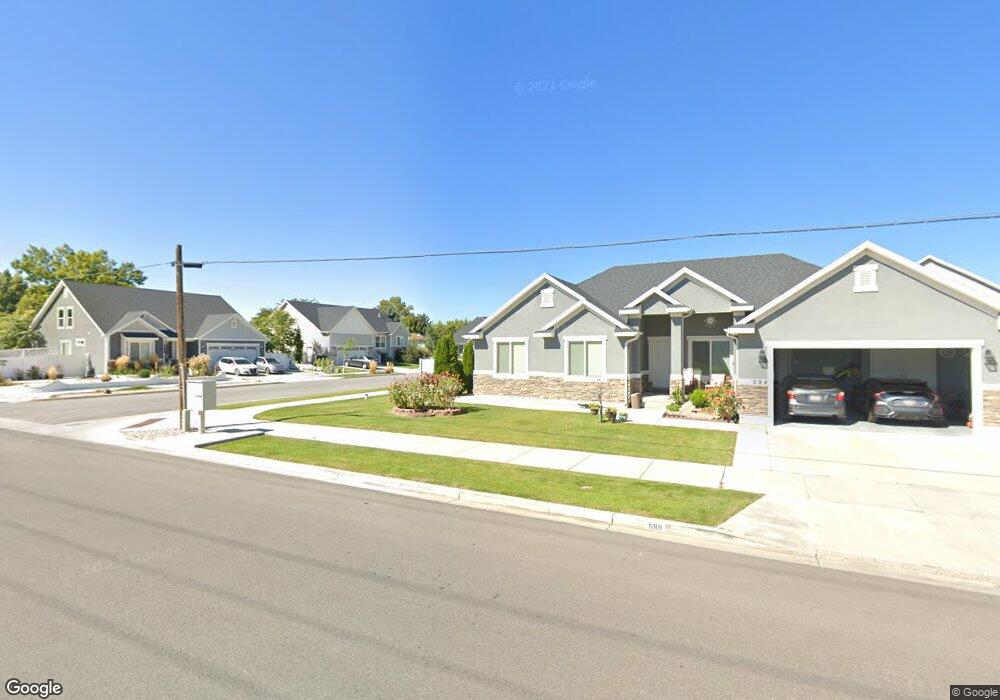
1505 S 620 W Unit 3 Provo, UT 84601
Franklin NeighborhoodEstimated Value: $633,000 - $692,000
5
Beds
4
Baths
2,573
Sq Ft
$261/Sq Ft
Est. Value
About This Home
This home is located at 1505 S 620 W Unit 3, Provo, UT 84601 and is currently estimated at $670,506, approximately $260 per square foot. 1505 S 620 W Unit 3 is a home located in Utah County with nearby schools including Franklin Elementary School, Dixon Middle School, and Provo High School.
Ownership History
Date
Name
Owned For
Owner Type
Purchase Details
Closed on
Jun 15, 2015
Sold by
Arive Homes Llc
Bought by
Seegmiller Joseph and Seegmiller Kimberly
Current Estimated Value
Home Financials for this Owner
Home Financials are based on the most recent Mortgage that was taken out on this home.
Original Mortgage
$311,791
Outstanding Balance
$240,539
Interest Rate
3.64%
Mortgage Type
New Conventional
Estimated Equity
$429,967
Purchase Details
Closed on
Dec 15, 2014
Sold by
New Roads Properties Llc
Bought by
Arive Homes Llc
Home Financials for this Owner
Home Financials are based on the most recent Mortgage that was taken out on this home.
Original Mortgage
$264,000
Interest Rate
4%
Mortgage Type
Construction
Create a Home Valuation Report for This Property
The Home Valuation Report is an in-depth analysis detailing your home's value as well as a comparison with similar homes in the area
Home Values in the Area
Average Home Value in this Area
Purchase History
| Date | Buyer | Sale Price | Title Company |
|---|---|---|---|
| Seegmiller Joseph | -- | Provo Land Title Co | |
| Arive Homes Llc | -- | Provo Land Title Co |
Source: Public Records
Mortgage History
| Date | Status | Borrower | Loan Amount |
|---|---|---|---|
| Open | Seegmiller Joseph | $311,791 | |
| Previous Owner | Arive Homes Llc | $264,000 |
Source: Public Records
Tax History Compared to Growth
Tax History
| Year | Tax Paid | Tax Assessment Tax Assessment Total Assessment is a certain percentage of the fair market value that is determined by local assessors to be the total taxable value of land and additions on the property. | Land | Improvement |
|---|---|---|---|---|
| 2025 | $3,332 | $341,000 | $257,700 | $362,300 |
| 2024 | $3,332 | $328,020 | $0 | $0 |
| 2023 | $3,263 | $316,690 | $0 | $0 |
| 2022 | $3,533 | $345,675 | $0 | $0 |
| 2021 | $2,842 | $485,000 | $145,400 | $339,600 |
| 2020 | $2,738 | $438,000 | $126,400 | $311,600 |
| 2019 | $2,398 | $399,000 | $126,400 | $272,600 |
| 2018 | $2,107 | $355,500 | $118,500 | $237,000 |
| 2017 | $1,855 | $171,985 | $0 | $0 |
| 2016 | $1,689 | $145,970 | $0 | $0 |
| 2015 | $633 | $55,300 | $0 | $0 |
Source: Public Records
Map
Nearby Homes
- 655 W 1280 S
- 588 W 1720 S
- 642 W 1870 S Unit 1046
- 311 W 1610 S
- Oakridge (Crawl) Plan at Osprey Towns
- 686 W 1920 S Unit 1024
- Dalton Plan at Osprey Towns
- Dumont Plan at Osprey Towns
- Millbrook (Crawl) Plan at Osprey Towns
- 1895 S 530 W Unit 1191
- 661 W 1920 S Unit 1072
- 1095 S 500 W Unit 11
- 985 S 600 W
- 914 W 1150 S Unit 2
- 908 W 1150 S Unit 3
- 272 W 1020 S Unit B
- 966 S Freedom Blvd Unit 1
- 239 S Meadow Dr Unit 10
- 131 S Meadow Dr Unit 20
- 169 S Meadow Dr Unit 18
- 1524 S 620 W Unit 2
- 635 W 1450 S
- 1501 S 680 W
- 1497 S 620 W Unit 4
- 1473 S 680 W
- 1521 S 680 W
- 607 W 1450 S
- 1542 S 620 W Unit 1
- 1542 S 620 W
- 1519 S 620 W Unit 5
- 1519 S 620 W
- 598 W 1560 S Unit 6
- 1539 S 620 W Unit 6
- 1541 S 680 W
- 579 W 1450 S
- 644 W 1450 S
- 664 W 1450 S
- 578 W 1560 S Unit 7
- 1441 S 680 W
- 1526 S 680 W