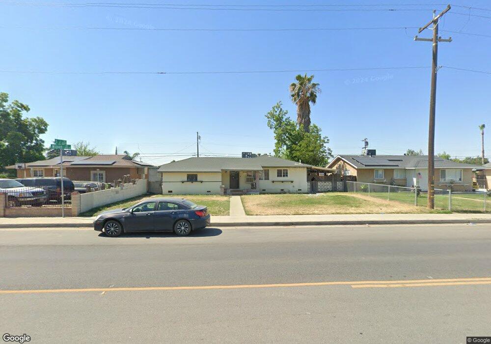
1505 Wilson Rd Bakersfield, CA 93304
Wible Orchard NeighborhoodEstimated Value: $238,000 - $299,000
3
Beds
1
Bath
1,049
Sq Ft
$255/Sq Ft
Est. Value
About This Home
This home is located at 1505 Wilson Rd, Bakersfield, CA 93304 and is currently estimated at $267,387, approximately $254 per square foot. 1505 Wilson Rd is a home located in Kern County with nearby schools including Frank West Elementary School, Curran Middle School, and South High School.
Ownership History
Date
Name
Owned For
Owner Type
Purchase Details
Closed on
Dec 13, 2008
Sold by
Bank Of New York
Bought by
Lozano Carmen A
Current Estimated Value
Purchase Details
Closed on
Sep 30, 2008
Sold by
Laris Marina G
Bought by
Bank Of New York
Purchase Details
Closed on
Oct 6, 2006
Sold by
Laris Javier
Bought by
Laris Marina G
Home Financials for this Owner
Home Financials are based on the most recent Mortgage that was taken out on this home.
Original Mortgage
$215,650
Interest Rate
6.44%
Mortgage Type
New Conventional
Purchase Details
Closed on
Oct 5, 2006
Sold by
Caracas Marco V and Caracas Thais
Bought by
Laris Marina G
Home Financials for this Owner
Home Financials are based on the most recent Mortgage that was taken out on this home.
Original Mortgage
$215,650
Interest Rate
6.44%
Mortgage Type
New Conventional
Create a Home Valuation Report for This Property
The Home Valuation Report is an in-depth analysis detailing your home's value as well as a comparison with similar homes in the area
Home Values in the Area
Average Home Value in this Area
Purchase History
| Date | Buyer | Sale Price | Title Company |
|---|---|---|---|
| Lozano Carmen A | $58,000 | First American Title Company | |
| Bank Of New York | $95,625 | Landsafe Title | |
| Laris Marina G | -- | Ticor Title Company Of Ca | |
| Laris Marina G | $227,000 | Ticor Title Company Of Ca |
Source: Public Records
Mortgage History
| Date | Status | Borrower | Loan Amount |
|---|---|---|---|
| Previous Owner | Laris Marina G | $215,650 |
Source: Public Records
Tax History
| Year | Tax Paid | Tax Assessment Tax Assessment Total Assessment is a certain percentage of the fair market value that is determined by local assessors to be the total taxable value of land and additions on the property. | Land | Improvement |
|---|---|---|---|---|
| 2025 | $1,569 | $74,674 | $19,307 | $55,367 |
| 2024 | $1,530 | $73,211 | $18,929 | $54,282 |
| 2023 | $1,530 | $71,776 | $18,558 | $53,218 |
| 2022 | $1,482 | $70,370 | $18,195 | $52,175 |
| 2021 | $1,383 | $68,991 | $17,839 | $51,152 |
| 2020 | $1,348 | $68,285 | $17,657 | $50,628 |
| 2019 | $1,323 | $68,285 | $17,657 | $50,628 |
| 2018 | $1,295 | $65,635 | $16,972 | $48,663 |
| 2017 | $1,286 | $64,349 | $16,640 | $47,709 |
| 2016 | $1,201 | $63,088 | $16,314 | $46,774 |
| 2015 | $1,190 | $62,141 | $16,069 | $46,072 |
| 2014 | $1,153 | $60,925 | $15,755 | $45,170 |
Source: Public Records
Map
Nearby Homes
- 2323 S J St
- 1312 Dorian Dr
- 443 Myrtle St
- 1804 Le May Ave
- 1512 Southgate Dr
- 1410 Southgate Dr
- 2222 S Chester Ave
- 1208 Lindsay Dr
- 1916 Wilson Rd
- 2120 S M St
- 1605 Sidney Dr
- 1917 S J St
- 1108 Southgate Dr
- 2701 Houchin Rd
- 2709 Laurel Dr
- 1920 Doolittle Ave
- 1709 Hodges Ave
- 1017 Curtis Dr
- 3204 S I St
- 1804 Hodges Ave
- 1509 Wilson Rd
- 1501 Wilson Rd
- 1513 Wilson Rd
- 1506 Antonia Way
- 1417 Wilson Rd
- 1510 Antonia Way
- 1502 Antonia Way
- 1514 Antonia Way
- 1601 Wilson Rd
- 1418 Antonia Way
- 1413 Wilson Rd
- 1508 Wilson Rd
- 1602 Antonia Way
- 1514 Wilson Rd
- 1414 Antonia Way
- 1605 Wilson Rd
- 1409 Wilson Rd
- 1522 Wilson Rd
- 1606 Antonia Way
- 1410 Antonia Way
Your Personal Tour Guide
Ask me questions while you tour the home.