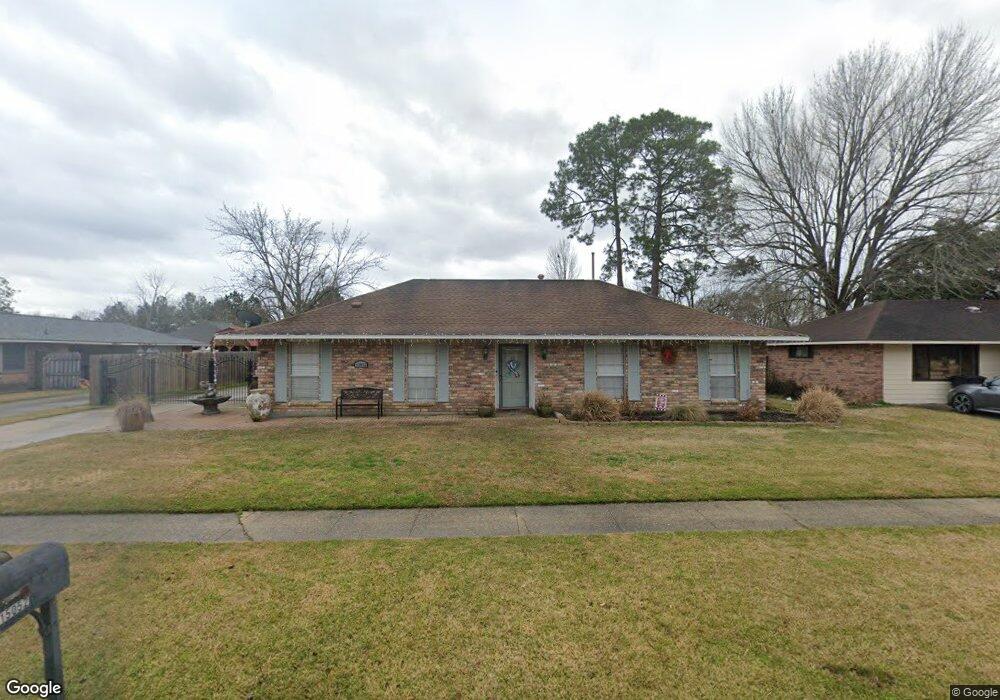
15052 Brent Ave Baton Rouge, LA 70818
Estimated Value: $165,000 - $332,000
3
Beds
2
Baths
1,788
Sq Ft
$130/Sq Ft
Est. Value
About This Home
This home is located at 15052 Brent Ave, Baton Rouge, LA 70818 and is currently estimated at $233,085, approximately $130 per square foot. 15052 Brent Ave is a home located in East Baton Rouge Parish with nearby schools including Bellingrath Hills Elementary School, Central Intermediate School, and Tanglewood Elementary School.
Ownership History
Date
Name
Owned For
Owner Type
Purchase Details
Closed on
Aug 20, 2013
Sold by
Tonguis Patricia G
Bought by
Tonguis Albert
Current Estimated Value
Purchase Details
Closed on
Apr 12, 2001
Sold by
Love John E
Bought by
Tonguis Albert and Tonguis Patricia Griffith
Home Financials for this Owner
Home Financials are based on the most recent Mortgage that was taken out on this home.
Original Mortgage
$105,610
Interest Rate
7%
Mortgage Type
FHA
Create a Home Valuation Report for This Property
The Home Valuation Report is an in-depth analysis detailing your home's value as well as a comparison with similar homes in the area
Home Values in the Area
Average Home Value in this Area
Purchase History
| Date | Buyer | Sale Price | Title Company |
|---|---|---|---|
| Tonguis Albert | -- | -- | |
| Tonguis Albert | $107,500 | -- |
Source: Public Records
Mortgage History
| Date | Status | Borrower | Loan Amount |
|---|---|---|---|
| Previous Owner | Tonguis Albert | $105,610 |
Source: Public Records
Tax History Compared to Growth
Tax History
| Year | Tax Paid | Tax Assessment Tax Assessment Total Assessment is a certain percentage of the fair market value that is determined by local assessors to be the total taxable value of land and additions on the property. | Land | Improvement |
|---|---|---|---|---|
| 2024 | $1,458 | $18,750 | $1,500 | $17,250 |
| 2023 | $1,458 | $16,500 | $1,500 | $15,000 |
| 2022 | $2,211 | $16,500 | $1,500 | $15,000 |
| 2021 | $2,211 | $16,500 | $1,500 | $15,000 |
| 2020 | $2,170 | $16,500 | $1,500 | $15,000 |
| 2019 | $1,987 | $14,650 | $1,500 | $13,150 |
| 2018 | $1,965 | $14,650 | $1,500 | $13,150 |
| 2017 | $1,965 | $14,650 | $1,500 | $13,150 |
| 2016 | $954 | $14,650 | $1,500 | $13,150 |
| 2015 | $974 | $14,650 | $1,500 | $13,150 |
| 2014 | $940 | $14,650 | $1,500 | $13,150 |
| 2013 | -- | $14,650 | $1,500 | $13,150 |
Source: Public Records
Map
Nearby Homes
- 14932 & 14934 Forest Grove Ave
- 9532 Sullivan Rd
- Lot A-1-E Wax Rd
- 9823 Banway Dr
- 9512 Overwood Dr
- TBD Banway Dr
- 14921 & 14923 Central Woods Ave
- 10213 Alderman Dr
- 14045 Grand Settlement Blvd
- 9976 Couret Dr
- 9986 Couret Dr
- 13013 N Vieux Carre Cir
- 13952 Grand Settlement Blvd
- 13985 Highgrove Ave
- 17468 Wax Rd
- 17486 Wax Rd
- 13975 Highgrove Ave
- 8600 Sullivan Rd
- 8135 Lavender Dr
- 11115 Sullivan Rd
- 15042 Brent Ave
- 14955 Republic Ave
- 15032 Brent Ave
- 15072 Brent Ave
- 14945 Republic Ave
- 15053 Brent Ave
- 15047 Republic Ave
- 15043 Brent Ave
- 15063 Brent Ave
- 14935 Republic Ave
- 15033 Brent Ave
- 15022 Brent Ave
- 15037 Republic Ave
- 15073 Brent Ave
- 15082 Brent Ave
- 15023 Brent Ave
- 14925 Republic Ave
- 15083 Brent Ave
- 9741 Biltmore Dr
- 15027 Republic Ave