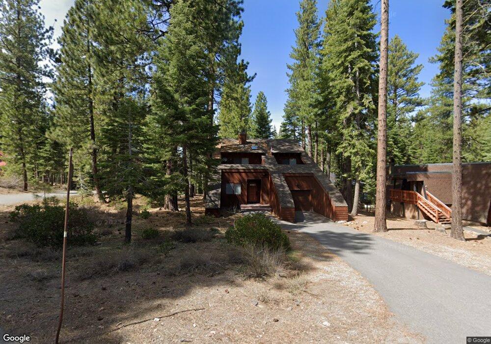
1506 Logging Trail Truckee, CA 96161
South Truckee NeighborhoodEstimated Value: $1,118,000 - $1,604,000
3
Beds
2
Baths
1,901
Sq Ft
$707/Sq Ft
Est. Value
About This Home
This home is located at 1506 Logging Trail, Truckee, CA 96161 and is currently estimated at $1,343,944, approximately $706 per square foot. 1506 Logging Trail is a home located in Placer County with nearby schools including Truckee Elementary School, Alder Creek Middle School, and Tahoe Truckee High School.
Ownership History
Date
Name
Owned For
Owner Type
Purchase Details
Closed on
May 3, 2024
Sold by
White John P and Galeb Peggy S
Bought by
White Galeb Family Trust and White
Current Estimated Value
Purchase Details
Closed on
Feb 21, 2003
Sold by
Schwartz Michelle J
Bought by
Roskopp Rob and Galeb Roskopp Ljepsova
Purchase Details
Closed on
Apr 15, 1997
Sold by
Schwartz Michelle
Bought by
Schwartz Michelle J
Purchase Details
Closed on
Dec 26, 1995
Sold by
Mcfarlane William L and Mcfarlane Gretchen G
Bought by
Schwartz Michelle
Create a Home Valuation Report for This Property
The Home Valuation Report is an in-depth analysis detailing your home's value as well as a comparison with similar homes in the area
Home Values in the Area
Average Home Value in this Area
Purchase History
| Date | Buyer | Sale Price | Title Company |
|---|---|---|---|
| White Galeb Family Trust | -- | None Listed On Document | |
| Roskopp Rob | $535,000 | Fidelity Natl Title Of Ca | |
| Schwartz Michelle J | -- | -- | |
| Schwartz Michelle | $275,000 | -- |
Source: Public Records
Tax History
| Year | Tax Paid | Tax Assessment Tax Assessment Total Assessment is a certain percentage of the fair market value that is determined by local assessors to be the total taxable value of land and additions on the property. | Land | Improvement |
|---|---|---|---|---|
| 2025 | $10,682 | $774,836 | $325,863 | $448,973 |
| 2023 | $10,682 | $744,750 | $313,210 | $431,540 |
| 2022 | $10,337 | $730,148 | $307,069 | $423,079 |
| 2021 | $9,691 | $715,833 | $301,049 | $414,784 |
| 2020 | $9,727 | $708,494 | $297,963 | $410,531 |
| 2019 | $9,753 | $694,603 | $292,121 | $402,482 |
| 2018 | $9,381 | $680,985 | $286,394 | $394,591 |
| 2017 | $9,208 | $667,633 | $280,779 | $386,854 |
| 2016 | $9,141 | $654,543 | $275,274 | $379,269 |
| 2015 | $8,913 | $644,713 | $271,140 | $373,573 |
| 2014 | $9,349 | $632,085 | $265,829 | $366,256 |
Source: Public Records
Map
Nearby Homes
- 1055 Martis Landing Unit B
- 1063 Martis Landing
- 5115 Gold Bend
- 5030 Gold Bend
- 2640 Mill Site Rd
- 2790 Cross Cut Ct
- 1809 Woods Point Way
- 725 Conifer
- 2785 Cross Cut Ct
- 519 Wolf Tree
- 265 Basque Dr
- 237 Basque Dr Unit 2
- 7401 Larkspur Ln
- 139 Basque Dr
- 415 Lodgepole
- 2338 Overlook Place
- 2301 Overlook Place
- 2203 Silver Fox Unit New Year's Week - Sh
- 970 Northstar Dr Unit 306
- 1768 Grouse Ridge Rd
- 1504 Logging Trail
- 1508 Logging Trail
- 1043 Martis Landing
- 1502 Logging Trail
- 1509 Logging Trail
- 1045 Martis Landing
- 1505 Logging Trail
- 1503 Logging Trail
- 1510 Logging Trail
- 1507 Logging Trail
- 1047 Martis Landing
- 1513 Logging Trail Unit 2
- 1511 Logging Trail
- 1501 Logging Trail
- 1512 Logging Trail
- 1049 Martis Landing
- 1042 Martis Landing
- 1038 Martis Landing
- 1040 Martis Landing
- 1044 Martis Landing
Your Personal Tour Guide
Ask me questions while you tour the home.