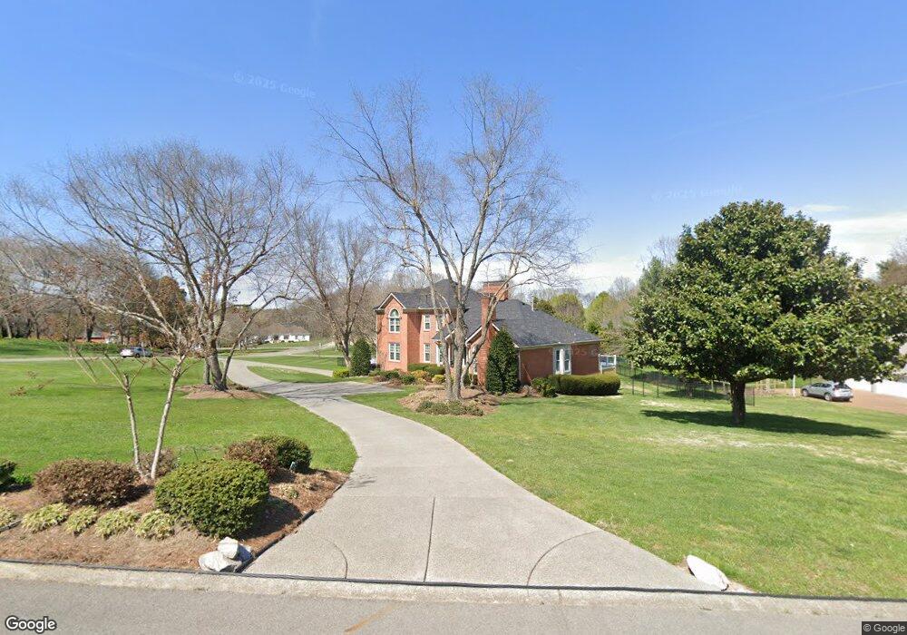
1506 Pear Tree Cir Brentwood, TN 37027
Estimated Value: $1,246,000 - $1,563,000
--
Bed
4
Baths
3,701
Sq Ft
$391/Sq Ft
Est. Value
About This Home
This home is located at 1506 Pear Tree Cir, Brentwood, TN 37027 and is currently estimated at $1,447,642, approximately $391 per square foot. 1506 Pear Tree Cir is a home located in Williamson County with nearby schools including Lipscomb Elementary School, Brentwood Middle School, and Brentwood High School.
Ownership History
Date
Name
Owned For
Owner Type
Purchase Details
Closed on
Feb 4, 2002
Sold by
Stern Richard and Stern Giovannina
Bought by
Lott Russell B and Lott Melissa M
Current Estimated Value
Home Financials for this Owner
Home Financials are based on the most recent Mortgage that was taken out on this home.
Original Mortgage
$265,000
Interest Rate
7.16%
Purchase Details
Closed on
Aug 10, 1994
Sold by
Cranfield Robert L
Bought by
Alexander Charles H
Create a Home Valuation Report for This Property
The Home Valuation Report is an in-depth analysis detailing your home's value as well as a comparison with similar homes in the area
Home Values in the Area
Average Home Value in this Area
Purchase History
| Date | Buyer | Sale Price | Title Company |
|---|---|---|---|
| Lott Russell B | $430,000 | Lawyers Title Insurance Corp | |
| Alexander Charles H | -- | -- |
Source: Public Records
Mortgage History
| Date | Status | Borrower | Loan Amount |
|---|---|---|---|
| Previous Owner | Lott Russell B | $265,000 |
Source: Public Records
Tax History Compared to Growth
Tax History
| Year | Tax Paid | Tax Assessment Tax Assessment Total Assessment is a certain percentage of the fair market value that is determined by local assessors to be the total taxable value of land and additions on the property. | Land | Improvement |
|---|---|---|---|---|
| 2025 | $4,517 | $358,000 | $97,500 | $260,500 |
| 2024 | $4,517 | $208,125 | $45,000 | $163,125 |
| 2023 | $4,517 | $208,125 | $45,000 | $163,125 |
| 2022 | $4,348 | $200,375 | $45,000 | $155,375 |
| 2021 | $4,348 | $200,375 | $45,000 | $155,375 |
| 2020 | $3,891 | $150,800 | $33,750 | $117,050 |
| 2019 | $3,891 | $150,800 | $33,750 | $117,050 |
| 2018 | $3,785 | $150,800 | $33,750 | $117,050 |
| 2017 | $3,755 | $150,800 | $33,750 | $117,050 |
| 2016 | $0 | $150,800 | $33,750 | $117,050 |
| 2015 | -- | $134,900 | $32,500 | $102,400 |
| 2014 | $594 | $134,900 | $32,500 | $102,400 |
Source: Public Records
Map
Nearby Homes
- 8230 Frontier Ln
- 1529 Sam Houston Dr
- 1502 Knox Valley Dr
- 8106 Turning Point Dr
- 1412 Knox Valley Dr
- 8103 Turning Point Dr
- 8122 Boiling Springs Place
- 8108 Turning Point Dr
- 8110 Turning Point Dr
- 8107 Turning Point Dr
- 1550 White Barn Way
- 1552 White Barn Way
- 1415 Devens Dr
- 8124 Boiling Springs Place
- 8115 Devens Dr
- 1556 White Barn Way
- Plan 25851 at Primm Farm
- RUTLEDGE Plan at Primm Farm
- MARABELLE Plan at Primm Farm
- 8115 Vaden Dr
- 1508 Pear Tree Cir
- 8215 Victory Trail
- 1501 Pear Tree Cir
- 1507 Pear Tree Cir
- 8217 Victory Trail
- 1503 Pear Tree Cir
- 1505 Pear Tree Cir
- 8211 Victory Trail
- 1509 Pear Tree Cir
- 1510 Pear Tree Cir
- 8219 Victory Trail
- 1512 Crockett Hills Blvd
- 1514 Crockett Hills Blvd
- 8214 Victory Trail
- 1511 Pear Tree Cir
- 8222 Frontier Ln
- 8216 Victory Trail
- 1516 Crockett Hills Blvd
- 1510 Crockett Hills Blvd
- 8212 Victory Trail