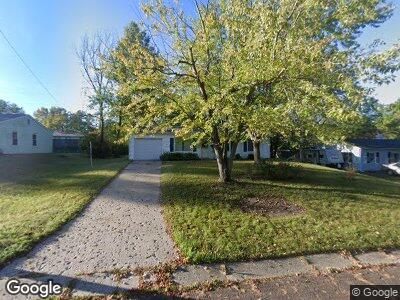
1506 Saint Andrew St Columbia, MO 65203
Westwinds Park NeighborhoodEstimated Value: $189,462 - $219,000
3
Beds
1
Bath
--
Sq Ft
10,193
Sq Ft Lot
About This Home
This home is located at 1506 Saint Andrew St, Columbia, MO 65203 and is currently estimated at $205,866. 1506 Saint Andrew St is a home located in Boone County with nearby schools including Russell Boulevard Elementary School, West Middle School, and David H. Hickman High School.
Ownership History
Date
Name
Owned For
Owner Type
Purchase Details
Closed on
Aug 14, 2020
Sold by
Meyer Beverly Esther and Beverly E Meyer Revocable Trus
Bought by
C R E A M Investments Llc
Current Estimated Value
Home Financials for this Owner
Home Financials are based on the most recent Mortgage that was taken out on this home.
Original Mortgage
$113,050
Outstanding Balance
$102,951
Interest Rate
3%
Mortgage Type
Future Advance Clause Open End Mortgage
Create a Home Valuation Report for This Property
The Home Valuation Report is an in-depth analysis detailing your home's value as well as a comparison with similar homes in the area
Home Values in the Area
Average Home Value in this Area
Purchase History
| Date | Buyer | Sale Price | Title Company |
|---|---|---|---|
| C R E A M Investments Llc | -- | None Available |
Source: Public Records
Mortgage History
| Date | Status | Borrower | Loan Amount |
|---|---|---|---|
| Open | C R E A M Investments Llc | $113,050 | |
| Previous Owner | Meyer Beverly Esther | $10,000 |
Source: Public Records
Tax History Compared to Growth
Tax History
| Year | Tax Paid | Tax Assessment Tax Assessment Total Assessment is a certain percentage of the fair market value that is determined by local assessors to be the total taxable value of land and additions on the property. | Land | Improvement |
|---|---|---|---|---|
| 2024 | $1,164 | $17,252 | $2,679 | $14,573 |
| 2023 | $1,154 | $17,252 | $2,679 | $14,573 |
| 2022 | $1,068 | $15,979 | $2,679 | $13,300 |
| 2021 | $1,070 | $15,979 | $2,679 | $13,300 |
| 2020 | $1,016 | $14,261 | $2,679 | $11,582 |
| 2019 | $1,016 | $14,261 | $2,679 | $11,582 |
| 2018 | $948 | $0 | $0 | $0 |
| 2017 | $961 | $13,205 | $2,679 | $10,526 |
| 2016 | $961 | $13,205 | $2,679 | $10,526 |
| 2015 | $886 | $13,205 | $2,679 | $10,526 |
| 2014 | $891 | $13,205 | $2,679 | $10,526 |
Source: Public Records
Map
Nearby Homes
- 1210 Saint Michael Dr
- 1418 Bradford Dr
- 1020 Crestland Ave
- 1209 Sunset Dr
- 1102 Westwinds Dr
- 906 Crestland Ave
- 1509 W Rollins Rd
- 839 Marylee Ct
- 1506 W Boulevard Ct
- 1703 W Rollins Rd
- 1905 Hatton Dr
- 702 Russell Blvd
- 914 Martin Dr
- 1813 Crystal Point
- 2321 Woodridge Rd
- 409 S Greenwood Ave
- 113 Westridge Dr
- 1004 Lakeshore Dr
- 707 W Rollins Rd
- 1326 Overhill Rd
- 1506 Saint Andrew St
- 1508 Saint Andrew St
- 1502 Saint Andrew St
- 1513 Saint Christopher St
- 1515 Saint Christopher St
- 1515 S St Christopher
- 1505 Saint Andrew St
- 1509 Saint Christopher St
- 1512 Saint Andrew St
- 1414 Saint Andrew St
- 1519 Saint Christopher St
- 1509 Saint Andrew St
- 1515 Saint Andrew St
- 1505 Saint Christopher St
- 1505 S St Christopher
- 1412 Saint Andrew St
- 1413 Saint Andrew St
- 1517 Saint Andrew St
- 1501 Saint Christopher St
- 1510 Saint Christopher St