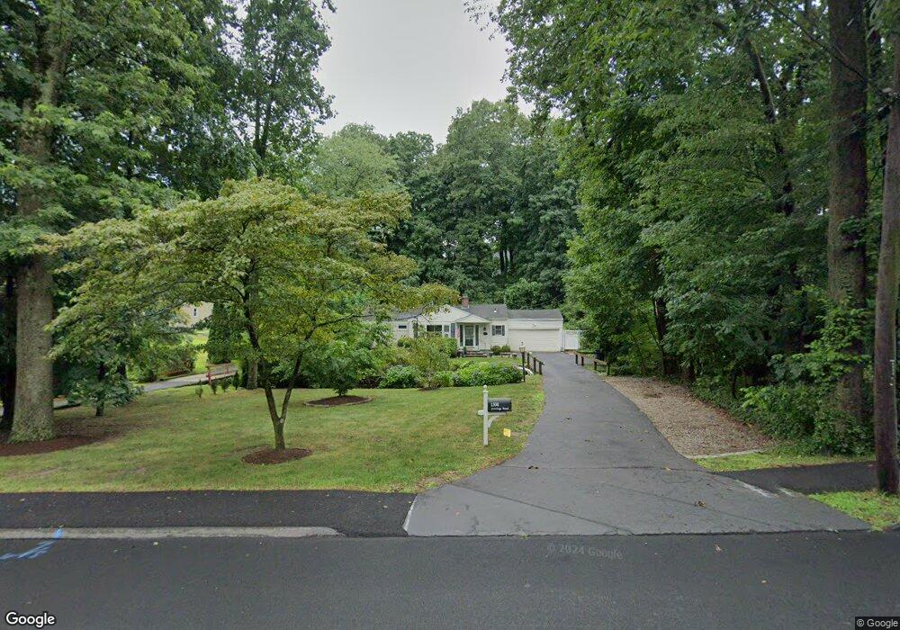
1508 Jennings Rd Fairfield, CT 06824
University NeighborhoodEstimated Value: $794,064 - $860,000
2
Beds
3
Baths
1,044
Sq Ft
$790/Sq Ft
Est. Value
About This Home
This home is located at 1508 Jennings Rd, Fairfield, CT 06824 and is currently estimated at $825,016, approximately $790 per square foot. 1508 Jennings Rd is a home located in Fairfield County with nearby schools including Osborn Hill Elementary School, Fairfield Woods Middle School, and Fairfield Ludlowe High School.
Ownership History
Date
Name
Owned For
Owner Type
Purchase Details
Closed on
Sep 12, 2022
Sold by
Baker Elizabeth A
Bought by
Baker Elizabeth A and Ferris William
Current Estimated Value
Home Financials for this Owner
Home Financials are based on the most recent Mortgage that was taken out on this home.
Original Mortgage
$424,000
Outstanding Balance
$404,985
Interest Rate
5.22%
Mortgage Type
Stand Alone Refi Refinance Of Original Loan
Estimated Equity
$420,031
Purchase Details
Closed on
Sep 23, 1994
Sold by
Martella Suzanne and Tusch Paul T
Bought by
Cahan Linda J
Purchase Details
Closed on
Jan 3, 1992
Sold by
Powers Richard A and Powers Dolores
Bought by
Martella Suzanne
Create a Home Valuation Report for This Property
The Home Valuation Report is an in-depth analysis detailing your home's value as well as a comparison with similar homes in the area
Home Values in the Area
Average Home Value in this Area
Purchase History
| Date | Buyer | Sale Price | Title Company |
|---|---|---|---|
| Baker Elizabeth A | -- | None Available | |
| Baker Elizabeth A | -- | None Available | |
| Baker Elizabeth A | -- | None Available | |
| Cahan Linda J | $200,000 | -- | |
| Martella Suzanne | $179,000 | -- | |
| Cahan Linda J | $200,000 | -- | |
| Martella Suzanne | $179,000 | -- |
Source: Public Records
Mortgage History
| Date | Status | Borrower | Loan Amount |
|---|---|---|---|
| Open | Baker Elizabeth A | $424,000 | |
| Closed | Baker Elizabeth A | $424,000 | |
| Previous Owner | Martella Suzanne | $50,000 | |
| Previous Owner | Martella Suzanne | $287,500 |
Source: Public Records
Tax History Compared to Growth
Tax History
| Year | Tax Paid | Tax Assessment Tax Assessment Total Assessment is a certain percentage of the fair market value that is determined by local assessors to be the total taxable value of land and additions on the property. | Land | Improvement |
|---|---|---|---|---|
| 2025 | $8,899 | $313,460 | $257,180 | $56,280 |
| 2024 | $8,746 | $313,460 | $257,180 | $56,280 |
| 2023 | $8,623 | $313,460 | $257,180 | $56,280 |
| 2022 | $8,539 | $313,460 | $257,180 | $56,280 |
| 2021 | $8,457 | $313,460 | $257,180 | $56,280 |
| 2020 | $7,119 | $265,720 | $211,190 | $54,530 |
| 2019 | $7,119 | $265,720 | $211,190 | $54,530 |
| 2018 | $7,004 | $265,720 | $211,190 | $54,530 |
| 2017 | $6,861 | $265,720 | $211,190 | $54,530 |
| 2016 | $6,763 | $265,720 | $211,190 | $54,530 |
| 2015 | $6,327 | $255,220 | $222,320 | $32,900 |
| 2014 | $6,227 | $255,220 | $222,320 | $32,900 |
Source: Public Records
Map
Nearby Homes
- 133 Green Acre Ln
- 168 Wormwood Rd
- 478 Crestwood Rd
- 15 Barton Rd
- 68 Figlar Ave
- 274 High St
- 109 Jeniford Rd
- 122 Colony St
- 45 Robin Cir
- 42 Robin Cir
- 38 Edge Hill Rd
- 44 Deer Run Rd
- 359 Reid St
- 20 Ermine St
- 105 Charter Oak Rd
- 2180 Kings Hwy Unit 1
- 270 Andrassy Ave
- 25 Country Rd
- 41 Pepperbush Ln
- 162 Country Rd Unit 162
- 1492 Jennings Rd
- 1478 Jennings Rd
- 1525 Jennings Rd
- 1538 Jennings Rd
- 104 Mayweed Rd
- 15 Deer Park Rd
- 72 Mayweed Rd
- 86 Mayweed Rd
- 336 Parkwood Rd
- 1554 Jennings Rd
- 56 Mayweed Rd
- 1581 Jennings Rd
- 172 Mayweed Rd
- 1446 Jennings Rd
- 40 Mayweed Rd
- 369 Parkwood Rd
- 45 Deer Park Rd
- 366 Parkwood Rd
- 1568 Jennings Rd