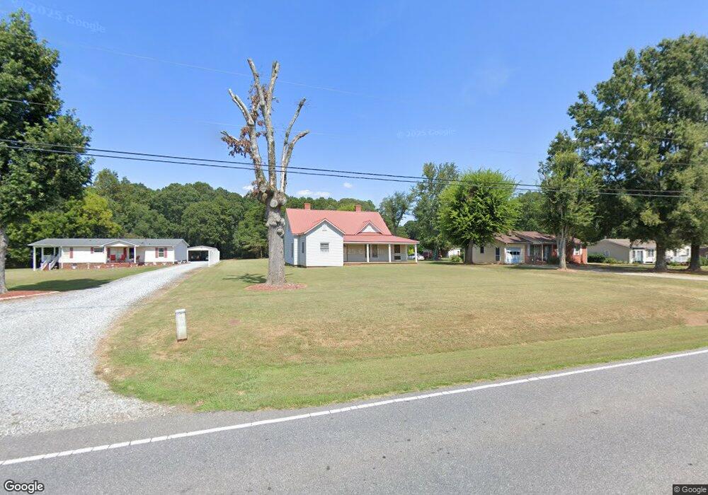
1508 W Highway 27 Lincolnton, NC 28092
Estimated Value: $138,000 - $231,000
3
Beds
1
Bath
1,350
Sq Ft
$123/Sq Ft
Est. Value
About This Home
This home is located at 1508 W Highway 27, Lincolnton, NC 28092 and is currently estimated at $165,991, approximately $122 per square foot. 1508 W Highway 27 is a home located in Lincoln County with nearby schools including Norris S. Childers Elementary School, West Lincoln Middle, and West Lincoln High School.
Ownership History
Date
Name
Owned For
Owner Type
Purchase Details
Closed on
Dec 16, 2016
Sold by
Wehunt Lisa I
Bought by
Wehunt Ralph C
Current Estimated Value
Purchase Details
Closed on
Apr 4, 2014
Sold by
Habitat For Humanity Of Lincoln Cnty N C
Bought by
Wehunt Ralph C and Wehunt Lisa I
Purchase Details
Closed on
Jan 15, 2014
Sold by
Wells Fargo Bank Na
Bought by
Habitat For Humanity Of Lincoln County N
Purchase Details
Closed on
Sep 16, 2013
Sold by
Wahunt Terry A and Wahunt Debra C
Bought by
Wells Fargo Bank Na
Create a Home Valuation Report for This Property
The Home Valuation Report is an in-depth analysis detailing your home's value as well as a comparison with similar homes in the area
Home Values in the Area
Average Home Value in this Area
Purchase History
| Date | Buyer | Sale Price | Title Company |
|---|---|---|---|
| Wehunt Ralph C | -- | None Available | |
| Wehunt Ralph C | $17,000 | None Available | |
| Habitat For Humanity Of Lincoln County N | -- | None Available | |
| Wells Fargo Bank Na | $27,273 | None Available |
Source: Public Records
Tax History Compared to Growth
Tax History
| Year | Tax Paid | Tax Assessment Tax Assessment Total Assessment is a certain percentage of the fair market value that is determined by local assessors to be the total taxable value of land and additions on the property. | Land | Improvement |
|---|---|---|---|---|
| 2025 | $547 | $64,089 | $32,935 | $31,154 |
| 2024 | $527 | $64,089 | $32,935 | $31,154 |
| 2023 | $521 | $64,016 | $32,862 | $31,154 |
| 2022 | $437 | $42,633 | $25,892 | $16,741 |
| 2021 | $437 | $42,633 | $25,892 | $16,741 |
| 2020 | $313 | $42,633 | $25,892 | $16,741 |
| 2019 | $313 | $42,633 | $25,892 | $16,741 |
| 2018 | $381 | $38,171 | $23,237 | $14,934 |
| 2017 | $280 | $38,171 | $23,237 | $14,934 |
| 2016 | $280 | $38,171 | $23,237 | $14,934 |
| 2015 | $274 | $38,171 | $23,237 | $14,934 |
| 2014 | $666 | $83,012 | $24,715 | $58,297 |
Source: Public Records
Map
Nearby Homes
- 217 Blossom Hill Rd
- 00 George Brown Rd Unit 10
- 00 George Brown Rd Unit 9
- 00 George Brown Rd Unit 8
- 00 George Brown Rd Unit 7
- 00 George Brown Rd Unit 6
- 00 George Brown Rd Unit 5
- 00 George Brown Rd Unit 4
- 00 George Brown Rd Unit 3
- 00 George Brown Rd Unit 2
- 1338 Pell Dr
- 000 Blossom Hill Rd Unit 138
- 536 Lincolnview Rd
- 1231 Better Brook Ln
- 00 Pleasant Grove Church Rd
- 1865 Rockdam Creek Ct
- 000 Better Brook Ln
- #168 Rolling Rd
- 792 Mace Ln
- 1070 N Carolina 182
- Lot # 9 Hwy 27 Hwy
- 1498 W Highway 27
- 1518 W Highway 27
- 1443 W Highway 27 Unit 2
- 1488 W Highway 27
- 1770 Marigold Ln
- 1780 Marigold Ln
- 1540 W Highway 27
- 1476 W Highway 27
- 1762 Marigold Ln
- 00 Westover Dr
- 1466 W Highway 27
- 161 Blossom Hill Rd
- 161 Blossom Hill Rd Unit 16
- 125 Westover Dr
- 1773 Marigold Ln
- 20 Westover Dr
- 1748 Marigold Ln
- 0000 Westover Dr
- 1751 Marigold Ln