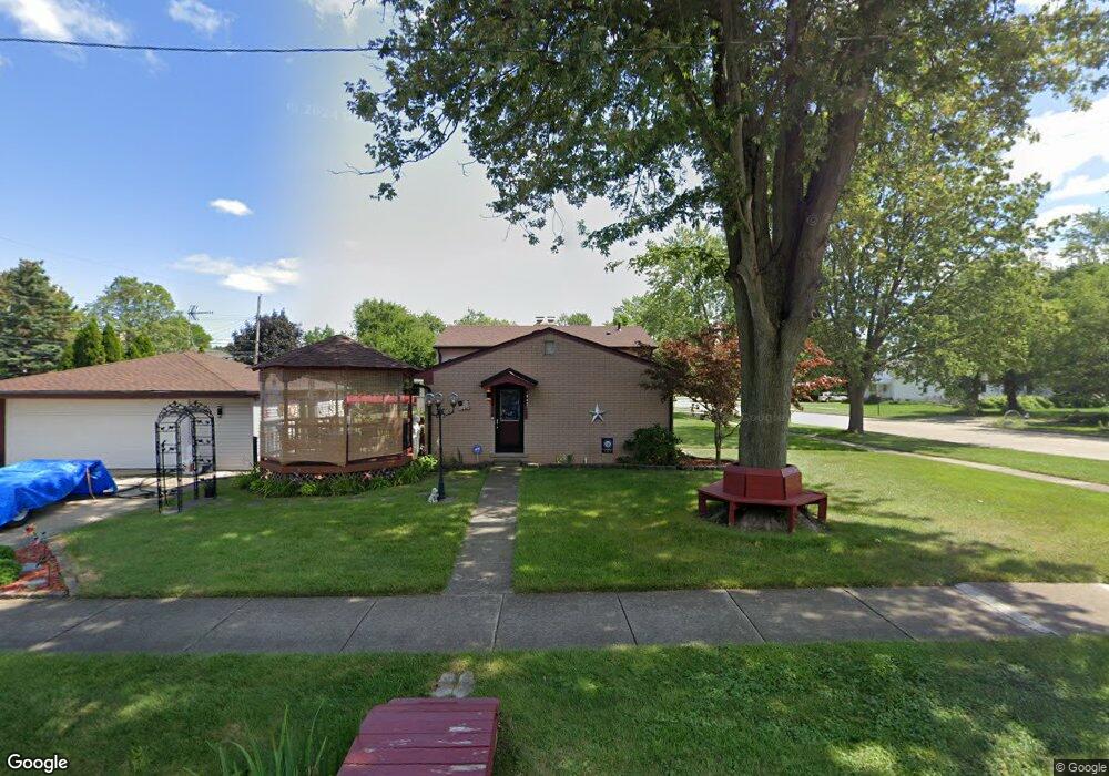
15086 Brest St Southgate, MI 48195
Estimated Value: $200,000 - $269,000
--
Bed
--
Bath
1,504
Sq Ft
$158/Sq Ft
Est. Value
About This Home
This home is located at 15086 Brest St, Southgate, MI 48195 and is currently estimated at $236,962, approximately $157 per square foot. 15086 Brest St is a home located in Wayne County with nearby schools including Shelters Elementary School, Davidson Middle School, and Southgate Anderson High School.
Ownership History
Date
Name
Owned For
Owner Type
Purchase Details
Closed on
Oct 9, 2021
Sold by
Sturgill Clarence E and Sturgill Margaret P
Bought by
Sturgill Edward and Sturgill Teresa
Current Estimated Value
Home Financials for this Owner
Home Financials are based on the most recent Mortgage that was taken out on this home.
Original Mortgage
$138,380
Interest Rate
3.01%
Mortgage Type
FHA
Purchase Details
Closed on
Aug 12, 2013
Sold by
Sturgill Clarence E and Sturgill Margaret P
Bought by
Sturgill Clarence E and Sturgill Margaret P
Create a Home Valuation Report for This Property
The Home Valuation Report is an in-depth analysis detailing your home's value as well as a comparison with similar homes in the area
Home Values in the Area
Average Home Value in this Area
Purchase History
| Date | Buyer | Sale Price | Title Company |
|---|---|---|---|
| Sturgill Edward | -- | Amrock Inc | |
| Sturgill Clarence E | -- | None Available |
Source: Public Records
Mortgage History
| Date | Status | Borrower | Loan Amount |
|---|---|---|---|
| Closed | Sturgill Edward | $138,380 |
Source: Public Records
Tax History Compared to Growth
Tax History
| Year | Tax Paid | Tax Assessment Tax Assessment Total Assessment is a certain percentage of the fair market value that is determined by local assessors to be the total taxable value of land and additions on the property. | Land | Improvement |
|---|---|---|---|---|
| 2025 | $2,560 | $118,200 | $0 | $0 |
| 2024 | $2,560 | $107,100 | $0 | $0 |
| 2023 | $2,940 | $95,200 | $0 | $0 |
| 2022 | $2,856 | $87,100 | $0 | $0 |
| 2021 | $3,745 | $78,700 | $0 | $0 |
| 2020 | $3,228 | $76,900 | $0 | $0 |
| 2019 | $3,263 | $69,200 | $0 | $0 |
| 2018 | $2,405 | $59,000 | $0 | $0 |
| 2017 | $1,257 | $57,800 | $0 | $0 |
| 2016 | $2,484 | $49,900 | $0 | $0 |
| 2015 | $4,439 | $47,200 | $0 | $0 |
| 2013 | $4,300 | $44,000 | $0 | $0 |
| 2012 | $1,797 | $42,400 | $8,900 | $33,500 |
Source: Public Records
Map
Nearby Homes
- 15048 Yorkshire St
- 12215 Manor Dr
- 15210 Heatherwood
- 15405 Wesley St
- 15455 Wesley St
- 12395 Timber Ct
- 12485 Timber Ct
- 12420 Churchill Ave
- 12503 Timber Ct
- 12450 Churchill Ave
- 11248 Kennebec Ave
- 12480 Churchill Ave
- 12510 Churchill Ave
- 4241 Fordline Rd
- 12540 Churchill Ave
- 11188 Kennebec Ave
- 12200 Helen St
- 12125 Helen St
- ESSEX Plan at Woodland Ridge
- DUPONT Plan at Woodland Ridge
- 15070 Brest St
- 11841 Drake St
- 7615 Drake St
- 11831 Drake St
- 11842 Richmond St
- 15136 Brest St
- 11830 Richmond St
- 15097 Brest St
- 15144 Brest St
- 15034 Brest St
- 15135 Brest St
- 15075 Brest St
- 15085 Brest St
- 15049 Brest St
- 15164 Brest St
- 11845 Richmond St
- 15025 Brest St
- 15047 Brest St
- 14918 Brest St
- 15184 Brest St