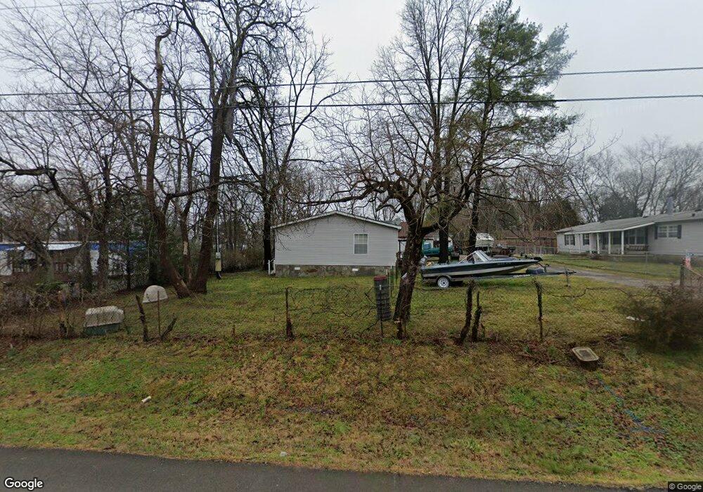
1509 Pearcy St La Vergne, TN 37086
Estimated Value: $184,928 - $237,000
--
Bed
--
Bath
--
Sq Ft
0.36
Acres
About This Home
This home is located at 1509 Pearcy St, La Vergne, TN 37086 and is currently estimated at $220,982. 1509 Pearcy St is a home with nearby schools including Lavergne Primary School, Roy L. Waldron Elementary School, and La Vergne Middle School.
Ownership History
Date
Name
Owned For
Owner Type
Purchase Details
Closed on
Dec 31, 2003
Sold by
Federal National Mortgage Association
Bought by
Andrews Matthew A and Andrews Betty A
Current Estimated Value
Purchase Details
Closed on
Sep 2, 2003
Sold by
Waldmiller and Kimberly
Bought by
Federal National Mtg Associati
Purchase Details
Closed on
Jun 13, 2000
Sold by
Blaine Goins Marion
Bought by
Tom Waldmiller
Purchase Details
Closed on
May 2, 1996
Sold by
Blair Joyce R
Bought by
Goins Marion B
Create a Home Valuation Report for This Property
The Home Valuation Report is an in-depth analysis detailing your home's value as well as a comparison with similar homes in the area
Home Values in the Area
Average Home Value in this Area
Purchase History
| Date | Buyer | Sale Price | Title Company |
|---|---|---|---|
| Andrews Matthew A | $49,000 | -- | |
| Federal National Mtg Associati | $66,190 | -- | |
| Tom Waldmiller | $75,000 | -- | |
| Goins Marion B | $39,900 | -- |
Source: Public Records
Tax History Compared to Growth
Tax History
| Year | Tax Paid | Tax Assessment Tax Assessment Total Assessment is a certain percentage of the fair market value that is determined by local assessors to be the total taxable value of land and additions on the property. | Land | Improvement |
|---|---|---|---|---|
| 2025 | $498 | $20,650 | $11,250 | $9,400 |
| 2024 | $498 | $20,650 | $11,250 | $9,400 |
| 2023 | $387 | $20,650 | $11,250 | $9,400 |
| 2022 | $334 | $20,650 | $11,250 | $9,400 |
| 2021 | $316 | $14,225 | $8,250 | $5,975 |
| 2020 | $316 | $14,225 | $8,250 | $5,975 |
| 2019 | $316 | $14,225 | $8,250 | $5,975 |
| 2018 | $400 | $14,225 | $0 | $0 |
| 2017 | $527 | $14,500 | $0 | $0 |
| 2016 | $527 | $14,500 | $0 | $0 |
| 2015 | $530 | $14,500 | $0 | $0 |
| 2014 | $361 | $14,500 | $0 | $0 |
| 2013 | -- | $14,100 | $0 | $0 |
Source: Public Records
Map
Nearby Homes
- 172 Parrish St
- 4004 George Buchanan
- 4007 George Buchanan
- 3038 Rg Buchanan Dr
- 140 Parrish St
- 1804 Mars St
- 1705 Money St
- 1704 George Thomas Dr
- 0 Hollandale Rd Unit RTC2696032
- 1820 Mars St
- 1400 Bright Sky Ct
- 402 Moshe Mualem Place
- 320 Moshe Feder Way
- 307 Moshe Feder Way
- 149 Alsup Ln
- 427 Rick McCormick Dr
- 122 Waldron Cir
- 316 Crockett Ct
- 8007 Logan Dr
- 144 Heritage Cir
- 1507 Pearcy St
- 1505 Pearcy St
- 1513 Pearcy St
- 1508 Nuview St
- 1510 Nuview St
- 1510 Pearcy St
- 1506 Pearcy St
- 1506 Nuview St
- 1504 Nuview St
- 1503 Pearcy St
- 1512 Pearcy St
- 1512 Nuview St
- 1515 Pearcy St
- 1502 Nuview St
- 1502 Pearcy St
- 1514 Pearcy St
- 1501 Pearcy St
- 1514 Nuview St
- 1507 Harrell St
- 1517 Pearcy St