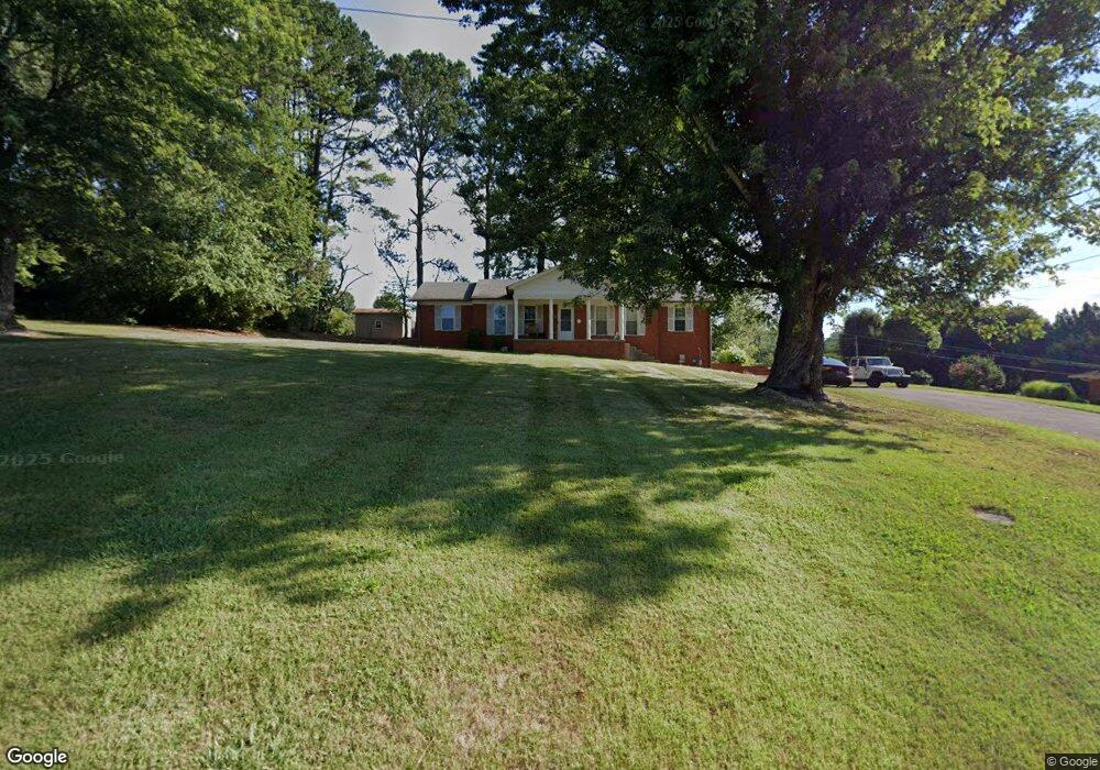
1509 Whiteside Dr Morristown, TN 37814
Estimated Value: $332,392 - $384,000
--
Bed
3
Baths
1,638
Sq Ft
$221/Sq Ft
Est. Value
About This Home
This home is located at 1509 Whiteside Dr, Morristown, TN 37814 and is currently estimated at $361,598, approximately $220 per square foot. 1509 Whiteside Dr is a home located in Hamblen County with nearby schools including West Elementary School, Lincoln Heights Middle School, and Morristown West High School.
Ownership History
Date
Name
Owned For
Owner Type
Purchase Details
Closed on
Mar 16, 2007
Sold by
Atkins Mary Frances
Bought by
Bristo Donald E
Current Estimated Value
Home Financials for this Owner
Home Financials are based on the most recent Mortgage that was taken out on this home.
Original Mortgage
$153,000
Outstanding Balance
$92,659
Interest Rate
6.27%
Mortgage Type
VA
Estimated Equity
$268,939
Purchase Details
Closed on
Apr 13, 1979
Bought by
Atkins Ursell B and Mary Frances
Create a Home Valuation Report for This Property
The Home Valuation Report is an in-depth analysis detailing your home's value as well as a comparison with similar homes in the area
Home Values in the Area
Average Home Value in this Area
Purchase History
| Date | Buyer | Sale Price | Title Company |
|---|---|---|---|
| Bristo Donald E | $153,000 | -- | |
| Atkins Ursell B | -- | -- |
Source: Public Records
Mortgage History
| Date | Status | Borrower | Loan Amount |
|---|---|---|---|
| Open | Atkins Ursell B | $153,000 |
Source: Public Records
Tax History Compared to Growth
Tax History
| Year | Tax Paid | Tax Assessment Tax Assessment Total Assessment is a certain percentage of the fair market value that is determined by local assessors to be the total taxable value of land and additions on the property. | Land | Improvement |
|---|---|---|---|---|
| 2024 | $781 | $44,350 | $10,025 | $34,325 |
| 2023 | $781 | $44,350 | $0 | $0 |
| 2022 | $781 | $44,350 | $10,025 | $34,325 |
| 2021 | $1,402 | $44,350 | $10,025 | $34,325 |
| 2020 | $1,400 | $44,350 | $10,025 | $34,325 |
| 2019 | $1,364 | $40,125 | $10,850 | $29,275 |
| 2018 | $1,264 | $40,125 | $10,850 | $29,275 |
| 2017 | $1,244 | $40,125 | $10,850 | $29,275 |
| 2016 | $1,188 | $40,125 | $10,850 | $29,275 |
| 2015 | $1,105 | $40,125 | $10,850 | $29,275 |
| 2014 | -- | $40,125 | $10,850 | $29,275 |
| 2013 | -- | $45,125 | $0 | $0 |
Source: Public Records
Map
Nearby Homes
- 1225 Appalachian Trace
- 1361 Appalachian Trace
- 1626 Cardinal Dr
- 1230 Mcfarland St Unit 37
- 1230 Mcfarland St Unit 3
- 509 Windridge Ln
- 1613 Cardinal Dr
- Lot 267 Waterview Way
- Lot 295 Inlet Cove
- 1318 Secretariat Dr
- 1770 Walters Dr
- 1033 Walters Dr
- 1171 Pine Haven Dr
- 941 Heykoop Dr
- 877 Pine Haven Dr
- 1442 Darbee Dr
- 145 Virginia Ave
- 1620 Evergreen Dr
- 707 Walters Dr
- 2020 N Economy Rd
- 1501 Whiteside Dr
- 1515 Whiteside Dr
- 1325 Daniel Boone Dr
- 1303 Daniel Boone Dr
- 1351 Daniel Boone Dr
- 1514 Whiteside Dr
- 1289 Daniel Boone Dr
- 1508 Whiteside Dr
- 1523 Whiteside Dr
- 1512 Whiteside Dr
- 1700 Crockett Ridge Rd
- 1285 Daniel Boone Dr
- 1373 Daniel Boone Dr
- 1575 Wiley Blount Dr
- 1304 Daniel Boone Dr
- 1290 Daniel Boone Dr
- 1350 Daniel Boone Dr
- 1704 Crockett Ridge Rd
- 1500 Whiteside Dr
- 1455 Walters Dr