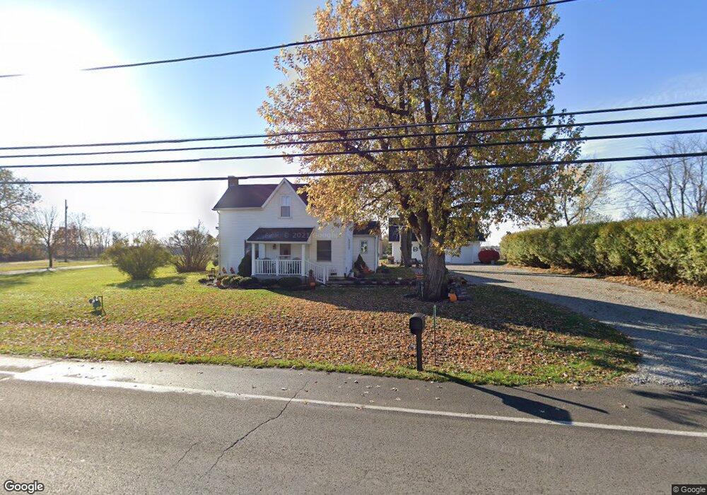
15096 State Route 309 Kenton, OH 43326
Estimated Value: $179,000 - $257,000
3
Beds
1
Bath
1,950
Sq Ft
$103/Sq Ft
Est. Value
About This Home
This home is located at 15096 State Route 309, Kenton, OH 43326 and is currently estimated at $200,672, approximately $102 per square foot. 15096 State Route 309 is a home located in Hardin County with nearby schools including Kenton Elementary School, Kenton Middle School, and Kenton High School.
Ownership History
Date
Name
Owned For
Owner Type
Purchase Details
Closed on
Nov 19, 2021
Sold by
Dickerson Linda M and Dickerson Lynn
Bought by
Dickerson Lynn and Dickerson Linda M
Current Estimated Value
Purchase Details
Closed on
May 7, 1999
Bought by
Dickerson Linda M
Purchase Details
Closed on
Jun 29, 1993
Bought by
Hare Virginia L
Create a Home Valuation Report for This Property
The Home Valuation Report is an in-depth analysis detailing your home's value as well as a comparison with similar homes in the area
Home Values in the Area
Average Home Value in this Area
Purchase History
| Date | Buyer | Sale Price | Title Company |
|---|---|---|---|
| Dickerson Lynn | -- | Mckinley Paul N | |
| Dickerson Linda M | -- | -- | |
| Hare Virginia L | -- | -- |
Source: Public Records
Tax History Compared to Growth
Tax History
| Year | Tax Paid | Tax Assessment Tax Assessment Total Assessment is a certain percentage of the fair market value that is determined by local assessors to be the total taxable value of land and additions on the property. | Land | Improvement |
|---|---|---|---|---|
| 2024 | $1,811 | $42,750 | $5,670 | $37,080 |
| 2023 | $1,811 | $42,750 | $5,670 | $37,080 |
| 2022 | $1,631 | $35,740 | $3,970 | $31,770 |
| 2021 | $1,637 | $35,740 | $3,970 | $31,770 |
| 2020 | $1,416 | $35,740 | $3,970 | $31,770 |
| 2019 | $1,109 | $29,000 | $3,780 | $25,220 |
| 2018 | $1,110 | $29,000 | $3,780 | $25,220 |
| 2017 | $1,042 | $29,000 | $3,780 | $25,220 |
| 2016 | $990 | $27,550 | $3,310 | $24,240 |
| 2015 | $961 | $27,550 | $3,310 | $24,240 |
| 2014 | $987 | $27,550 | $3,310 | $24,240 |
| 2013 | $1,081 | $28,870 | $3,310 | $25,560 |
Source: Public Records
Map
Nearby Homes
- 115 Scioto St
- 79 Broadway St
- 215 Henry St
- 530 E Franklin St
- 125 Hester St
- 513 E Franklin St
- 506 E Franklin St
- 510 Decatur St
- 121 S High St
- 460 Oriental St
- 814 S Wayne St
- 324 E North St
- 120 E Ohio St
- 137 E Espy St
- 416 N Cherry St
- 727 S Detroit St
- 233 N Main St
- 223 W Railroad St
- 618 N High St
- 328 N Detroit St
- 15123 State Route 309
- 15143 State Route 309
- 1107 E Franklin St
- 942 E Franklin St
- 940 E Franklin St
- 24 Washington Blvd
- 936 E Franklin St
- 939 E Franklin St
- 103 Jacob Parrot Rd
- 900 E Franklin St
- 40 Washington Blvd
- 15230 State Route 309
- 950 King St
- 430 Halevy St
- 451 Moriah Dr
- 440 Halevy St
- 103 Madison St
- 315 Madison St Unit 317
- 503 Moriah Dr
- 113 Jacob Parrot Rd