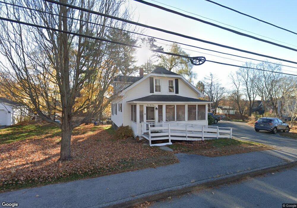
151 Bridge St Westbrook, ME 04092
Estimated Value: $400,562 - $489,000
4
Beds
2
Baths
1,334
Sq Ft
$330/Sq Ft
Est. Value
About This Home
This home is located at 151 Bridge St, Westbrook, ME 04092 and is currently estimated at $440,141, approximately $329 per square foot. 151 Bridge St is a home located in Cumberland County with nearby schools including Westbrook High School, The Little Dolphin School Foundation, and Breakwater School.
Ownership History
Date
Name
Owned For
Owner Type
Purchase Details
Closed on
Aug 27, 2015
Sold by
Carol Jean Hyatt Ret and Hyatt Carol J
Bought by
Hyatt Carol J
Current Estimated Value
Purchase Details
Closed on
May 11, 2015
Sold by
Smith Jonathan E and Smith Cynthia A
Bought by
Carol J Hyatt Ret and Hyatt Carol J
Purchase Details
Closed on
Jun 1, 2011
Sold by
Curtis Kevin M and Curtis Joanne M
Bought by
Smith Cynthia A and Smith Jonathan E
Home Financials for this Owner
Home Financials are based on the most recent Mortgage that was taken out on this home.
Original Mortgage
$75,000
Interest Rate
4.85%
Mortgage Type
Purchase Money Mortgage
Create a Home Valuation Report for This Property
The Home Valuation Report is an in-depth analysis detailing your home's value as well as a comparison with similar homes in the area
Purchase History
| Date | Buyer | Sale Price | Title Company |
|---|---|---|---|
| Hyatt Carol J | -- | -- | |
| Carol J Hyatt Ret | -- | -- | |
| Smith Cynthia A | -- | -- |
Source: Public Records
Mortgage History
| Date | Status | Borrower | Loan Amount |
|---|---|---|---|
| Previous Owner | Smith Cynthia A | $75,000 |
Source: Public Records
Tax History
| Year | Tax Paid | Tax Assessment Tax Assessment Total Assessment is a certain percentage of the fair market value that is determined by local assessors to be the total taxable value of land and additions on the property. | Land | Improvement |
|---|---|---|---|---|
| 2023 | $4,183 | $250,800 | $84,400 | $166,400 |
| 2022 | $3,796 | $209,700 | $70,300 | $139,400 |
| 2021 | $3,739 | $209,700 | $70,300 | $139,400 |
| 2020 | $3,745 | $209,700 | $70,300 | $139,400 |
| 2019 | $3,745 | $209,700 | $70,300 | $139,400 |
| 2018 | $3,631 | $182,000 | $61,200 | $120,800 |
| 2017 | $3,436 | $182,000 | $61,200 | $120,800 |
| 2016 | $3,334 | $181,200 | $61,200 | $120,000 |
| 2015 | $3,276 | $182,400 | $61,200 | $121,200 |
| 2014 | $3,137 | $182,400 | $61,200 | $121,200 |
| 2013 | -- | $182,400 | $61,200 | $121,200 |
Source: Public Records
Map
Nearby Homes
- 132 North St
- 30 Lincoln St Unit 213
- 30 Lincoln St Unit 220
- 25 Cole St Unit 2
- 18 Cole St
- 32 Kennard St
- 78 North St
- 26 King St Unit 1
- 17 Mechanic St
- 21 Clover Ln Unit 109
- 21 Clover Ln Unit 210
- 21 Clover Ln Unit 306
- 21 Clover Ln Unit 407
- 21 Clover Ln Unit 207
- 21 Clover Ln Unit 212
- 21 Clover Ln Unit 107
- 21 Clover Ln Unit 209
- 21 Clover Ln Unit 104
- 10 Everett Ct
- 50 Hogan Cir Unit 2
Your Personal Tour Guide
Ask me questions while you tour the home.