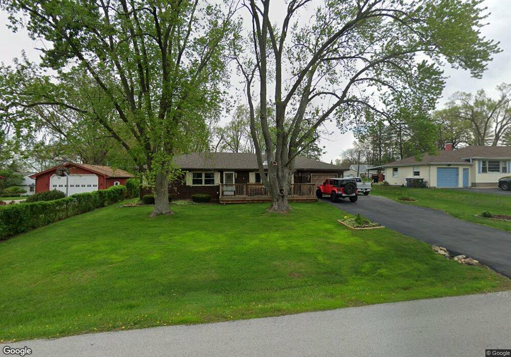
151 Maple Ln New Lenox, IL 60451
Estimated Value: $367,000 - $459,000
3
Beds
2
Baths
--
Sq Ft
21,780
Sq Ft Lot
About This Home
This home is located at 151 Maple Ln, New Lenox, IL 60451 and is currently estimated at $416,833. 151 Maple Ln is a home located in Will County with nearby schools including Oster-Oakview School, Haines Elementary School, and Lincoln Way West.
Ownership History
Date
Name
Owned For
Owner Type
Purchase Details
Closed on
Apr 17, 2018
Sold by
Seaborg Roger L
Bought by
Dyrcon Living Trust
Current Estimated Value
Purchase Details
Closed on
Feb 27, 2018
Sold by
Dyrcon Robert J and Bayview Loan Servicing Llc
Bought by
Seaborg Roger
Purchase Details
Closed on
Jan 10, 2010
Sold by
North Star Trust Company
Bought by
Drycon Robert J
Home Financials for this Owner
Home Financials are based on the most recent Mortgage that was taken out on this home.
Original Mortgage
$186,558
Interest Rate
5.25%
Mortgage Type
FHA
Create a Home Valuation Report for This Property
The Home Valuation Report is an in-depth analysis detailing your home's value as well as a comparison with similar homes in the area
Home Values in the Area
Average Home Value in this Area
Purchase History
| Date | Buyer | Sale Price | Title Company |
|---|---|---|---|
| Dyrcon Living Trust | $176,000 | None Available | |
| Seaborg Roger | -- | None Available | |
| Drycon Robert J | $190,000 | Ticor Title |
Source: Public Records
Mortgage History
| Date | Status | Borrower | Loan Amount |
|---|---|---|---|
| Previous Owner | Drycon Robert J | $186,558 |
Source: Public Records
Tax History
| Year | Tax Paid | Tax Assessment Tax Assessment Total Assessment is a certain percentage of the fair market value that is determined by local assessors to be the total taxable value of land and additions on the property. | Land | Improvement |
|---|---|---|---|---|
| 2024 | $6,931 | $85,411 | $31,876 | $53,535 |
| 2023 | $6,931 | $77,858 | $29,057 | $48,801 |
| 2022 | $6,206 | $71,725 | $26,768 | $44,957 |
| 2021 | $5,912 | $67,455 | $25,174 | $42,281 |
| 2020 | $5,756 | $65,048 | $24,276 | $40,772 |
| 2019 | $4,994 | $63,031 | $23,523 | $39,508 |
| 2018 | $4,871 | $60,858 | $22,712 | $38,146 |
| 2017 | $4,622 | $59,108 | $22,059 | $37,049 |
| 2016 | $4,481 | $57,526 | $21,469 | $36,057 |
| 2015 | $4,310 | $55,715 | $20,793 | $34,922 |
| 2014 | $4,310 | $55,027 | $20,536 | $34,491 |
| 2013 | $4,310 | $55,769 | $20,813 | $34,956 |
Source: Public Records
Map
Nearby Homes
- 209 Linden Oaks Ln
- 1111 N Cedar Rd
- Lot 207 N Cedar Rd
- 338 Willow St
- 225 E Francis Rd
- 326 Old Hickory Rd
- 111 Oak St
- 380 N Cedar Rd
- 1301 Silver Cross Blvd
- 211 Manor Dr Unit 1
- 213 Manor Dr Unit 2
- Vacant W Maple St
- 404 Livingston Dr
- 625 Crescenzo Ct Unit B
- 0 N Cedar Rd
- 1500 Ramp
- 0 Silver Cross Blvd
- 1999 Silver Cross Blvd
- 830 Wagon Dr
- 328 E Lincoln Hwy
Your Personal Tour Guide
Ask me questions while you tour the home.