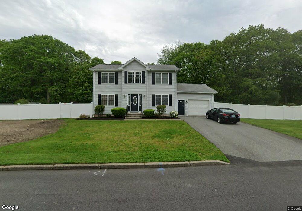
151 Thunder Trail Cranston, RI 02921
Western Cranston NeighborhoodEstimated Value: $643,000 - $719,000
3
Beds
3
Baths
2,508
Sq Ft
$271/Sq Ft
Est. Value
About This Home
This home is located at 151 Thunder Trail, Cranston, RI 02921 and is currently estimated at $680,297, approximately $271 per square foot. 151 Thunder Trail is a home located in Providence County with nearby schools including Orchard Farms El. School, Hope Highlands Middle School, and Cranston High School West.
Ownership History
Date
Name
Owned For
Owner Type
Purchase Details
Closed on
Aug 16, 2010
Sold by
Rossi Bobby A and Rossi Toni Ann
Bought by
Petrucci Richard J
Current Estimated Value
Home Financials for this Owner
Home Financials are based on the most recent Mortgage that was taken out on this home.
Original Mortgage
$240,750
Outstanding Balance
$159,260
Interest Rate
4.63%
Mortgage Type
Purchase Money Mortgage
Estimated Equity
$521,037
Purchase Details
Closed on
Aug 29, 2003
Sold by
Good Max and Good Philip
Bought by
Russi Bobby
Home Financials for this Owner
Home Financials are based on the most recent Mortgage that was taken out on this home.
Original Mortgage
$175,000
Interest Rate
5.69%
Create a Home Valuation Report for This Property
The Home Valuation Report is an in-depth analysis detailing your home's value as well as a comparison with similar homes in the area
Home Values in the Area
Average Home Value in this Area
Purchase History
| Date | Buyer | Sale Price | Title Company |
|---|---|---|---|
| Petrucci Richard J | $321,000 | -- | |
| Russi Bobby | $310,000 | -- |
Source: Public Records
Mortgage History
| Date | Status | Borrower | Loan Amount |
|---|---|---|---|
| Open | Russi Bobby | $240,750 | |
| Previous Owner | Russi Bobby | $175,000 | |
| Previous Owner | Russi Bobby | $200,000 |
Source: Public Records
Tax History
| Year | Tax Paid | Tax Assessment Tax Assessment Total Assessment is a certain percentage of the fair market value that is determined by local assessors to be the total taxable value of land and additions on the property. | Land | Improvement |
|---|---|---|---|---|
| 2025 | $7,370 | $531,000 | $173,600 | $357,400 |
| 2024 | $7,227 | $531,000 | $173,600 | $357,400 |
| 2023 | $6,927 | $366,500 | $124,100 | $242,400 |
| 2022 | $6,784 | $366,500 | $124,100 | $242,400 |
| 2021 | $6,597 | $366,500 | $124,100 | $242,400 |
| 2020 | $6,732 | $324,100 | $128,500 | $195,600 |
| 2019 | $6,732 | $324,100 | $128,500 | $195,600 |
| 2018 | $6,576 | $324,100 | $128,500 | $195,600 |
| 2017 | $6,793 | $296,100 | $115,200 | $180,900 |
| 2016 | $6,647 | $296,100 | $115,200 | $180,900 |
| 2015 | $6,647 | $296,100 | $115,200 | $180,900 |
| 2014 | $6,402 | $280,300 | $110,800 | $169,500 |
Source: Public Records
Map
Nearby Homes
- 44 Robinlyn Dr
- 161 Thunder Trail
- 131 Thunder Trail
- 141 Thunder Trail
- 168 Thunder Trail
- 164 Thunder Trail
- 170 Thunder Trail
- 30 Robinlyn Dr
- 177 Thunder Trail
- 123 Ellen Ln
- 178 Thunder Trail
- 55 Robinlyn Dr
- 130 Thunder Trail
- 121 Thunder Trail
- 47 Robinlyn Dr
- 42 Vincent Way
- 37 Robinlyn Dr
- 20 Robinlyn Dr
- 46 Vincent Way
- 36 Vincent Way