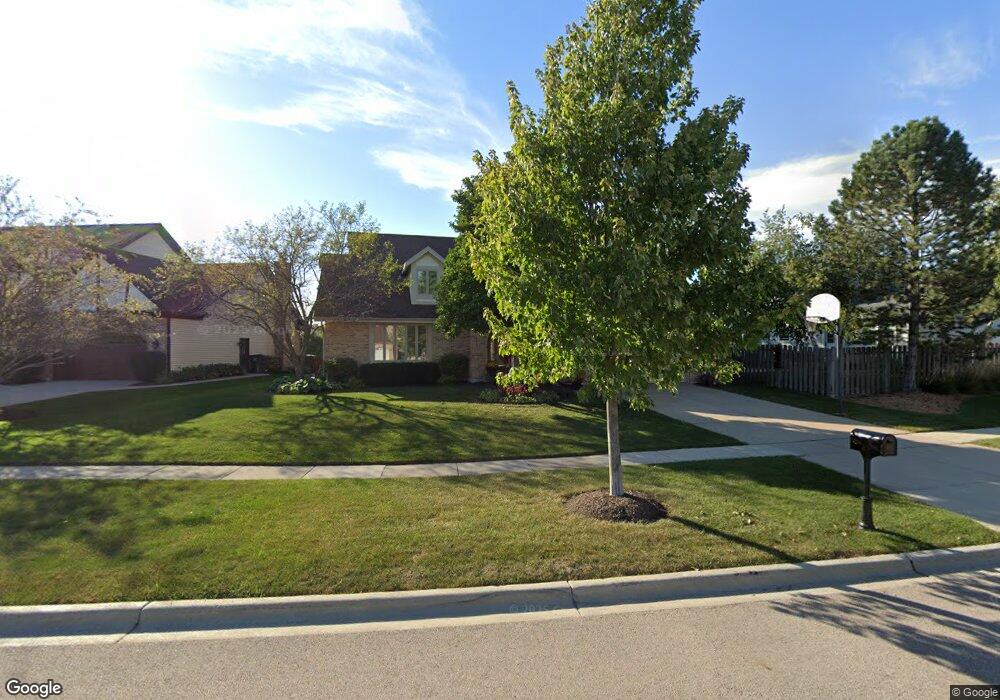
1510 Laburnum Rd Hoffman Estates, IL 60192
South Ridge NeighborhoodEstimated Value: $657,949 - $748,000
4
Beds
3
Baths
2,838
Sq Ft
$246/Sq Ft
Est. Value
About This Home
This home is located at 1510 Laburnum Rd, Hoffman Estates, IL 60192 and is currently estimated at $697,237, approximately $245 per square foot. 1510 Laburnum Rd is a home located in Cook County with nearby schools including Thomas Jefferson Elementary School, Frank C. Whiteley Elementary School, and William Fremd High School.
Ownership History
Date
Name
Owned For
Owner Type
Purchase Details
Closed on
Aug 5, 2017
Sold by
Hyla John E and Hyla Kathleen S
Bought by
Hyla John E and Hyla Kathleen S
Current Estimated Value
Purchase Details
Closed on
Apr 15, 2003
Sold by
Hyla John E and Mix Kathleen S
Bought by
Hyla John E and Hyla Kathleen S
Purchase Details
Closed on
Sep 18, 2001
Sold by
Cristiano Gary and Cristiano Sandra
Bought by
Hyla John E and Mix Kathleen S
Home Financials for this Owner
Home Financials are based on the most recent Mortgage that was taken out on this home.
Original Mortgage
$275,000
Outstanding Balance
$101,149
Interest Rate
6.99%
Estimated Equity
$596,088
Create a Home Valuation Report for This Property
The Home Valuation Report is an in-depth analysis detailing your home's value as well as a comparison with similar homes in the area
Home Values in the Area
Average Home Value in this Area
Purchase History
| Date | Buyer | Sale Price | Title Company |
|---|---|---|---|
| Hyla John E | -- | Attorney | |
| Hyla John E | -- | -- | |
| Hyla John E | -- | -- | |
| Hyla John E | $420,000 | -- |
Source: Public Records
Mortgage History
| Date | Status | Borrower | Loan Amount |
|---|---|---|---|
| Open | Hyla John E | $275,000 |
Source: Public Records
Tax History
| Year | Tax Paid | Tax Assessment Tax Assessment Total Assessment is a certain percentage of the fair market value that is determined by local assessors to be the total taxable value of land and additions on the property. | Land | Improvement |
|---|---|---|---|---|
| 2025 | $12,948 | $62,000 | $11,619 | $50,381 |
| 2024 | $12,948 | $46,000 | $9,760 | $36,240 |
| 2023 | $12,496 | $46,000 | $9,760 | $36,240 |
| 2022 | $12,496 | $46,000 | $9,760 | $36,240 |
| 2021 | $11,342 | $37,566 | $5,809 | $31,757 |
| 2020 | $12,069 | $40,321 | $5,809 | $34,512 |
| 2019 | $12,404 | $46,297 | $5,809 | $40,488 |
| 2018 | $11,529 | $39,968 | $5,344 | $34,624 |
| 2017 | $12,897 | $45,039 | $5,344 | $39,695 |
| 2016 | $12,232 | $45,039 | $5,344 | $39,695 |
| 2015 | $11,580 | $40,016 | $4,879 | $35,137 |
| 2014 | $11,381 | $40,016 | $4,879 | $35,137 |
| 2013 | $11,067 | $40,016 | $4,879 | $35,137 |
Source: Public Records
Map
Nearby Homes
- 3830 Anjou Ln
- 3881 Bordeaux Dr
- 4100 N Victoria Dr
- 4175 Victoria Dr
- 4475 Olmstead Dr
- 1690 Cape Breton Ct
- 4480 Thornbark Dr
- 4490 Capstan Dr
- 1280 Clover Ln
- 1281 Old Timber Ct
- 1213 Silver Pine Dr
- 2113 Greenock
- Lot 4 E Mundhank Rd
- 61 E Rd
- 61 E Rd
- 61 E Palatine #4 Rd
- 34 Abbey Woods Dr
- 8 Farmington Rd
- 1030 Ridgeview Dr
- 4950 Tarrington Dr
- 1520 Laburnum Rd Unit 3
- 1515 Brittany Ln
- 1535 Brittany Ln
- 1530 Laburnum Rd
- 1505 Laburnum Rd
- 1509 Laburnum Rd
- 1540 Laburnum Rd
- 1495 Laburnum Rd
- 1515 Laburnum Rd
- 1555 Brittany Ln
- 1520 Brittany Ln
- 1519 Laburnum Rd
- 1540 Brittany Ln
- 1500 Brittany Ln
- 1550 Laburnum Rd
- 1525 Laburnum Rd
- 1550 Brittany Ln
- 3940 Charlemagne Dr
- 1480 Brittany Ln
- 3930 Charlemagne Dr
Your Personal Tour Guide
Ask me questions while you tour the home.