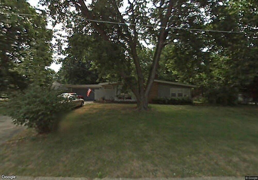
1510 Lewis Ave Des Moines, IA 50315
Watrous South NeighborhoodEstimated Value: $245,000 - $269,000
3
Beds
3
Baths
1,561
Sq Ft
$166/Sq Ft
Est. Value
About This Home
This home is located at 1510 Lewis Ave, Des Moines, IA 50315 and is currently estimated at $259,047, approximately $165 per square foot. 1510 Lewis Ave is a home located in Polk County with nearby schools including Wright Elementary School, Brody Middle School, and Lincoln High School.
Ownership History
Date
Name
Owned For
Owner Type
Purchase Details
Closed on
Jul 12, 2021
Sold by
Allison Charles R and Allison Vera Sue
Bought by
Allison Charles R and Allison Vera Sue
Current Estimated Value
Purchase Details
Closed on
Jun 1, 2010
Sold by
Peters Eunice
Bought by
Allison Charles R and Allison Vera Sue
Home Financials for this Owner
Home Financials are based on the most recent Mortgage that was taken out on this home.
Original Mortgage
$93,750
Interest Rate
5.05%
Mortgage Type
New Conventional
Create a Home Valuation Report for This Property
The Home Valuation Report is an in-depth analysis detailing your home's value as well as a comparison with similar homes in the area
Home Values in the Area
Average Home Value in this Area
Purchase History
| Date | Buyer | Sale Price | Title Company |
|---|---|---|---|
| Allison Charles R | -- | None Available | |
| Allison Charles R | $124,500 | None Available |
Source: Public Records
Mortgage History
| Date | Status | Borrower | Loan Amount |
|---|---|---|---|
| Closed | Allison Charles R | $93,750 |
Source: Public Records
Tax History Compared to Growth
Tax History
| Year | Tax Paid | Tax Assessment Tax Assessment Total Assessment is a certain percentage of the fair market value that is determined by local assessors to be the total taxable value of land and additions on the property. | Land | Improvement |
|---|---|---|---|---|
| 2025 | -- | $254,300 | $44,100 | $210,200 |
| 2024 | -- | $228,400 | $38,900 | $189,500 |
| 2023 | $0 | $228,400 | $38,900 | $189,500 |
| 2022 | $0 | $186,000 | $32,800 | $153,200 |
| 2021 | $0 | $186,000 | $32,800 | $153,200 |
| 2020 | $0 | $173,900 | $30,600 | $143,300 |
| 2019 | $0 | $173,900 | $30,600 | $143,300 |
| 2018 | $0 | $162,600 | $27,900 | $134,700 |
| 2017 | $0 | $160,800 | $27,900 | $132,900 |
| 2016 | $0 | $142,800 | $24,500 | $118,300 |
| 2015 | $0 | $142,800 | $24,500 | $118,300 |
| 2014 | -- | $136,000 | $22,900 | $113,100 |
Source: Public Records
Map
Nearby Homes
- 4506 Wakonda Pkwy
- 4710 SW 16th St
- 1607 Carrie Ave
- 1223 Emma Ave
- 1219 Elder Ln
- 1207 Emma Ave
- 1204 Elder Ln
- 5013 SW 16th St
- 1203 Herold Ave
- 4916 SW 13th St
- 1229 Evans St
- 4108 SW 12th St
- 1222 Watrous Ave
- 4020 SW 12th St
- 1116 Herold Ave
- 1243 Hackley Ave
- 5120 SW 14th St
- 1605 Frazier Ave
- 3724 SW 13th St
- 930 Emma Ave
- 1504 Lewis Ave
- 4513 SW 16th St
- 1507 Emma Ave
- 1505 Emma Ave
- 1502 Lewis Ave
- 4512 SW 16th St
- 1503 Emma Ave
- 4514 SW 16th St
- 1511 Lewis Ave
- 1505 Lewis Ave
- 4516 SW 16th St
- 1507 Lewis Ave
- 1500 Lewis Ave
- 4603 SW 16th St
- 1509 Lewis Ave
- 1501 Emma Ave
- 4518 SW 16th St
- 1501 Lewis Ave
- 1504 Emma Ave
- 4511 Wakonda Pkwy