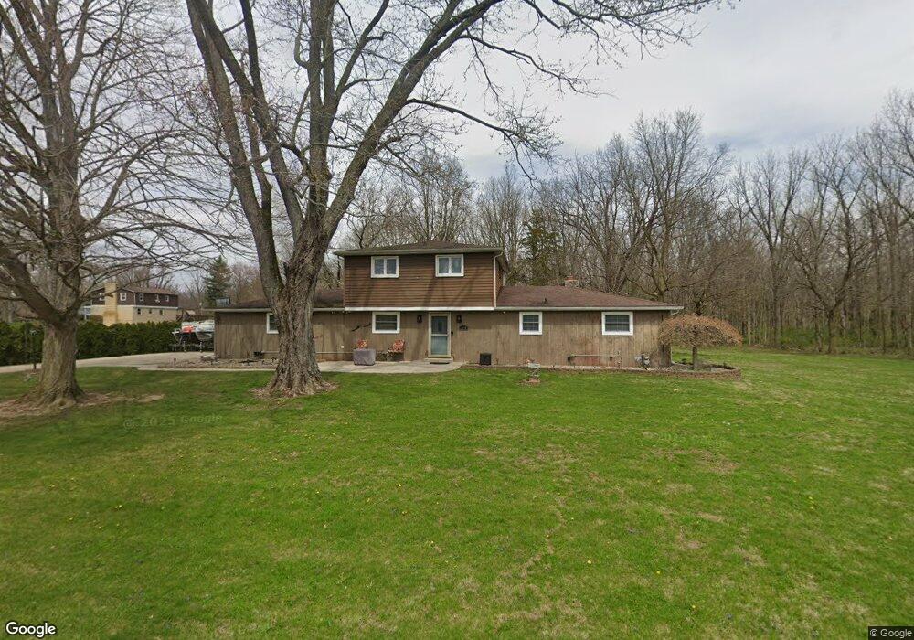
1510 N Michael Dr Marion, IN 46952
Shady Hills NeighborhoodEstimated Value: $194,000 - $217,000
3
Beds
2
Baths
1,873
Sq Ft
$110/Sq Ft
Est. Value
About This Home
This home is located at 1510 N Michael Dr, Marion, IN 46952 and is currently estimated at $205,705, approximately $109 per square foot. 1510 N Michael Dr is a home located in Grant County with nearby schools including Riverview Elementary School, Justice Thurgood Marshall Intermediate School, and John L. McCulloch Junior High School.
Ownership History
Date
Name
Owned For
Owner Type
Purchase Details
Closed on
Mar 13, 2012
Sold by
Hale Michele L
Bought by
Hale Mark A
Current Estimated Value
Purchase Details
Closed on
Jul 22, 2005
Sold by
Wells Fargo Bank Na
Bought by
Hale Mark A and Hale Michele L
Home Financials for this Owner
Home Financials are based on the most recent Mortgage that was taken out on this home.
Original Mortgage
$80,000
Outstanding Balance
$39,556
Interest Rate
4.85%
Mortgage Type
Adjustable Rate Mortgage/ARM
Estimated Equity
$166,149
Purchase Details
Closed on
May 6, 2005
Sold by
Tippner Judy Leann
Bought by
Wells Fargo Bank Minnesota Na
Create a Home Valuation Report for This Property
The Home Valuation Report is an in-depth analysis detailing your home's value as well as a comparison with similar homes in the area
Home Values in the Area
Average Home Value in this Area
Purchase History
| Date | Buyer | Sale Price | Title Company |
|---|---|---|---|
| Hale Mark A | -- | None Available | |
| Hale Mark A | -- | None Available | |
| Wells Fargo Bank Minnesota Na | $97,750 | None Available |
Source: Public Records
Mortgage History
| Date | Status | Borrower | Loan Amount |
|---|---|---|---|
| Open | Hale Mark A | $80,000 |
Source: Public Records
Tax History Compared to Growth
Tax History
| Year | Tax Paid | Tax Assessment Tax Assessment Total Assessment is a certain percentage of the fair market value that is determined by local assessors to be the total taxable value of land and additions on the property. | Land | Improvement |
|---|---|---|---|---|
| 2024 | $985 | $168,500 | $23,800 | $144,700 |
| 2023 | $801 | $151,200 | $23,800 | $127,400 |
| 2022 | $756 | $134,300 | $23,800 | $110,500 |
| 2021 | $722 | $125,200 | $23,800 | $101,400 |
| 2020 | $556 | $117,400 | $23,800 | $93,600 |
| 2019 | $452 | $109,400 | $23,800 | $85,600 |
| 2018 | $429 | $111,700 | $23,800 | $87,900 |
| 2017 | $421 | $113,000 | $23,800 | $89,200 |
| 2016 | $379 | $110,800 | $23,800 | $87,000 |
| 2014 | $409 | $115,700 | $23,800 | $91,900 |
| 2013 | $409 | $120,500 | $23,800 | $96,700 |
Source: Public Records
Map
Nearby Homes
- 4141 N River Rd
- 3930 N Avalon Dr
- 2214 N Wabash Rd
- 2302 N Miller Ave
- 3105 N Huntington Rd
- 916 W Sydney Ln
- 933 E Bocock Rd
- 2325 N Huntington Rd
- 1103 W Milborn St
- 425 E Val Ln
- 2220 N Huntington Rd
- 1614 Fox Trail Unit 1
- 1431 Fox Trail Unit 49
- 1605 Fox Trail Unit 11
- 1615 Fox Trail Unit 16
- 1422 Fox Trail Unit 20
- 1424 Fox Trail Unit 19
- 1425 Fox Trail Unit 46
- 1426 Fox Trail Unit 18
- 1420 Fox Trail Unit 21
- 1515 N Michael Dr
- 4151 N River Rd
- 4218 N Conner Dr
- 1525 N Michael Dr
- 4220 N Conner Dr
- 4140 N Conner Dr
- 4241 N Conner Dr
- 4121 N River Rd
- 4211 N Conner Dr
- 4130 N Conner Dr
- 4221 N Conner Dr
- 4151 N Conner Dr
- 4119 N River Rd
- 4141 N Conner Dr
- 0 W Lola Dr
- 4210 N Sherry Dr
- 4041 N River Rd
- 4220 N Sherry Dr
- 1615 N Michael Dr
- 4131 N Conner Dr