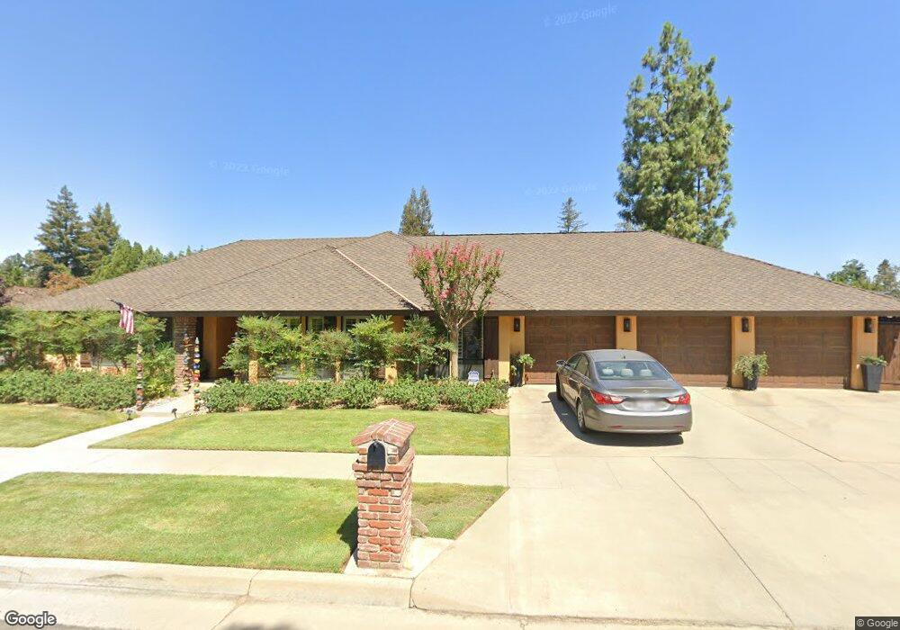
1510 W Locust Ave Fresno, CA 93711
Bullard NeighborhoodEstimated Value: $577,000 - $742,000
4
Beds
3
Baths
2,300
Sq Ft
$296/Sq Ft
Est. Value
About This Home
This home is located at 1510 W Locust Ave, Fresno, CA 93711 and is currently estimated at $680,373, approximately $295 per square foot. 1510 W Locust Ave is a home located in Fresno County with nearby schools including Nelson Elementary School, Kastner Intermediate School, and Clovis West High School.
Ownership History
Date
Name
Owned For
Owner Type
Purchase Details
Closed on
Mar 23, 2023
Sold by
Brenda A Torigian Revocable Living Trust
Bought by
Brenda Allison Revocable Living Trust
Current Estimated Value
Purchase Details
Closed on
Sep 11, 2012
Sold by
Torigian Brenda
Bought by
Torigian Brenda A
Home Financials for this Owner
Home Financials are based on the most recent Mortgage that was taken out on this home.
Original Mortgage
$150,000
Interest Rate
3.5%
Mortgage Type
New Conventional
Purchase Details
Closed on
May 16, 2012
Sold by
Torigian Brenda A and Torigian Brenda
Bought by
Torigian Brenda A
Purchase Details
Closed on
Sep 22, 2010
Sold by
Torigian Dennis N and Torigian Brenda
Bought by
Torigian Brenda
Purchase Details
Closed on
Jun 8, 2009
Sold by
Torigian Dennis N and Torigian Brenda
Bought by
Torigian Dennis N and Torigian Brenda
Purchase Details
Closed on
Mar 4, 2009
Sold by
Parlavecchio Samual and Parley Samual
Bought by
Torigian Brenda and Torigian Dennis N
Home Financials for this Owner
Home Financials are based on the most recent Mortgage that was taken out on this home.
Original Mortgage
$91,645
Interest Rate
5.19%
Mortgage Type
Purchase Money Mortgage
Purchase Details
Closed on
Aug 10, 2005
Sold by
Bougoukalos Parley Mishell
Bought by
Parley Samual
Home Financials for this Owner
Home Financials are based on the most recent Mortgage that was taken out on this home.
Original Mortgage
$290,000
Interest Rate
5.64%
Mortgage Type
Seller Take Back
Purchase Details
Closed on
Aug 9, 2005
Sold by
Urive Rachel and Urive Jacob
Bought by
Parley Samual
Home Financials for this Owner
Home Financials are based on the most recent Mortgage that was taken out on this home.
Original Mortgage
$290,000
Interest Rate
5.64%
Mortgage Type
Seller Take Back
Purchase Details
Closed on
Aug 4, 2003
Sold by
Urive Kathleen M
Bought by
Urive Rachel and Urive Jacob
Home Financials for this Owner
Home Financials are based on the most recent Mortgage that was taken out on this home.
Original Mortgage
$128,000
Interest Rate
5.17%
Mortgage Type
Balloon
Create a Home Valuation Report for This Property
The Home Valuation Report is an in-depth analysis detailing your home's value as well as a comparison with similar homes in the area
Home Values in the Area
Average Home Value in this Area
Purchase History
| Date | Buyer | Sale Price | Title Company |
|---|---|---|---|
| Brenda Allison Revocable Living Trust | -- | Simplifile | |
| Torigian Brenda A | -- | None Available | |
| Torigian Brenda | -- | Placer Title Company | |
| Torigian Brenda A | -- | None Available | |
| Torigian Brenda | -- | None Available | |
| Torigian Dennis N | -- | None Available | |
| Torigian Brenda | $378,000 | Chicago Title Company | |
| Parley Samual | -- | Financial Title Company | |
| Parley Samual | $300,000 | Financial Title Company | |
| Urive Rachel | -- | Financial Title Company |
Source: Public Records
Mortgage History
| Date | Status | Borrower | Loan Amount |
|---|---|---|---|
| Previous Owner | Torigian Brenda | $150,000 | |
| Previous Owner | Torigian Brenda | $91,645 | |
| Previous Owner | Parley Samual | $290,000 | |
| Previous Owner | Urive Rachel | $128,000 |
Source: Public Records
Tax History Compared to Growth
Tax History
| Year | Tax Paid | Tax Assessment Tax Assessment Total Assessment is a certain percentage of the fair market value that is determined by local assessors to be the total taxable value of land and additions on the property. | Land | Improvement |
|---|---|---|---|---|
| 2025 | $6,242 | $584,898 | $115,892 | $469,006 |
| 2023 | $5,552 | $464,148 | $111,393 | $352,755 |
| 2022 | $5,475 | $455,048 | $109,209 | $345,839 |
| 2021 | $5,321 | $446,126 | $107,068 | $339,058 |
| 2020 | $5,299 | $441,553 | $105,971 | $335,582 |
| 2019 | $5,194 | $432,896 | $103,894 | $329,002 |
| 2018 | $5,080 | $424,408 | $101,857 | $322,551 |
| 2017 | $4,991 | $416,087 | $99,860 | $316,227 |
| 2016 | $4,822 | $407,929 | $97,902 | $310,027 |
| 2015 | $4,747 | $401,803 | $96,432 | $305,371 |
| 2014 | $4,655 | $393,934 | $94,544 | $299,390 |
Source: Public Records
Map
Nearby Homes
- 7166 N Fruit Ave Unit 160
- 7166 N Fruit Ave Unit 132
- 7178 N Fruit Ave Unit 108
- 7166 N Fruit Ave Unit 127
- 7334 N Teilman Ave
- 7047 N Teilman Ave Unit 101
- 7047 N Teilman Ave Unit 102
- 7355 N Pacific Ave
- 7258 N Channing Way
- 6671 N Channing Way
- 1067 W Minarets Ave
- 6569 N Teilman Ave
- 6737 N Harrison Ave
- 6658 N Thorne Ave
- 6743 N Dolores Ave
- 1110 W Bedford Ave
- 6594 N Farris Ave
- 1 Palm Ave
- 2290 W Atlanta Ave
- 6518 N Dolores Ave
- 7194 N Pacific Ave
- 1496 W Locust Ave
- 1488 W Locust Ave
- 1507 W Locust Ave
- 1485 W Spruce Ave
- 7206 N Pacific Ave
- 1519 W Locust Ave
- 7179 N Pacific Ave
- 7157 N Delno Ave
- 7193 N Pacific Ave
- 1533 W Locust Ave
- 1476 W Locust Ave
- 1488 W Spruce Ave
- 1477 W Spruce Ave
- 7141 N Delno Ave
- 7205 N Pacific Ave
- 7218 N Pacific Ave
- 1520 W Fir Ave
- 1545 W Locust Ave
- 1468 W Locust Ave