1511 Cedar Hill Rd Lancaster, OH 43130
Estimated payment $160/month
About This Lot
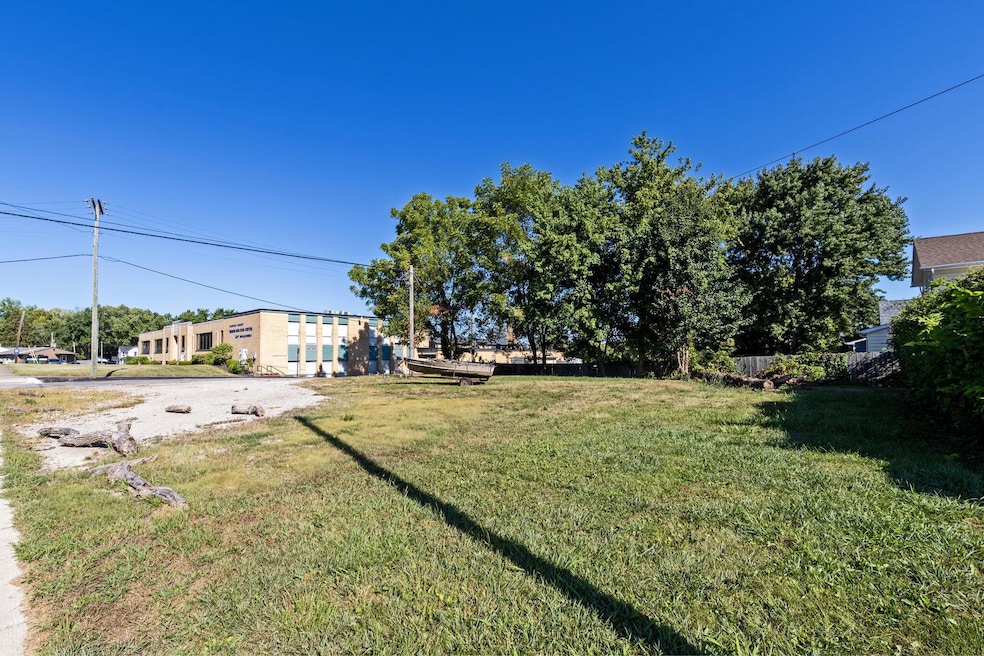
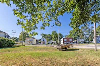
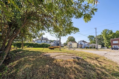
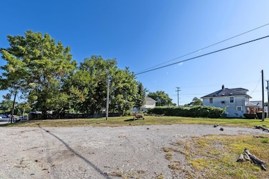
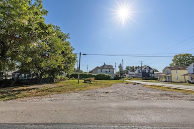
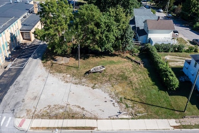
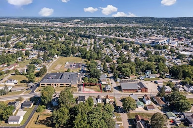
Don't miss this excellent opportunity to own a prime corner lot situated on nearly a quarter of an acre. Currently zoned R4 Residential, the property offers flexibility for future development, with the potential to build either a single-family home or a multi-family dwelling, not to exceed a structure size of 40 feet by 85 feet by 35 feet. With its strategic corner location and strong visibility, the lot also presents the possibility of rezoning for commercial use—ideal for an office or storage facility—pending city approval and required variances. Whether you're an investor, developer, or future homeowner, this parcel holds significant potential. Buyer to perform all due diligence regarding zoning, permitted uses, and utility access prior to submitting an offer.
Property Details
Property Type
- Land
Est. Annual Taxes
- $222
Additional Features
- 9,583 Sq Ft Lot
- Gas Available
Listing and Financial Details
- Assessor Parcel Number 05-36149-000
Map
Home Values in the Area
Average Home Value in this Area
Tax History
| Year | Tax Paid | Tax Assessment Tax Assessment Total Assessment is a certain percentage of the fair market value that is determined by local assessors to be the total taxable value of land and additions on the property. | Land | Improvement |
|---|---|---|---|---|
| 2024 | $495 | $5,510 | $5,510 | -- |
| 2023 | $205 | $5,510 | $5,510 | -- |
| 2022 | $716 | $5,510 | $5,510 | $0 |
| 2021 | $291 | $5,510 | $5,510 | $0 |
| 2020 | $281 | $5,510 | $5,510 | $0 |
| 2019 | $270 | $5,510 | $5,510 | $0 |
| 2018 | $221 | $4,620 | $4,620 | $0 |
| 2017 | $220 | $4,620 | $4,620 | $0 |
| 2016 | $213 | $4,620 | $4,620 | $0 |
| 2015 | $215 | $4,620 | $4,620 | $0 |
| 2014 | $205 | $4,620 | $4,620 | $0 |
| 2013 | $205 | $5,320 | $4,620 | $700 |
Property History
| Date | Event | Price | List to Sale | Price per Sq Ft | Prior Sale |
|---|---|---|---|---|---|
| 08/28/2025 08/28/25 | For Sale | $27,000 | +80.0% | -- | |
| 07/05/2022 07/05/22 | Sold | $15,000 | -11.8% | -- | View Prior Sale |
| 04/26/2022 04/26/22 | For Sale | $17,000 | -- | -- |
Purchase History
| Date | Type | Sale Price | Title Company |
|---|---|---|---|
| Deed | $15,000 | -- | |
| Warranty Deed | -- | Hocking Valley Title | |
| Warranty Deed | -- | Hocking Valley Title | |
| Sheriffs Deed | $15,000 | Attorney | |
| Deed | $75,000 | -- | |
| Deed | $22,000 | -- |
Mortgage History
| Date | Status | Loan Amount | Loan Type |
|---|---|---|---|
| Closed | -- | No Value Available | |
| Previous Owner | $30,000 | Commercial |
Source: Columbus and Central Ohio Regional MLS
MLS Number: 225032609
APN: 05-36149-000
Disclaimer: Certain information contained herein is derived from information provided by parties other than Homes.com. All information provided is deemed reliable, but is not guaranteed to be accurate and should be independently verified.
![]() IDX information is provided exclusively for personal, non-commercial use, and may not be used for any purpose other than to identify prospective properties consumers may be interested in purchasing.
IDX information is provided exclusively for personal, non-commercial use, and may not be used for any purpose other than to identify prospective properties consumers may be interested in purchasing.
Information is deemed reliable but not guaranteed.
- 1318 Cedar Hill Rd
- 114-116 S Cedar Ave
- 1715 W Walnut St
- 136 Sherman Ave
- 140 Sherman Ave
- 117 N Pierce Ave
- 896 Elizabeth Dr
- 404 Garfield Ave
- 215 Harrison Ave
- 970 Elizabeth Dr
- 1829 Shoshone Dr
- 539 N Ohio Ave
- 317 Harrison Ave
- 429 Harrison Ave
- 145 Alameda Ct
- 510 W Wheeling St
- 738 Maryland Ave
- 628 Harrison Ave
- 1628 W Fair Ave
- 1935 Smith Ave
- 119 N Ohio Ave
- 546 Reese Ave
- 343 Whiley Ave
- 123 N Broad St
- 724 N Columbus St Unit 724
- 708 S Broad St
- 1733 Bellmeadow Dr
- 250 Hillcrest Dr
- 193 Lake St Unit 193 1/2 Unit 1
- 929 3rd St
- 1237 Watermark Dr
- 1300 Community Way
- 617 E Main St Unit A
- 1545 Timbertop St
- 154 Littlebrook Dr
- 2753 Michaelsway Ave
- 805 E Wheeling St
- 2271 Landcrest Dr
- 1508 Greyfield St
- 2661 Hardwood Ave
