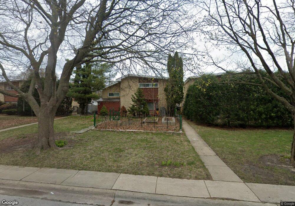
1511 Darrow Ave Unit A Evanston, IL 60201
West Evanston NeighborhoodEstimated Value: $316,000 - $505,000
3
Beds
1
Bath
1,281
Sq Ft
$301/Sq Ft
Est. Value
About This Home
This home is located at 1511 Darrow Ave Unit A, Evanston, IL 60201 and is currently estimated at $385,241, approximately $300 per square foot. 1511 Darrow Ave Unit A is a home located in Cook County with nearby schools including Dewey Elementary School, Washington Elementary School, and Nichols Middle School.
Ownership History
Date
Name
Owned For
Owner Type
Purchase Details
Closed on
Jun 20, 2017
Sold by
Gentles Madeline
Bought by
Truong May
Current Estimated Value
Home Financials for this Owner
Home Financials are based on the most recent Mortgage that was taken out on this home.
Original Mortgage
$150,000
Outstanding Balance
$75,174
Interest Rate
2.75%
Mortgage Type
New Conventional
Estimated Equity
$310,067
Purchase Details
Closed on
Sep 9, 1998
Sold by
Gentles Madeline and Gentles Jacqueline L
Bought by
Gentles Madeline
Home Financials for this Owner
Home Financials are based on the most recent Mortgage that was taken out on this home.
Original Mortgage
$69,000
Interest Rate
7.02%
Create a Home Valuation Report for This Property
The Home Valuation Report is an in-depth analysis detailing your home's value as well as a comparison with similar homes in the area
Home Values in the Area
Average Home Value in this Area
Purchase History
| Date | Buyer | Sale Price | Title Company |
|---|---|---|---|
| Truong May | $200,000 | Baird & Warner Title Service | |
| Gentles Madeline | -- | Advantage Title |
Source: Public Records
Mortgage History
| Date | Status | Borrower | Loan Amount |
|---|---|---|---|
| Open | Truong May | $150,000 | |
| Previous Owner | Gentles Madeline | $69,000 |
Source: Public Records
Tax History Compared to Growth
Tax History
| Year | Tax Paid | Tax Assessment Tax Assessment Total Assessment is a certain percentage of the fair market value that is determined by local assessors to be the total taxable value of land and additions on the property. | Land | Improvement |
|---|---|---|---|---|
| 2024 | $5,976 | $28,000 | $5,000 | $23,000 |
| 2023 | $5,710 | $28,000 | $5,000 | $23,000 |
| 2022 | $5,710 | $28,000 | $5,000 | $23,000 |
| 2021 | $3,969 | $18,286 | $3,564 | $14,722 |
| 2020 | $3,976 | $18,286 | $3,564 | $14,722 |
| 2019 | $3,941 | $20,251 | $3,564 | $16,687 |
| 2018 | $6,739 | $24,597 | $2,956 | $21,641 |
| 2017 | $155 | $24,597 | $2,956 | $21,641 |
| 2016 | $697 | $24,597 | $2,956 | $21,641 |
| 2015 | $5,114 | $19,073 | $2,434 | $16,639 |
| 2014 | $752 | $19,073 | $2,434 | $16,639 |
| 2013 | $752 | $19,073 | $2,434 | $16,639 |
Source: Public Records
Map
Nearby Homes
- 1723 Greenwood St
- 1600 Greenwood St
- 1621 Church St
- 1739 Dodge Ave
- 1718 Hovland Ct
- 1216 Darrow Ave
- 1801 Lyons St
- 1213 Darrow Ave
- 1801 Brown Ave
- 1813 Dodge Ave
- 1335 Asbury Ave
- 1832 Hovland Ct
- 1133 Dodge Ave
- 1585 Ridge Ave Unit 506
- 1585 Ridge Ave Unit 404
- 1585 Ridge Ave Unit 608
- 1500 Oak Ave Unit 4B
- 1112 Greenwood St
- 1232 Ridge Ave
- 1808 Laurel Ave
- 1511 Darrow Ave
- 1511 Darrow Ave
- 1515 Darrow Ave
- 1515 Darrow Ave
- 1507 Darrow Ave
- 1507 Darrow Ave
- 1507 Darrow Ave Unit A
- 1507 Darrow Ave Unit B
- 1519 Darrow Ave
- 1519 Darrow Ave
- 1519 Darrow Ave
- 1519 Darrow Ave Unit B
- 1501B Darrow Ave Unit B
- 1501 Darrow Ave
- 1501 Darrow Ave
- 1501 Darrow Ave Unit A
- 1501 Darrow Ave Unit B
- 1508 Dewey Ave
- 1510 Dewey Ave
- 1504 Dewey Ave