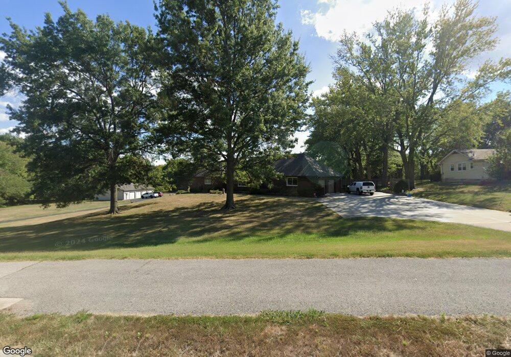
1511 NE Colbern Rd Lees Summit, MO 64086
Estimated Value: $479,000 - $863,038
3
Beds
4
Baths
2,438
Sq Ft
$278/Sq Ft
Est. Value
About This Home
This home is located at 1511 NE Colbern Rd, Lees Summit, MO 64086 and is currently estimated at $678,510, approximately $278 per square foot. 1511 NE Colbern Rd is a home located in Jackson County with nearby schools including Underwood Elementary School, Bernard C. Campbell Middle School, and Lee's Summit North High School.
Ownership History
Date
Name
Owned For
Owner Type
Purchase Details
Closed on
Jan 7, 2016
Sold by
Mathews Richard S and Mathews Terry L
Bought by
Mathews Richard S and Mathews Terry L
Current Estimated Value
Purchase Details
Closed on
May 9, 2008
Sold by
Mathews Properties Llc
Bought by
Mathews Richard S and Mathews Terry L
Home Financials for this Owner
Home Financials are based on the most recent Mortgage that was taken out on this home.
Original Mortgage
$417,000
Outstanding Balance
$264,222
Interest Rate
5.89%
Mortgage Type
Purchase Money Mortgage
Estimated Equity
$414,288
Purchase Details
Closed on
Mar 15, 2006
Sold by
Pollard Patricia M
Bought by
Wilbur Enterprises Llc
Home Financials for this Owner
Home Financials are based on the most recent Mortgage that was taken out on this home.
Original Mortgage
$417,000
Interest Rate
5.75%
Mortgage Type
Fannie Mae Freddie Mac
Purchase Details
Closed on
Feb 17, 2006
Sold by
Mathews Richard S and Mathews Terry L
Bought by
Mathews Properties Llc
Home Financials for this Owner
Home Financials are based on the most recent Mortgage that was taken out on this home.
Original Mortgage
$417,000
Interest Rate
5.75%
Mortgage Type
Fannie Mae Freddie Mac
Purchase Details
Closed on
Nov 7, 2005
Sold by
Commercial Federal Bank
Bought by
Mathews Properties Llc
Purchase Details
Closed on
Oct 18, 2004
Sold by
Miller Jeffrey L and Miller Karla J
Bought by
Commercial Federal Bank
Purchase Details
Closed on
Jan 21, 2002
Sold by
Miller Jeffrey L and Miller Karla J
Bought by
American Bail Bonding Co Llc
Purchase Details
Closed on
Jun 20, 1997
Sold by
Patricia M Trustee Pollard Wilbur Dean Truste
Bought by
Miller Jeffrey L
Home Financials for this Owner
Home Financials are based on the most recent Mortgage that was taken out on this home.
Original Mortgage
$244,000
Interest Rate
7.93%
Mortgage Type
Purchase Money Mortgage
Create a Home Valuation Report for This Property
The Home Valuation Report is an in-depth analysis detailing your home's value as well as a comparison with similar homes in the area
Home Values in the Area
Average Home Value in this Area
Purchase History
| Date | Buyer | Sale Price | Title Company |
|---|---|---|---|
| Mathews Richard S | -- | None Available | |
| Mathews Richard S | -- | Assured Quality Title Co | |
| Wilbur Enterprises Llc | -- | None Available | |
| Mathews Properties Llc | -- | Trusted Title | |
| Mathews Richard S | -- | Trusted Title | |
| Mathews Properties Llc | -- | First American Title Ins Co | |
| Commercial Federal Bank | $649,343 | Assured Quality Title Co | |
| American Bail Bonding Co Llc | -- | Old Republic Title Company | |
| Miller Jeffrey L | -- | -- |
Source: Public Records
Mortgage History
| Date | Status | Borrower | Loan Amount |
|---|---|---|---|
| Open | Mathews Richard S | $417,000 | |
| Previous Owner | Mathews Richard S | $417,000 | |
| Previous Owner | Miller Jeffrey L | $244,000 |
Source: Public Records
Tax History Compared to Growth
Tax History
| Year | Tax Paid | Tax Assessment Tax Assessment Total Assessment is a certain percentage of the fair market value that is determined by local assessors to be the total taxable value of land and additions on the property. | Land | Improvement |
|---|---|---|---|---|
| 2025 | $7,709 | $93,976 | $22,920 | $71,056 |
| 2024 | $7,653 | $106,763 | $35,893 | $70,870 |
| 2023 | $7,653 | $106,763 | $35,893 | $70,870 |
| 2022 | $5,736 | $71,060 | $15,134 | $55,926 |
| 2021 | $5,855 | $71,060 | $15,134 | $55,926 |
| 2020 | $5,186 | $62,330 | $15,134 | $47,196 |
| 2019 | $5,045 | $62,330 | $15,134 | $47,196 |
| 2018 | $5,175 | $59,335 | $10,991 | $48,344 |
| 2017 | $5,175 | $59,335 | $10,991 | $48,344 |
| 2016 | $5,097 | $57,849 | $9,066 | $48,783 |
| 2014 | $5,200 | $57,849 | $9,066 | $48,783 |
Source: Public Records
Map
Nearby Homes
- 1632 NE Stonewood Dr
- 1817 NE Burgandy Cir
- 1400 NE Colbern Rd
- 1717 NE Luther Rd
- 1425 NE Stonewood Dr
- 1424 NE Stonewood Dr
- 1408 NE Whitestone Dr
- 1637 NE Westwind Dr
- 27008 E Olive Dr
- 27104 E Cedar Grove Dr
- 1676 NE Ozark Dr
- 1220 NE Hendrix Dr
- 13507 Woodland Ranch Dr
- 13404 Woodland Ranch Dr
- 13311 Woodland Ranch Dr
- 13511 Woodland Ranch Dr
- 13401 Woodland Ranch Dr
- 2329 NE Lake Breeze Ln
- The Gunnison IV Plan at Woodland Oaks
- The Modern Gunnison Plan at Woodland Oaks
- 1507 NE Colbern Rd
- 1503 NE Colbern Rd
- 1712 NE Colbern Rd
- 1836 NE Bren Mar Rd
- 1824 NE Bren Mar Rd
- 1813 NE Stonewood Dr
- 1812 NE Bren Mar Rd
- 1821 NE Stonewood Dr
- 1809 NE Stonewood Dr
- 1805 NE Stonewood Dr
- 1801 NE Stonewood Dr
- 1718 NE Bren Mar Rd
- 1825 NE Stonewood Dr
- 1721 NE Stonewood Dr
- 1824 NE Stonewood Dr
- 1839 NE Bren Mar Rd
- 1825 NE Bren Mar Rd
- 1804 NE Stonewood Dr
- 1717 NE Stonewood Dr
- 1800 NE Stonewood Dr