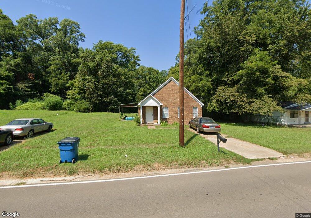
1511 S College St Covington, TN 38019
Estimated Value: $135,000 - $217,000
3
Beds
2
Baths
980
Sq Ft
$166/Sq Ft
Est. Value
About This Home
This home is located at 1511 S College St, Covington, TN 38019 and is currently estimated at $162,554, approximately $165 per square foot. 1511 S College St is a home located in Tipton County with nearby schools including Crestview Elementary School, Crestview Middle School, and Covington High School.
Ownership History
Date
Name
Owned For
Owner Type
Purchase Details
Closed on
Feb 28, 2025
Sold by
Chumley Robert J
Bought by
Chumley Robert J and Chumley Kathrin
Current Estimated Value
Home Financials for this Owner
Home Financials are based on the most recent Mortgage that was taken out on this home.
Original Mortgage
$50,000
Outstanding Balance
$25,433
Interest Rate
6.95%
Mortgage Type
Construction
Estimated Equity
$137,121
Purchase Details
Closed on
Jan 28, 2022
Sold by
Chumley Robert J and Chumley Kathrin L
Bought by
Rmi Sfr Propco B Lp
Purchase Details
Closed on
Aug 13, 2020
Sold by
Carlisle Bradley W
Bought by
Chumley Robert J
Home Financials for this Owner
Home Financials are based on the most recent Mortgage that was taken out on this home.
Original Mortgage
$58,650
Interest Rate
3%
Mortgage Type
Commercial
Purchase Details
Closed on
Mar 24, 2016
Sold by
Mangum Cathy Baskin
Bought by
Carlisle Bradley W
Home Financials for this Owner
Home Financials are based on the most recent Mortgage that was taken out on this home.
Original Mortgage
$30,000
Interest Rate
3.62%
Mortgage Type
New Conventional
Purchase Details
Closed on
Jun 25, 2009
Sold by
Erwin Paul A
Bought by
Whitehorn
Purchase Details
Closed on
Oct 21, 2005
Sold by
Wilkins John H
Bought by
Whitehorn And Baskin Rentals L
Home Financials for this Owner
Home Financials are based on the most recent Mortgage that was taken out on this home.
Original Mortgage
$73,500
Interest Rate
5.76%
Purchase Details
Closed on
Dec 10, 2004
Sold by
Larry Richardson
Bought by
Wilkins John H
Purchase Details
Closed on
Sep 25, 2003
Sold by
Marbry Robert E
Bought by
Larry Richardson
Purchase Details
Closed on
Sep 7, 1998
Sold by
Ruth Marbry Mary
Bought by
Edward Marbry Robert
Purchase Details
Closed on
Jun 30, 1980
Bought by
Marbry Mary Ruth
Purchase Details
Closed on
Jan 1, 1978
Purchase Details
Closed on
Mar 5, 1976
Purchase Details
Closed on
Nov 3, 1973
Create a Home Valuation Report for This Property
The Home Valuation Report is an in-depth analysis detailing your home's value as well as a comparison with similar homes in the area
Home Values in the Area
Average Home Value in this Area
Purchase History
| Date | Buyer | Sale Price | Title Company |
|---|---|---|---|
| Chumley Robert J | -- | None Listed On Document | |
| Chumley Robert J | -- | None Listed On Document | |
| Rmi Sfr Propco B Lp | $220,000 | New Title Company Name | |
| Chumley Robert J | $69,000 | None Available | |
| Carlisle Bradley W | $40,000 | -- | |
| Mangum Cathy Baskin | -- | -- | |
| Whitehorn | -- | -- | |
| Whitehorn And Baskin Rentals L | $7,500 | -- | |
| Wilkins John H | $4,000 | -- | |
| Larry Richardson | $3,000 | -- | |
| Edward Marbry Robert | -- | -- | |
| Marbry Mary Ruth | -- | -- | |
| -- | $7,000 | -- | |
| -- | -- | -- | |
| -- | -- | -- |
Source: Public Records
Mortgage History
| Date | Status | Borrower | Loan Amount |
|---|---|---|---|
| Open | Chumley Robert J | $50,000 | |
| Closed | Chumley Robert J | $50,000 | |
| Previous Owner | Chumley Robert J | $58,650 | |
| Previous Owner | Carlisle Bradley W | $30,000 | |
| Previous Owner | Not Available | $73,500 |
Source: Public Records
Tax History Compared to Growth
Tax History
| Year | Tax Paid | Tax Assessment Tax Assessment Total Assessment is a certain percentage of the fair market value that is determined by local assessors to be the total taxable value of land and additions on the property. | Land | Improvement |
|---|---|---|---|---|
| 2024 | $690 | $27,225 | $3,800 | $23,425 |
| 2023 | $690 | $27,225 | $3,800 | $23,425 |
| 2022 | $626 | $19,075 | $2,800 | $16,275 |
| 2021 | $626 | $19,075 | $2,800 | $16,275 |
| 2020 | $748 | $19,075 | $2,800 | $16,275 |
| 2019 | $724 | $19,300 | $2,150 | $17,150 |
| 2018 | $724 | $19,300 | $2,150 | $17,150 |
| 2017 | $724 | $19,300 | $2,150 | $17,150 |
| 2016 | $724 | $19,300 | $2,150 | $17,150 |
| 2015 | $708 | $18,900 | $2,150 | $16,750 |
| 2014 | $709 | $18,909 | $0 | $0 |
Source: Public Records
Map
Nearby Homes
- 502 James Ave
- 417 Lennanwood Ave
- 1519 Walters St
- 1469 S Main St
- 1329 Herring Dr
- 714 W Sherrod Ave
- 210 Kinney Ave
- 722 S Main St
- 600 W Sherrod Ave
- 715 S Maple St
- 513 Garland Ave
- 624 Fyfe St
- 316 Sanford Ave
- 133 W Washington Ave
- 111 W Washington Ave
- 0 Burnett Ln Unit RTC2939045
- 296 E Washington Ave Unit 3
- 107 W Pleasant Ave
- 0 Oil Mill Rd Unit 10206359
- 0 N Munford St Unit 10156263
- 1509 S College St
- 1519 S College St
- 312 Carr Ave
- 1503 S College St
- 1510 S College St
- 1512 S College St
- 1605 S College St
- 1508 S College St
- 1518 S College St
- 314 Carr Ave
- 1504 S College St
- 412 Hyde Park Cir
- 1524 S College St
- 1607 S College St
- 1407 S College St
- 320 Carr Ave
- 200 Gillespie Dr
- 1602 S College St
- 414 Hyde Park Cir
- 201 Gillespie Dr