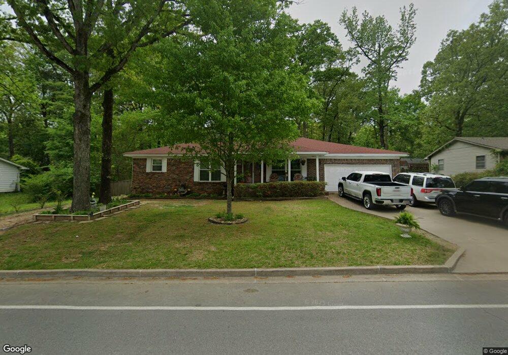
1512 Chris Dr Benton, AR 72015
Estimated Value: $149,000 - $223,000
3
Beds
2
Baths
2,040
Sq Ft
$96/Sq Ft
Est. Value
About This Home
This home is located at 1512 Chris Dr, Benton, AR 72015 and is currently estimated at $195,875, approximately $96 per square foot. 1512 Chris Dr is a home located in Saline County with nearby schools including Perrin Elementary School, Benton Middle School, and Benton Junior High School.
Ownership History
Date
Name
Owned For
Owner Type
Purchase Details
Closed on
Jan 16, 2020
Sold by
Kp Properties Of Arkansas Llc
Bought by
Darrough Thomas L and Darrough Diane
Current Estimated Value
Home Financials for this Owner
Home Financials are based on the most recent Mortgage that was taken out on this home.
Original Mortgage
$80,000
Outstanding Balance
$70,860
Interest Rate
3.73%
Mortgage Type
New Conventional
Estimated Equity
$125,015
Purchase Details
Closed on
Dec 23, 2009
Sold by
Coleman Russell and Coleman Carolyn
Bought by
Kp Properties Of Arkansas Llc
Home Financials for this Owner
Home Financials are based on the most recent Mortgage that was taken out on this home.
Original Mortgage
$75,000
Interest Rate
4.9%
Mortgage Type
Future Advance Clause Open End Mortgage
Purchase Details
Closed on
Jul 16, 1997
Bought by
Coleman Family Trust
Create a Home Valuation Report for This Property
The Home Valuation Report is an in-depth analysis detailing your home's value as well as a comparison with similar homes in the area
Home Values in the Area
Average Home Value in this Area
Purchase History
| Date | Buyer | Sale Price | Title Company |
|---|---|---|---|
| Darrough Thomas L | $89,900 | Stewart Title Of Ar Llc | |
| Kp Properties Of Arkansas Llc | $74,000 | -- | |
| Coleman Family Trust | -- | -- |
Source: Public Records
Mortgage History
| Date | Status | Borrower | Loan Amount |
|---|---|---|---|
| Open | Darrough Thomas L | $80,000 | |
| Previous Owner | Kp Properties Of Arkansas Llc | $75,000 |
Source: Public Records
Tax History
| Year | Tax Paid | Tax Assessment Tax Assessment Total Assessment is a certain percentage of the fair market value that is determined by local assessors to be the total taxable value of land and additions on the property. | Land | Improvement |
|---|---|---|---|---|
| 2025 | $1,351 | $34,202 | $1,680 | $32,522 |
| 2024 | $1,382 | $34,202 | $1,680 | $32,522 |
| 2023 | $867 | $34,202 | $1,680 | $32,522 |
| 2022 | $858 | $34,202 | $1,680 | $32,522 |
| 2021 | $799 | $21,200 | $1,200 | $20,000 |
| 2020 | $608 | $21,200 | $1,200 | $20,000 |
| 2019 | $608 | $21,200 | $1,200 | $20,000 |
| 2018 | $588 | $21,200 | $1,200 | $20,000 |
| 2017 | $546 | $21,200 | $1,200 | $20,000 |
| 2016 | $875 | $15,430 | $1,200 | $14,230 |
| 2015 | $509 | $15,430 | $1,200 | $14,230 |
| 2014 | $516 | $15,430 | $1,200 | $14,230 |
Source: Public Records
Map
Nearby Homes
- 1522 Chris Dr
- 2002 Lynnwood
- 1912 Fairmont Dr
- 1123 Scenic Way
- 1811 E Lakeview
- 2610 Alcoa Rd
- 1815 Watts Rd
- 1108 Watson Place
- 1100 Watson Place
- 2606 Eagle Run
- 1702 Lynnwood
- 1912 Alcoa Blvd
- 901 Brookview
- 2909 Eagle Run
- 2309 W Lakeview
- 2703 Timbermist Cir
- 3002 Sue St
- 2521 Northshore Dr
- Lot 20 & 21 Longview St
- 3209 Galloway Dr
Your Personal Tour Guide
Ask me questions while you tour the home.