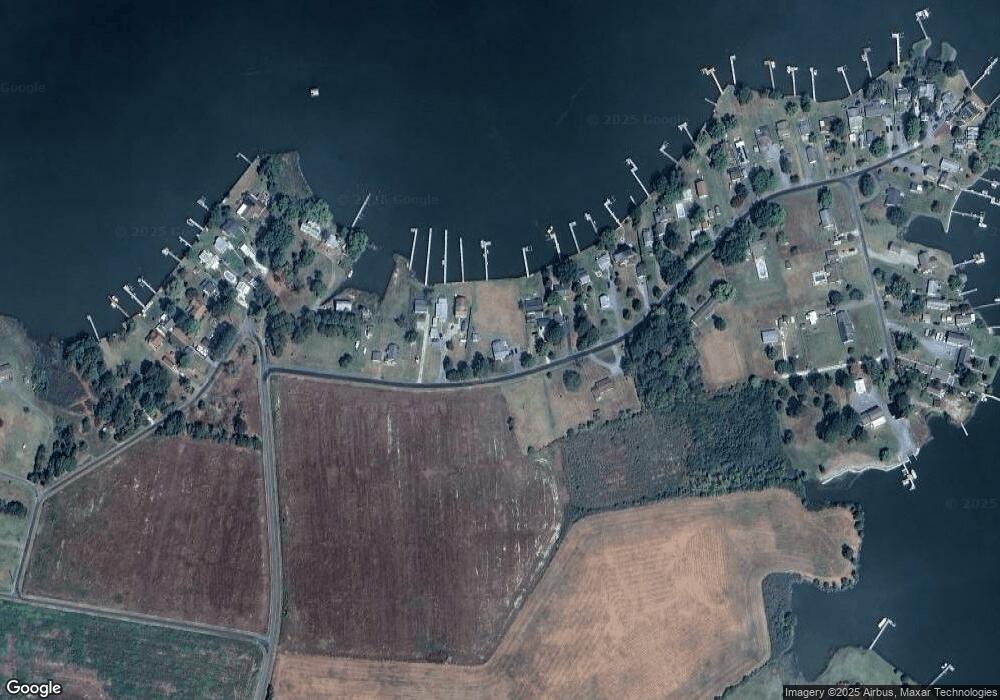
1512 Deep Point Rd Woolford, MD 21677
Estimated Value: $528,000 - $613,000
Studio
2
Baths
1,520
Sq Ft
$378/Sq Ft
Est. Value
About This Home
This home is located at 1512 Deep Point Rd, Woolford, MD 21677 and is currently estimated at $574,523, approximately $377 per square foot. 1512 Deep Point Rd is a home located in Dorchester County with nearby schools including South Dorchester School, Cambridge-South Dorchester High School, and Visionquest Morning Star Youth Academy.
Ownership History
Date
Name
Owned For
Owner Type
Purchase Details
Closed on
Jan 23, 2023
Sold by
Walsh Daniel E
Bought by
Staub Living Trust
Current Estimated Value
Purchase Details
Closed on
Jun 18, 2001
Sold by
Schiesser Deborah Dietrich
Bought by
Walsh Daniel E and Walsh Deanna L
Purchase Details
Closed on
Jun 5, 2001
Sold by
Schiesser Deborah Dietrich
Bought by
Schiesser Deborah Dietrich and Schiesser Marilyn Thorman
Create a Home Valuation Report for This Property
The Home Valuation Report is an in-depth analysis detailing your home's value as well as a comparison with similar homes in the area
Purchase History
| Date | Buyer | Sale Price | Title Company |
|---|---|---|---|
| Staub Living Trust | $525,000 | -- | |
| Walsh Daniel E | $163,000 | -- | |
| Schiesser Deborah Dietrich | -- | -- |
Source: Public Records
Mortgage History
| Date | Status | Borrower | Loan Amount |
|---|---|---|---|
| Closed | Walsh Daniel E | -- |
Source: Public Records
Tax History Compared to Growth
Tax History
| Year | Tax Paid | Tax Assessment Tax Assessment Total Assessment is a certain percentage of the fair market value that is determined by local assessors to be the total taxable value of land and additions on the property. | Land | Improvement |
|---|---|---|---|---|
| 2025 | $4,725 | $408,500 | $0 | $0 |
| 2024 | $4,147 | $388,000 | $0 | $0 |
| 2023 | $4,147 | $367,500 | $225,100 | $142,400 |
| 2022 | $3,821 | $338,233 | $0 | $0 |
| 2021 | $3,170 | $308,967 | $0 | $0 |
| 2020 | $3,170 | $279,700 | $150,200 | $129,500 |
| 2019 | $3,170 | $279,700 | $150,200 | $129,500 |
| 2018 | $3,170 | $279,700 | $150,200 | $129,500 |
| 2017 | $3,481 | $314,400 | $0 | $0 |
| 2016 | -- | $314,400 | $0 | $0 |
| 2015 | $4,143 | $314,400 | $0 | $0 |
| 2014 | $4,143 | $320,400 | $0 | $0 |
Source: Public Records
Map
Nearby Homes
- 1529 Deep Water Rd
- 5202 Heron Rd
- 5216 Heron Rd
- 5211 Heron Rd
- 5219 Heron Rd
- 1609 Heliport Rd
- 5223 Heron Rd
- 5226 Heron Rd
- 5229 Heron Rd
- 0 Laurie Ln Unit MDDO2009086
- 5200 Travelers Rest Rd
- 1403 Town Point Rd
- 1829 Brannocks Neck Rd
- 5210 Wilson Rd
- 1307 Broadview Dr
- 1242 Old Madison Rd
- 4825 Madison Canning House Rd
- 2197 Winterberry Ln
- 2187 Winterberry Ln
- 2210 Winterberry Ln
- 1510 Deep Point Rd
- 1514 Deep Point Rd
- 1508 Deep Point Rd
- 1516 Deep Point Rd
- 1506 Deep Point Rd
- 1518 Deep Point Rd
- 1608 Vanada Way
- 1504 Deep Point Rd
- 1616 Deep Point Rd
- 1517 Deep Point Rd
- 1520 Deep Point Rd
- 1522 Deep Point Rd
- 1524 Deep Point Rd
- 1502 Deep Point Rd
- 1526 Deep Point Rd
- 1527 Deep Point Rd
- 1528 Deep Point Rd
- 1530 Deep Point Rd
- 1532 Deep Point Rd
- 1535 Deep Point Rd
