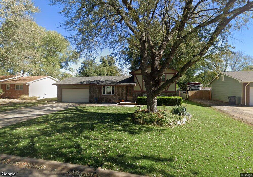
1512 N Timothy Ln Wichita, KS 67212
West Wichita NeighborhoodEstimated Value: $217,573 - $240,000
4
Beds
2
Baths
949
Sq Ft
$241/Sq Ft
Est. Value
About This Home
This home is located at 1512 N Timothy Ln, Wichita, KS 67212 and is currently estimated at $228,787, approximately $241 per square foot. 1512 N Timothy Ln is a home located in Sedgwick County with nearby schools including Kensler Elementary School, Wilbur Middle School, and Wichita Northwest High School.
Ownership History
Date
Name
Owned For
Owner Type
Purchase Details
Closed on
Jan 14, 2022
Sold by
Wallis Loyd E and Wallis Lloyd E
Bought by
De Mejia Karla Antonieta Re
Current Estimated Value
Home Financials for this Owner
Home Financials are based on the most recent Mortgage that was taken out on this home.
Original Mortgage
$181,115
Outstanding Balance
$166,920
Interest Rate
3.11%
Mortgage Type
FHA
Estimated Equity
$61,867
Create a Home Valuation Report for This Property
The Home Valuation Report is an in-depth analysis detailing your home's value as well as a comparison with similar homes in the area
Home Values in the Area
Average Home Value in this Area
Purchase History
| Date | Buyer | Sale Price | Title Company |
|---|---|---|---|
| De Mejia Karla Antonieta Re | -- | Security 1St Title |
Source: Public Records
Mortgage History
| Date | Status | Borrower | Loan Amount |
|---|---|---|---|
| Open | De Mejia Karla Antonieta Re | $181,115 |
Source: Public Records
Tax History Compared to Growth
Tax History
| Year | Tax Paid | Tax Assessment Tax Assessment Total Assessment is a certain percentage of the fair market value that is determined by local assessors to be the total taxable value of land and additions on the property. | Land | Improvement |
|---|---|---|---|---|
| 2025 | $2,103 | $21,437 | $4,497 | $16,940 |
| 2023 | $2,103 | $18,088 | $2,933 | $15,155 |
| 2022 | $1,999 | $18,088 | $2,772 | $15,316 |
| 2021 | $2,123 | $18,608 | $2,772 | $15,836 |
| 2020 | $2,131 | $18,608 | $2,772 | $15,836 |
| 2019 | $1,955 | $17,067 | $2,772 | $14,295 |
| 2018 | $1,902 | $16,572 | $2,082 | $14,490 |
| 2017 | $1,608 | $0 | $0 | $0 |
| 2016 | $1,606 | $0 | $0 | $0 |
| 2015 | $1,594 | $0 | $0 | $0 |
| 2014 | $1,572 | $0 | $0 | $0 |
Source: Public Records
Map
Nearby Homes
- 7811 W Suncrest Ave
- 1336 N Denmark Ave
- 8117 W Aberdeen St
- 1553 N Brunswick St
- 8205 W 16th St N
- 8301 W Aberdeen Cir
- 1642 & 1644 N Brunswick
- 7311 W Suncrest St
- 1308 N Brunswick St
- 1706 N Brunswick St
- 8309 W 17th St N
- 1140 N Country Acres Ave
- 8608 W Nantucket St
- 1914 N Redbarn Ln
- 1978 N Northwest Pkwy
- 1235 N Mulberry Place
- 7418 W Westlawn St
- 8418 W 19th St N
- 7410 W Dorsey Ave
- 6611 W Briarwood Cir
- 1506 N Timothy Ln
- 1518 N Timothy Ln
- 1513 N Holland Ln
- 1519 N Holland Ln
- 1507 N Holland Ln
- 1500 N Timothy Ln
- 1524 N Timothy Ln
- 1513 N Timothy Ln
- 1519 N Timothy Ln
- 1501 N Holland Ln
- 1525 N Holland Ln
- 1505 N Timothy Ln
- 1452 N Timothy Ln
- 1523 N Timothy Ln
- 1451 N Holland Ln
- 1451 N Timothy Ln
- 1447 N Holland Ln
- 1512 N Glenhurst St
- 1527 N Timothy Ln
- 1512 N Holland Ln