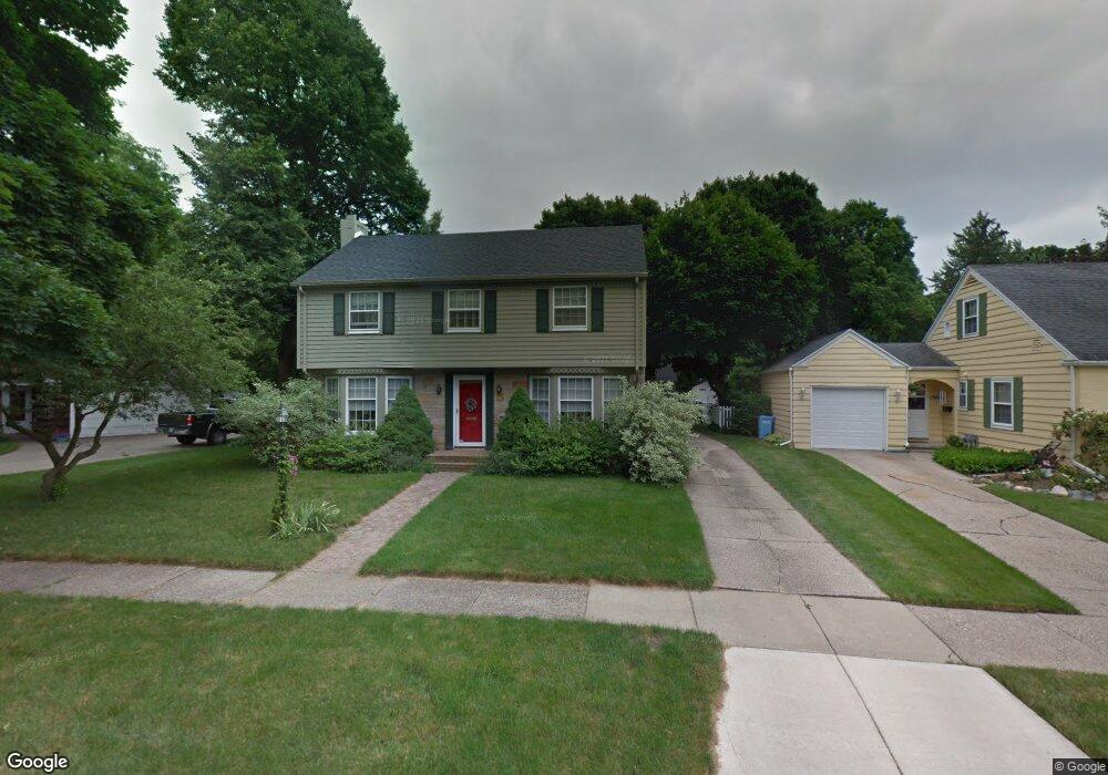
1512 Pershing Dr Lansing, MI 48910
Forest View NeighborhoodEstimated Value: $302,330 - $349,000
Studio
1
Bath
2,221
Sq Ft
$148/Sq Ft
Est. Value
About This Home
This home is located at 1512 Pershing Dr, Lansing, MI 48910 and is currently estimated at $328,110, approximately $147 per square foot. 1512 Pershing Dr is a home located in Ingham County with nearby schools including Lyons Elementary School, Pattengill Academy, and Eastern High School.
Ownership History
Date
Name
Owned For
Owner Type
Purchase Details
Closed on
Feb 10, 2011
Sold by
Grether Deborah P
Bought by
Grether Deborah P and Deborah P Grether Trust
Current Estimated Value
Purchase Details
Closed on
Jul 16, 1998
Sold by
Guilbeau Kimberly O and Guilbeau Gregory
Bought by
Grether Deborah P
Purchase Details
Closed on
Apr 1, 1994
Create a Home Valuation Report for This Property
The Home Valuation Report is an in-depth analysis detailing your home's value as well as a comparison with similar homes in the area
Home Values in the Area
Average Home Value in this Area
Purchase History
| Date | Buyer | Sale Price | Title Company |
|---|---|---|---|
| Grether Deborah P | -- | None Available | |
| Grether Deborah P | $143,500 | -- | |
| -- | $124,900 | -- |
Source: Public Records
Tax History
| Year | Tax Paid | Tax Assessment Tax Assessment Total Assessment is a certain percentage of the fair market value that is determined by local assessors to be the total taxable value of land and additions on the property. | Land | Improvement |
|---|---|---|---|---|
| 2025 | $7,628 | $207,700 | $14,200 | $193,500 |
| 2024 | $62 | $193,400 | $14,200 | $179,200 |
| 2023 | $7,144 | $169,600 | $14,200 | $155,400 |
| 2022 | $6,426 | $153,600 | $11,500 | $142,100 |
| 2021 | $6,292 | $147,600 | $10,300 | $137,300 |
| 2020 | $6,255 | $139,500 | $10,300 | $129,200 |
| 2019 | $6,005 | $130,800 | $10,300 | $120,500 |
| 2018 | $5,617 | $104,700 | $10,300 | $94,400 |
| 2017 | $5,380 | $104,700 | $10,300 | $94,400 |
| 2016 | $5,145 | $102,700 | $10,300 | $92,400 |
| 2015 | $5,145 | $98,000 | $20,637 | $77,363 |
| 2014 | $5,145 | $93,800 | $27,189 | $66,611 |
Source: Public Records
Map
Nearby Homes
- 0 E Mount Hope Ave
- 1501 Shubel Ave
- 2237 Sunnyside Ave
- 2215 Alpha St
- 2201 S Pennsylvania Ave
- 1423 Pontiac St
- 2309 S Pennsylvania Ave
- 1437 Ada St
- 1731 Lyons Ave
- 1134 S Holmes St
- 1204 Shepard St
- 2340 S Pennsylvania Ave
- 1601 Bailey St
- 704 Mckim Ave
- 616 Isbell St
- 1535 Linval St
- 1515 Linval St
- 1019 Dakin St
- 2118 Roberts Ln
- 2015 Forest Rd
- 1508 Pershing Dr
- 1700 Lindbergh Dr
- 1714 Lindbergh Dr
- 1701 Sunnyside Ave
- 1503 Pershing Dr
- 1515 Pershing Dr
- 1715 Sunnyside Ave
- 1519 Pershing Dr
- 1651 Sunnyside Ave
- 1800 Lindbergh Dr
- 1801 Sunnyside Ave
- 1645 Sunnyside Ave
- 1702 Sunnyside Ave
- 1806 Lindbergh Dr
- 1660 Sunnyside Ave
- 1650 Lindbergh Dr
- 1652 Sunnyside Ave
- 1641 Sunnyside Ave
- 1811 Sunnyside Ave
- 1716 Sunnyside Ave
Your Personal Tour Guide
Ask me questions while you tour the home.