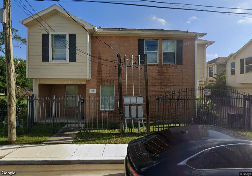
1512 Robin St Unit B Houston, TX 77019
Midtown NeighborhoodEstimated Value: $320,138 - $369,000
3
Beds
2
Baths
1,322
Sq Ft
$266/Sq Ft
Est. Value
About This Home
This home is located at 1512 Robin St Unit B, Houston, TX 77019 and is currently estimated at $351,535, approximately $265 per square foot. 1512 Robin St Unit B is a home located in Harris County with nearby schools including Gregory-Lincoln Ed Center, Heights High School, and Elevate Collegiate.
Ownership History
Date
Name
Owned For
Owner Type
Purchase Details
Closed on
Oct 20, 2006
Sold by
Antioch Project Reach Inc
Bought by
Stelivan Nicole
Current Estimated Value
Home Financials for this Owner
Home Financials are based on the most recent Mortgage that was taken out on this home.
Original Mortgage
$77,100
Outstanding Balance
$45,778
Interest Rate
6.37%
Mortgage Type
Purchase Money Mortgage
Estimated Equity
$305,757
Create a Home Valuation Report for This Property
The Home Valuation Report is an in-depth analysis detailing your home's value as well as a comparison with similar homes in the area
Home Values in the Area
Average Home Value in this Area
Purchase History
| Date | Buyer | Sale Price | Title Company |
|---|---|---|---|
| Stelivan Nicole | -- | Fidelity National Title |
Source: Public Records
Mortgage History
| Date | Status | Borrower | Loan Amount |
|---|---|---|---|
| Open | Stelivan Nicole | $77,100 |
Source: Public Records
Tax History Compared to Growth
Tax History
| Year | Tax Paid | Tax Assessment Tax Assessment Total Assessment is a certain percentage of the fair market value that is determined by local assessors to be the total taxable value of land and additions on the property. | Land | Improvement |
|---|---|---|---|---|
| 2025 | $2,438 | $289,013 | $112,560 | $176,453 |
| 2024 | $2,438 | $280,871 | $112,560 | $168,311 |
| 2023 | $2,438 | $288,813 | $112,560 | $176,253 |
| 2022 | $3,589 | $254,150 | $96,480 | $157,670 |
| 2021 | $3,453 | $239,001 | $88,440 | $150,561 |
| 2020 | $3,262 | $267,302 | $115,776 | $151,526 |
| 2019 | $3,099 | $271,493 | $115,776 | $155,717 |
| 2018 | $6,956 | $274,909 | $115,776 | $159,133 |
| 2017 | $2,559 | $258,845 | $115,776 | $143,069 |
| 2016 | $2,326 | $92,000 | $57,888 | $34,112 |
| 2015 | $1,722 | $92,000 | $57,888 | $34,112 |
| 2014 | $1,722 | $92,000 | $28,944 | $63,056 |
Source: Public Records
Map
Nearby Homes
- 1515 Saulnier St
- 1511 Andrews St
- 1606 Ruthven St
- 1619 Andrews St
- 1511 Ruthven St
- 1408 Ruthven St
- 1316 Robin St Unit C
- 1316 Robin St Unit A
- 1316 Robin St Unit B
- 1208 Wilson St
- 1318 Cleveland St
- 11 Robita St
- 907 Rhode Place Unit C
- 1204 Andrews St
- 314 W Clay St
- 00 Ruthven St
- 1112 Andrews St Unit A
- 219 W Gray St
- 403 W Polk St
- 407 W Polk St
- 1512 Robin St Unit C
- 1512 Robin St
- 1512 Robin St Unit C
- 1512 Robin St
- 1510 Robin St
- 1510 Robin St
- 1510 Robin St
- 1510 Robin St Unit A
- 1510 Robin St Unit C
- 1516 Robin St
- 1512 Robin St
- 1507 Robin St
- 1507 Robin St Unit B
- 1507 Robin St Unit A
- 1507 Robin St Unit C
- 1519 Saulnier St
- 1201 Gillette St Unit 4
- 1201 Gillette St Unit 8
- 1201 Gillette St Unit 1-4
- 1201 Gillette St Unit 1