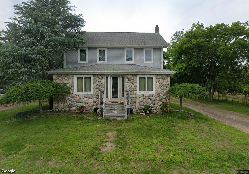
1512 Silverton Rd Toms River, NJ 08755
Estimated Value: $532,000 - $1,026,000
3
Beds
2
Baths
1,970
Sq Ft
$360/Sq Ft
Est. Value
About This Home
This home is located at 1512 Silverton Rd, Toms River, NJ 08755 and is currently estimated at $709,411, approximately $360 per square foot. 1512 Silverton Rd is a home located in Ocean County with nearby schools including Ocean County Christian Academy and Talmud Torah Bais Avrohom.
Ownership History
Date
Name
Owned For
Owner Type
Purchase Details
Closed on
Mar 5, 2013
Sold by
Aiello Joseph and Hurley Tracy
Bought by
1512 Silverton Road Trust
Current Estimated Value
Purchase Details
Closed on
Sep 28, 1998
Sold by
Anken Ronald B and Anken Nancy
Bought by
Aiello Joseph
Home Financials for this Owner
Home Financials are based on the most recent Mortgage that was taken out on this home.
Original Mortgage
$26,400
Interest Rate
6.3%
Create a Home Valuation Report for This Property
The Home Valuation Report is an in-depth analysis detailing your home's value as well as a comparison with similar homes in the area
Home Values in the Area
Average Home Value in this Area
Purchase History
| Date | Buyer | Sale Price | Title Company |
|---|---|---|---|
| 1512 Silverton Road Trust | -- | None Available | |
| Aiello Joseph | $132,000 | Lawyers Title Insurance Corp |
Source: Public Records
Mortgage History
| Date | Status | Borrower | Loan Amount |
|---|---|---|---|
| Previous Owner | Aiello Joseph | $26,400 |
Source: Public Records
Tax History Compared to Growth
Tax History
| Year | Tax Paid | Tax Assessment Tax Assessment Total Assessment is a certain percentage of the fair market value that is determined by local assessors to be the total taxable value of land and additions on the property. | Land | Improvement |
|---|---|---|---|---|
| 2025 | $7,999 | $439,000 | $222,000 | $217,000 |
| 2024 | $7,599 | $439,000 | $222,000 | $217,000 |
| 2023 | $7,323 | $439,000 | $222,000 | $217,000 |
| 2022 | $7,323 | $439,000 | $222,000 | $217,000 |
| 2021 | $6,610 | $264,600 | $125,300 | $139,300 |
| 2020 | $6,581 | $264,600 | $125,300 | $139,300 |
| 2019 | $6,295 | $264,600 | $125,300 | $139,300 |
| 2018 | $6,231 | $264,600 | $125,300 | $139,300 |
| 2017 | $6,189 | $264,600 | $125,300 | $139,300 |
| 2016 | $6,043 | $264,600 | $125,300 | $139,300 |
| 2015 | $5,826 | $264,600 | $125,300 | $139,300 |
| 2014 | $5,538 | $264,600 | $125,300 | $139,300 |
Source: Public Records
Map
Nearby Homes
- 1461 Burr Oak Rd
- 1776 Buttonwood Ave
- 1453 Forelle Ln
- 1570 Beaver Hollow Dr
- 1392 Gleniffer Hill Rd
- 1582 Beaver Hollow Dr
- 1849 New Hampshire Ave
- 1541 Alpen Ln
- 1869 Buttonwood Ave
- 1417 Silverton Rd
- 1792 Todd Rd
- 1766 Todd Rd
- 1762 Todd Rd
- 1797 Sweetbay Dr
- 1886 New Hampshire Ave
- 1580 Scholar Place
- 1878 Crimson Ct
- 1912 Quimby Ct
- 1887 Crimson Ct
- 1895 Crimson Ct
- 1508 Silverton Rd
- 1517 Silverton Rd
- 1505 Silverton Rd
- 1484 Silverton Rd
- 1525 Silverton Rd
- 1497 Silverton Rd
- 1489 Burr Oak Rd
- 1485 Burr Oak Rd
- 1493 Burr Oak Rd
- 1481 Burr Oak Rd
- 1497 Burr Oak Rd
- 1477 Burr Oak Rd
- 1473 Burr Oak Rd
- 1501 Burr Oak Rd
- 1797 Esto Ct
- 1469 Burr Oak Rd
- 1505 Burr Oak Rd
- 1465 Burr Oak Rd
- 1509 Burr Oak Rd
- 1793 Esto Ct