Estimated Value: $53,000 - $135,000
3
Beds
1
Bath
1,056
Sq Ft
$103/Sq Ft
Est. Value
About This Home
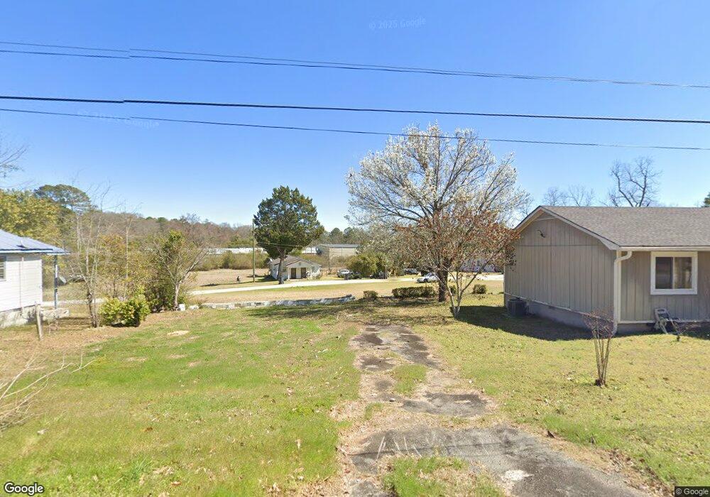
This home is located at 1512 State St, Perry, GA 31069 and is currently estimated at $108,538, approximately $102 per square foot. 1512 State St is a home located in Houston County with nearby schools including Morningside Elementary School, Perry Middle School, and Perry High School.
Ownership History
Date
Name
Owned For
Owner Type
Purchase Details
Closed on
Oct 19, 2017
Sold by
Davis Maxine Milton
Bought by
Thomas Mary Katherine Milton
Current Estimated Value
Purchase Details
Closed on
Sep 21, 1993
Sold by
Milton Cyrus Estate
Bought by
Milton Ellen K
Purchase Details
Closed on
Jul 11, 1989
Sold by
Mid-State Trust Ii Etal
Bought by
Milton Cyrus and Milton Ellen K
Purchase Details
Closed on
Jun 26, 1989
Sold by
Napier Mildred
Bought by
Mid-State Trust Ii
Purchase Details
Closed on
Jun 7, 1989
Sold by
Jim Walter Homes Inc
Bought by
Mid-State Trust Ii
Purchase Details
Closed on
Apr 10, 1981
Sold by
Mcginty George L
Bought by
Napier Mildred
Purchase Details
Closed on
Jun 14, 1977
Sold by
City Of Perry-Tax Deed
Bought by
Mcginty George L
Purchase Details
Closed on
May 15, 1955
Bought by
Napier Minnie Lee
Create a Home Valuation Report for This Property
The Home Valuation Report is an in-depth analysis detailing your home's value as well as a comparison with similar homes in the area
Home Values in the Area
Average Home Value in this Area
Purchase History
| Date | Buyer | Sale Price | Title Company |
|---|---|---|---|
| Thomas Mary Katherine Milton | -- | None Available | |
| Milton Ellen K | -- | -- | |
| Milton Cyrus | -- | -- | |
| Mid-State Trust Ii | $1,000 | -- | |
| Mid-State Trust Ii | -- | -- | |
| Napier Mildred | -- | -- | |
| Mcginty George L | -- | -- | |
| Napier Minnie Lee | -- | -- |
Source: Public Records
Tax History Compared to Growth
Tax History
| Year | Tax Paid | Tax Assessment Tax Assessment Total Assessment is a certain percentage of the fair market value that is determined by local assessors to be the total taxable value of land and additions on the property. | Land | Improvement |
|---|---|---|---|---|
| 2024 | $729 | $19,840 | $1,480 | $18,360 |
| 2023 | $592 | $16,000 | $1,480 | $14,520 |
| 2022 | $339 | $14,760 | $1,480 | $13,280 |
| 2021 | $300 | $12,960 | $1,480 | $11,480 |
| 2020 | $482 | $12,920 | $1,480 | $11,440 |
| 2019 | $300 | $12,920 | $1,480 | $11,440 |
| 2018 | $300 | $12,920 | $1,480 | $11,440 |
| 2017 | $300 | $12,920 | $1,480 | $11,440 |
| 2016 | $301 | $12,920 | $1,480 | $11,440 |
| 2015 | $302 | $12,920 | $1,480 | $11,440 |
| 2014 | -- | $12,920 | $1,480 | $11,440 |
| 2013 | -- | $12,920 | $1,480 | $11,440 |
Source: Public Records
Map
Nearby Homes
- 113 Flat Rock Ln
- 100 Flat Rock Ln
- 1402 Park Ave
- 1009 N Davis Dr
- 1304 Davis Ave
- 1802 Kings Chapel Rd
- 1152 Lovely Ln
- 1207 Swift St
- 1212 Swift St
- 1205 Morningside Dr
- 0 Carroll Aly
- 1008 Ridge Cir S
- 1405 Cambridge Rd
- 905 Massee Ln
- 903 Massee Ln
- 312 Bridgehampton Way
- 706 Hillcrest Ave
- 1406 Main St
- 102 N Haven Ln
- 132 Sadie Heights Blvd
- 1510 State Ave
- 1324 Houston St
- 1326 Houston St
- 1328 Houston St
- 1320 Houston St
- 1318 Houston St
- 1513 State Ave
- 1312 Houston St
- 1325 Houston St
- 1323 Houston St
- 1327 Houston St
- 1329 Houston St
- 1321 Houston St
- 1319 Houston St
- 1508 State Ave
- 1508 State Ave
- 2018 Sam Nunn Blvd N
- 1506 State Ave
- 1327 Grant St
- 1315 Houston St